File:Ordot Dump aerial.jpg
From Wikimedia Commons, the free media repository
Jump to navigation
Jump to search
Size of this preview: 800 × 600 pixels. Other resolutions: 320 × 240 pixels | 640 × 480 pixels | 1,024 × 768 pixels | 1,280 × 960 pixels | 2,560 × 1,920 pixels | 2,800 × 2,100 pixels.
Original file (2,800 × 2,100 pixels, file size: 8.14 MB, MIME type: image/jpeg)
File information
Structured data
Captions
Summary[edit]
DescriptionOrdot Dump aerial.jpg |
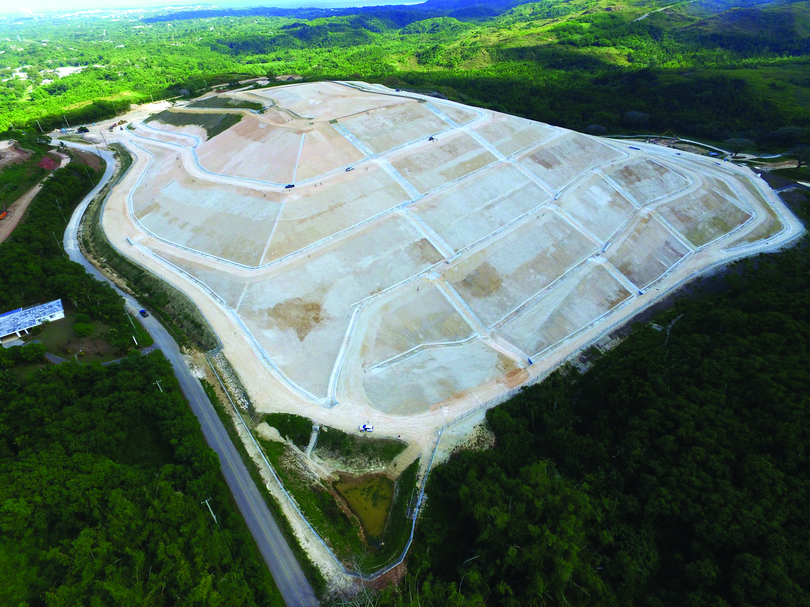
English: Aerial photo of Ordot Landfill, a Superfund site in Chalan Pago-Ordot, Guam. Subject of a 2021 U.S. Supreme Court Case |
Date | |
Source | https://19january2017snapshot.epa.gov/sites/production/files/2016-04/aerial_ordot_dump_hi-res.jpg. Used at https://19january2017snapshot.epa.gov/pacific-southwest-media-center/2016-epa-pacific-southwest-progress-report_.html |
Author | U.S. Environmental Protection Agency |
Camera location | 13° 26′ 24.86″ N, 144° 44′ 48.92″ E | View this and other nearby images on: OpenStreetMap | 13.440238; 144.746921 |
---|
Licensing[edit]
Public domainPublic domainfalsefalse |
This image (or other media) is a work of an Environmental Protection Agency employee, taken or made as part of that person's official duties. As works of the U.S. federal government, all EPA images are in the public domain.
|
||
العربية ∙ Deutsch ∙ English ∙ eesti ∙ italiano ∙ 日本語 ∙ македонски ∙ Nederlands ∙ polski ∙ português ∙ sicilianu ∙ slovenščina ∙ ไทย ∙ українська ∙ 简体中文 ∙ 繁體中文 ∙ +/− |
File history
Click on a date/time to view the file as it appeared at that time.
Date/Time | Thumbnail | Dimensions | User | Comment | |
---|---|---|---|---|---|
current | 05:07, 30 November 2021 | 2,800 × 2,100 (8.14 MB) | Featous (talk | contribs) | Uploaded a work by U.S. Environmental Protection Agency from https://19january2017snapshot.epa.gov/sites/production/files/2016-04/aerial_ordot_dump_hi-res.jpg. Used at https://19january2017snapshot.epa.gov/pacific-southwest-media-center/2016-epa-pacific-southwest-progress-report_.html with UploadWizard |
You cannot overwrite this file.
File usage on Commons
There are no pages that use this file.
File usage on other wikis
The following other wikis use this file:
- Usage on en.wikipedia.org
Metadata
This file contains additional information such as Exif metadata which may have been added by the digital camera, scanner, or software program used to create or digitize it. If the file has been modified from its original state, some details such as the timestamp may not fully reflect those of the original file. The timestamp is only as accurate as the clock in the camera, and it may be completely wrong.
Image title |
|
---|---|
Camera manufacturer | DJI |
Camera model | FC300S |
Exposure time | 1,219/1,000,000 sec (0.001219) |
F-number | f/2.8 |
ISO speed rating | 100 |
Date and time of data generation | 14:58, 18 January 2016 |
Lens focal length | 3.61 mm |
Latitude | 13° 26′ 24.86″ N |
Longitude | 144° 44′ 48.92″ E |
Altitude | 113.1 meters above sea level |
Width | 4,000 px |
Height | 3,000 px |
Bits per component |
|
Pixel composition | RGB |
Orientation | Normal |
Number of components | 3 |
Horizontal resolution | 300 dpi |
Vertical resolution | 300 dpi |
Software used | Adobe Photoshop CC 2015 (Macintosh) |
File change date and time | 10:05, 5 April 2016 |
Y and C positioning | Centered |
Exposure Program | Normal program |
Exif version | 2.3 |
Date and time of digitizing | 14:58, 18 January 2016 |
Meaning of each component |
|
Image compression mode | 3.526376 |
APEX aperture | 2 |
APEX exposure bias | 0 |
Maximum land aperture | 2 APEX (f/2) |
Subject distance | 0 meters |
Metering mode | Spot |
Light source | Unknown |
Flash | Flash did not fire, No flash function |
Supported Flashpix version | 0.1 |
Color space | Uncalibrated |
File source | Digital still camera |
Scene type | 0 |
Custom image processing | Normal process |
Exposure mode | Auto exposure |
White balance | Auto white balance |
Focal length in 35 mm film | 20 mm |
Scene capture type | Standard |
Scene control | None |
Contrast | Hard |
Saturation | High saturation |
Sharpness | Normal |
Subject distance range | Unknown |
GPS tag version | 0.0.2.3 |
Date metadata was last modified | 03:05, 5 April 2016 |
Unique ID of original document | D9050E0DD75EB83CB15979FE7AA32CF9 |
IIM version | 32,767 |