File:Open-ended Grid (25262933460).jpg
Jump to navigation
Jump to search
Size of this preview: 800 × 600 pixels. Other resolutions: 320 × 240 pixels | 640 × 480 pixels | 1,024 × 768 pixels.
Original file (1,024 × 768 pixels, file size: 150 KB, MIME type: image/jpeg)
Captions
Captions
Add a one-line explanation of what this file represents
Summary[edit]
.jpg&action=edit§ion=1)
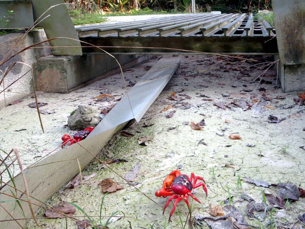
| Description | Open-ended grids and crab fences have been installed on many roads on Christmas Island, Australia, to prevent the millions of red crabs from being crushed during their annual migration to the sea. |
| Date | |
| Source | Open-ended Grid |
| Author | David Stanley from Nanaimo, Canada |
| Camera location | | View this and other nearby images on: OpenStreetMap |
|---|
.jpg¶ms=-10.475174_N_0105.677263_E_globe:Earth_type:camera_source:Flickr_&language=en)
Licensing[edit]
.jpg&action=edit§ion=2)
This file is licensed under the Creative Commons Attribution 2.0 Generic license.
- You are free:
- to share – to copy, distribute and transmit the work
- to remix – to adapt the work
- Under the following conditions:
- attribution – You must give appropriate credit, provide a link to the license, and indicate if changes were made. You may do so in any reasonable manner, but not in any way that suggests the licensor endorses you or your use.
| This image was originally posted to Flickr by D-Stanley at https://flickr.com/photos/79721788@N00/25262933460 (archive). It was reviewed on 20 April 2018 by FlickreviewR 2 and was confirmed to be licensed under the terms of the cc-by-2.0. |
File history
Click on a date/time to view the file as it appeared at that time.
| Date/Time | Thumbnail | Dimensions | User | Comment | |
|---|---|---|---|---|---|
| current | 03:48, 20 April 2018 | | 1,024 × 768 (150 KB) | LittleT889 (talk | contribs) | Transferred from Flickr via #flickr2commons |
You cannot overwrite this file.
File usage on Commons
There are no pages that use this file.
.jpg&oldid=500477139)