File:Oolitic ironstone (Brassfield Formation, Lower Silurian; Ohio Brush Creek roadcut, southern Ohio, USA) 4 (35933559334).jpg
Original file (3,494 × 2,860 pixels, file size: 6.38 MB, MIME type: image/jpeg)
Captions
Captions
Summary[edit]
_4_(35933559334).jpg&action=edit§ion=1)
| Description |
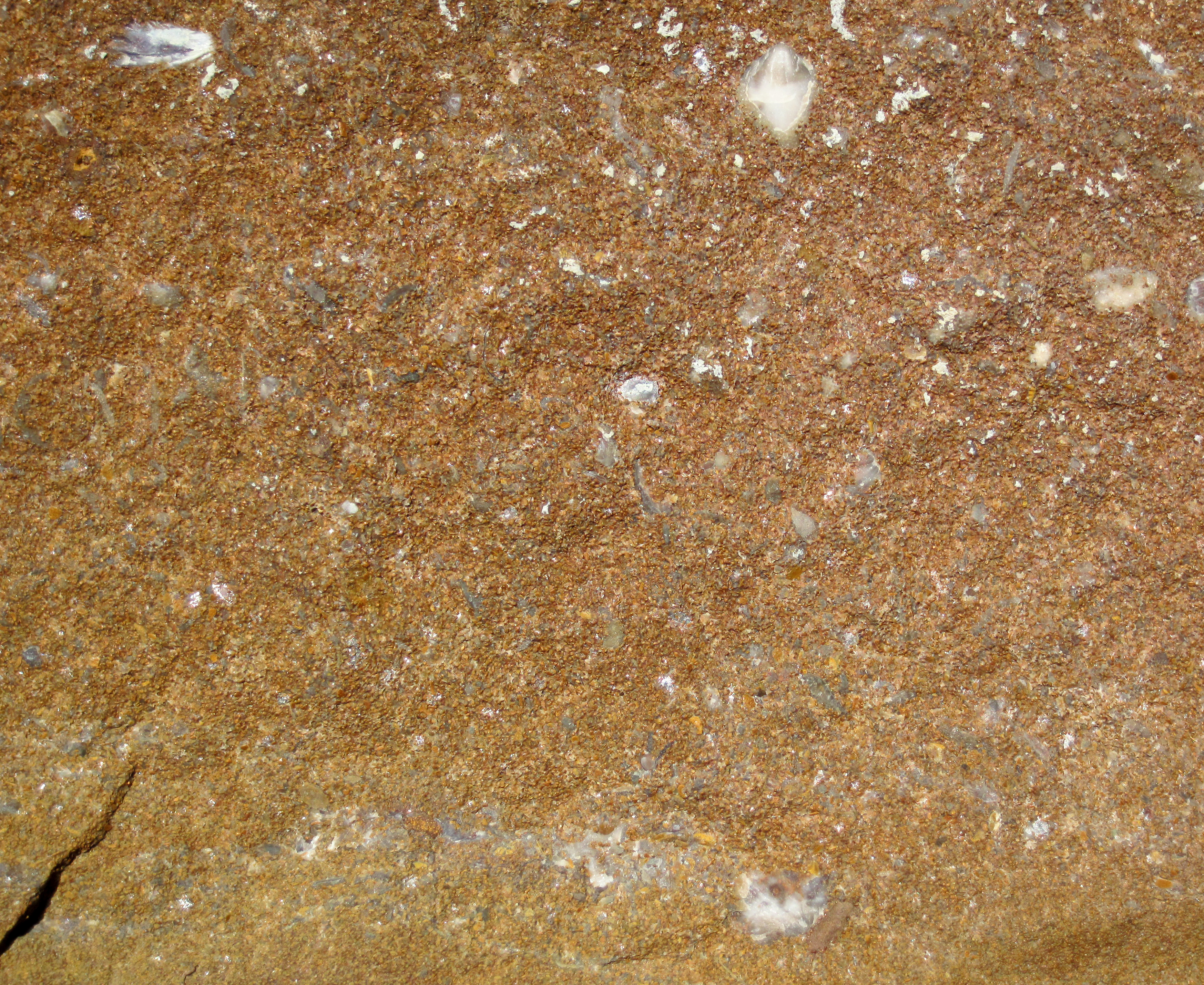
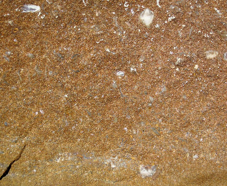
Oolitic ironstone in the Silurian of Ohio, USA. This is a scarce sedimentary lithology - oolitic ironstone. The rock is a bit more complicated that even that, however. The dominant grains are rounded oolites and peloids composed of rusty brown to reddish-brown to yellowish-brown iron oxides (click on the photo to zoom in and look around). The oolites are cemented together with calcite (CaCO3 - calcium carbonate). Macrofossils are common - mostly brachiopods, but other typical Paleozoic shallow marine invertebrates are also present. The fossils are usually irregularly-shaped, gray-colored clasts. This unusual rock comes from the Early Silurian-aged Brassfield Formation of Ohio. The Brassfield is a heterolithic unit dominated by limestones, dolostones, and shales. Other lithologies include cherty limestone, fossiliferous chert, and glauconitic chert. In the subsurface of eastern Ohio, the Brassfield's lateral equivalent is called the Clinton Sandstone, or Clinton Formation. The Clinton is an interbedded succession of quartzose sandstones and shales. The sandstones are frequently charged with economic volumes of petroleum (crude oil & natural gas). The Clinton is one of the most economically significant petroleum systems in all of Ohio (others being the Ordovician-aged Trenton Limestone of northwestern Ohio and the Cambro-Ordovician aged Knox-Rose Run interval). Stratigraphy: talus derived from the Brassfield Formation, Llandoverian Series, Lower Silurian Locality: Ohio Brush Creek outcrop - roadcut on the western side of Rt. 41, immediately south of the Ohio Brush Creek bridge, southwest of Peebles & northeast of West Union, north-central Adams County, southern Ohio, USA (38° 53' 36.54" North latitude, 83° 27' 11.27" West longitude) |
| Date | |
| Source | Oolitic ironstone (Brassfield Formation, Lower Silurian; Ohio Brush Creek roadcut, southern Ohio, USA) 4 |
| Author | James St. John |
Licensing[edit]
_4_(35933559334).jpg&action=edit§ion=2)
- You are free:
- to share – to copy, distribute and transmit the work
- to remix – to adapt the work
- Under the following conditions:
- attribution – You must give appropriate credit, provide a link to the license, and indicate if changes were made. You may do so in any reasonable manner, but not in any way that suggests the licensor endorses you or your use.
| This image was originally posted to Flickr by James St. John at https://flickr.com/photos/47445767@N05/35933559334 (archive). It was reviewed on 6 December 2019 by FlickreviewR 2 and was confirmed to be licensed under the terms of the cc-by-2.0. |
File history
Click on a date/time to view the file as it appeared at that time.
| Date/Time | Thumbnail | Dimensions | User | Comment | |
|---|---|---|---|---|---|
| current | 03:03, 6 December 2019 | | 3,494 × 2,860 (6.38 MB) | Ser Amantio di Nicolao (talk | contribs) | Transferred from Flickr via #flickr2commons |
You cannot overwrite this file.
File usage on Commons
There are no pages that use this file.
_4_(35933559334).jpg&oldid=650669085)