File:Oghuz languages.PNG
Jump to navigation
Jump to search
No higher resolution available.
Oghuz_languages.PNG (770 × 481 pixels, file size: 31 KB, MIME type: image/png)
Captions
Captions
Add a one-line explanation of what this file represents
Summary[edit]
| Description | |
| Date | |
| Source | Own work |
| Author | Arab League at English Wikipedia. A later version was uploaded by Beao at English Wikipedia. |
Licensing[edit]
| This work has been released into the public domain by its author, Arab League at English Wikipedia. This applies worldwide. In some countries this may not be legally possible; if so: Arab League grants anyone the right to use this work for any purpose, without any conditions, unless such conditions are required by law. |
Original upload log[edit]
Transferred from en.wikipedia to Commons by Innotata using CommonsHelper.
The original description page was here. All following user names refer to en.wikipedia.
- 2010-07-11 13:02 Beao 770×481× (26676 bytes)
- 2008-06-22 22:45 Arab League 770×481× (34615 bytes)
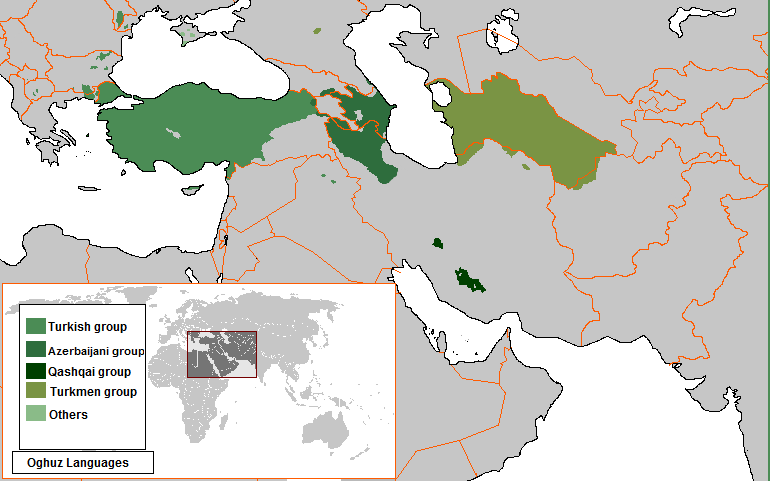
- 2007-11-26 02:20 Arab League 770×481× (34568 bytes) Map of the Oghuz Languages in Central Asia, and Easter Europe...
File history
Click on a date/time to view the file as it appeared at that time.
| Date/Time | Thumbnail | Dimensions | User | Comment | |
|---|---|---|---|---|---|
| current | 10:33, 6 January 2021 | | 770 × 481 (31 KB) | Ds02006 (talk | contribs) | Azerbaijani language is now spoken in liberated Nagorno-Karabakh |
| 12:15, 12 March 2019 |  | 770 × 481 (31 KB) | Maphobbyist (talk | contribs) | Reverted to version as of 20:44, 3 January 2018 (UTC) | |
| 14:51, 24 February 2019 |  | 770 × 481 (32 KB) | LenguaMapa (talk | contribs) | Reverted to version as of 01:09, 2 January 2018 (UTC), incorrect, please provide a reliable source for that | |
| 20:44, 3 January 2018 |  | 770 × 481 (31 KB) | A2D2 (talk | contribs) | Version which is based on the CIA World Factbook source. | |
| 01:09, 2 January 2018 |  | 770 × 481 (32 KB) | HistoryofIran (talk | contribs) | Sigh, removed disruptive edit, Azeri is not the majority in Markazi nor Tehran. | |
| 00:58, 2 January 2018 |  | 770 × 481 (31 KB) | A2D2 (talk | contribs) | Added areas where Azerbaijani is spoken by a majority as a mother language in Georgia, Turkey and Dagestan (Russia), corrected areas inside Republic of Azerbaijan where Azerbaijani is spoken and not spoken as a mother language by a majority. Based on v... | |
| 21:04, 1 January 2018 |  | 770 × 481 (32 KB) | HistoryofIran (talk | contribs) | Didn't realize Turkic is the majority language in Markazi and Tehran. Oh wait, just nationalistic nonsense again. | |
| 17:06, 27 December 2017 |  | 770 × 481 (33 KB) | A2D2 (talk | contribs) | Added areas where Azerbaijani is spoken by a majority as a mother language in Georgia, Turkey and Dagestan (Russia), corrected areas inside Republic of Azerbaijan where Azerbaijani is spoken and not spoken as a mother language by a majority. Based on v... | |
| 00:51, 12 December 2017 |  | 770 × 481 (31 KB) | BasilLeaf (talk | contribs) | Can we stop spamming now? Zanjan is clearly Turki, so is northern Hamadan, Astara of Iran, Urmia, and a lot of places in between. | |
| 22:18, 7 May 2017 |  | 770 × 481 (32 KB) | Dogstar (talk | contribs) | Shumen, Silistra, Razgrad and Targovishte in Bulgaria fix Kars, Artvin, Erzurum, Malatya, Elazig, Sanliurfa, Gaziantep, Kilis, Hatay, Adana, Osmaniye, Igdir in Turkey fix Prizren in Kosovo fix Turkmen Mountain area in Syria fix |
You cannot overwrite this file.
File usage on Commons
The following 17 pages use this file:
- User:Chumwa/OgreBot/Travel and communication maps/2016 August 11-20
- User:Chumwa/OgreBot/Travel and communication maps/2016 July 1-10
- User:Chumwa/OgreBot/Travel and communication maps/2016 July 11-20
- User:Chumwa/OgreBot/Travel and communication maps/2016 June 21-30
- User:Chumwa/OgreBot/Travel and communication maps/2016 March 11-20
- User:Chumwa/OgreBot/Travel and communication maps/2016 November 21-30
- User:Chumwa/OgreBot/Travel and communication maps/2017 April 21-30
- User:Chumwa/OgreBot/Travel and communication maps/2017 December 11-20
- User:Chumwa/OgreBot/Travel and communication maps/2017 December 21-31
- User:Chumwa/OgreBot/Travel and communication maps/2017 May 1-10
- User:Chumwa/OgreBot/Travel and communication maps/2019 February 19-28
- User:Chumwa/OgreBot/Travel and communication maps/2019 March 11-20
- User:Chumwa/OgreBot/Travel and communication maps/2021 January 1-10
- User:Geagea/Israel/2017 December 12
- User:Geagea/Israel/2017 December 27
- User:Geagea/Israel/2018 January 2
- User:Geagea/Israel/2018 January 3
File usage on other wikis
The following other wikis use this file:
- Usage on az.wikipedia.org
- Usage on en.wikipedia.org
- Usage on eu.wikipedia.org
- Usage on fa.wikipedia.org
- Usage on no.wikipedia.org
- Usage on ro.wikipedia.org
- Usage on sr.wikipedia.org
- Usage on test.wikipedia.org
- Usage on tg.wikipedia.org
- Usage on th.wikipedia.org
- Usage on tr.wikipedia.org
- Usage on tt.wikipedia.org
- Usage on ur.wikipedia.org
- Usage on vi.wikipedia.org