File:Obertraun - Dachstein-Krippensteinbahn, Kabine.JPG
Jump to navigation
Jump to search
Size of this preview: 400 × 600 pixels. Other resolutions: 160 × 240 pixels | 320 × 480 pixels | 512 × 768 pixels | 682 × 1,024 pixels | 1,365 × 2,048 pixels | 3,024 × 4,536 pixels.
Original file (3,024 × 4,536 pixels, file size: 10.31 MB, MIME type: image/jpeg)
Captions
Captions
Add a one-line explanation of what this file represents
Summary[edit]
| Description |
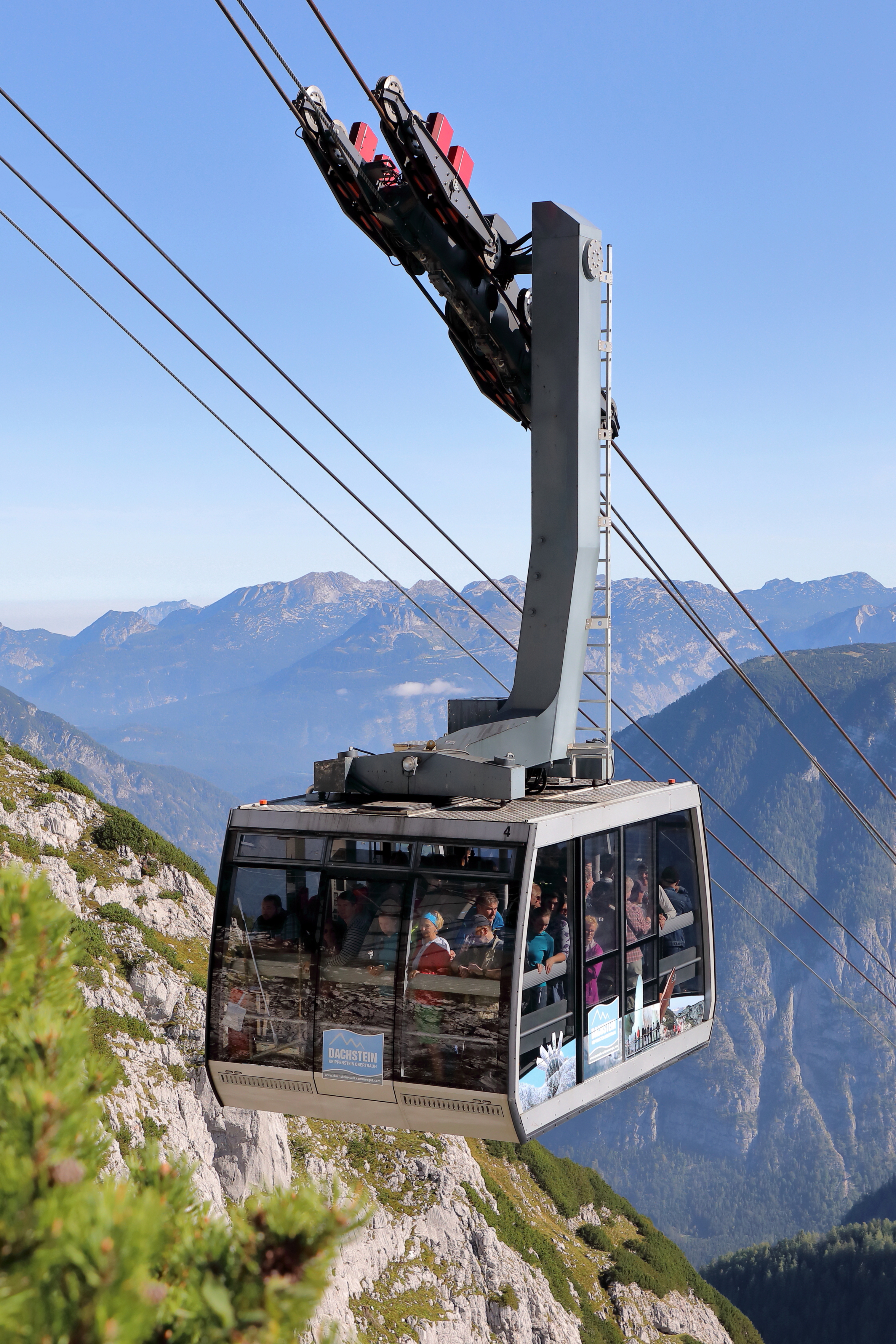
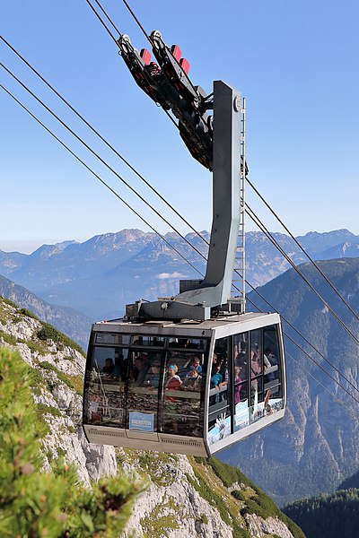
Deutsch: Kabine der Dachsteinseilbahn kurz vor der Krippenstein-Bergstation in der oberösterreichischen Gemeinde Obertraun und im Hintergrund das Tote Gebirge sowie rechts der Sarstein-Gebirgsstock. Die Seilbahn wurde ursprünglich 1951 (Sektion Obertraun-Schönbergalm) und 1956 (Sektion Schönbergalm-Krippenstein) errichtet. Im Jahr 2007 erfolgte die Kompletterneuerung beider Sektionen von der Vorarlberger Firma Steurer durch den Bau von zwei modernen Pendelbahnen mit 60 Personen fassenden Kabinen. |
| Date | |
| Source | Own work |
| Author | C.Stadler/Bwag |
| Permission (Reusing this file) |
Deutsch: Hallo, du darfst mein Foto kostenlos nutzen, aber nenne mich bitte als Fotograf, beispielsweise „Foto: C.Stadler/Bwag“ oder © C.Stadler/Bwag; CC-BY-SA-4.0. Auf mehr Angaben bestehe ich nicht - im Gegensatz zu manch anderen, die die Vorgaben der unten angeführten Lizenzierung auf Punkt und Beistrich einfordern. English: Feel free to use my photos, but please mention me as the author like © C.Stadler/Bwag or © C.Stadler/Bwag; CC-BY-SA-4.0 (that's good enough) and if you want send me a message: bwag@gmx.net. |
| Object location | | View this and other nearby images on: OpenStreetMap |
|---|
| Camera location | | View this and other nearby images on: OpenStreetMap |
|---|
Licensing[edit]
I, the copyright holder of this work, hereby publish it under the following license:
This file is licensed under the Creative Commons Attribution-Share Alike 4.0 International license.
- You are free:
- to share – to copy, distribute and transmit the work
- to remix – to adapt the work
- Under the following conditions:
- attribution – You must give appropriate credit, provide a link to the license, and indicate if changes were made. You may do so in any reasonable manner, but not in any way that suggests the licensor endorses you or your use.
- share alike – If you remix, transform, or build upon the material, you must distribute your contributions under the same or compatible license as the original.

|
Diese Datei wurde im Rahmen von WikiDaheim 2019 in Österreich erstellt und hochgeladen. Sie wurde dem Themenbereich Wikidata zugeordnet. |
| Annotations | This image is annotated: View the annotations at Commons |
This image has been assessed using the Quality image guidelines and is considered a Quality image.
|
File history
Click on a date/time to view the file as it appeared at that time.
| Date/Time | Thumbnail | Dimensions | User | Comment | |
|---|---|---|---|---|---|
| current | 18:50, 19 September 2019 | | 3,024 × 4,536 (10.31 MB) | Bwag (talk | contribs) | -dust |
| 18:42, 19 September 2019 |  | 3,024 × 4,536 (10.04 MB) | Bwag (talk | contribs) | b | |
| 18:23, 19 September 2019 |  | 3,039 × 4,559 (9.88 MB) | Bwag (talk | contribs) | {{Information |Description= {{de|1= Kabine der Dachsteinseilbahn kurz vor der Krippenstein-Bergstation in der oberösterreichischen Gemeinde Obertraun.<br/>Die Seilbahn wurde ursprünglich 1951 (Sektion Obertraun-Schönbergalm) und 1956 (Sektion Schönbergalm-Krippenstein) errichtet. Im Jahr 2007 erfolgte die Kompletterneuerung beider Sektionen durch den Bau von zwei modernen Pendelbahnen mit 60 Personen fassenden Kabinen durch die V... |
You cannot overwrite this file.
File usage on Commons
The following 4 pages use this file:
File usage on other wikis
The following other wikis use this file:
- Usage on de.wikipedia.org
- Usage on www.wikidata.org