File:OH 4 Bypass map alternate colors.svg
Jump to navigation
Jump to search

Size of this PNG preview of this SVG file: 800 × 471 pixels. Other resolutions: 320 × 188 pixels | 640 × 377 pixels | 1,024 × 603 pixels | 1,280 × 753 pixels | 2,560 × 1,506 pixels | 1,006 × 592 pixels.
Original file (SVG file, nominally 1,006 × 592 pixels, file size: 1.54 MB)
Captions
Captions
Add a one-line explanation of what this file represents
Summary[edit]
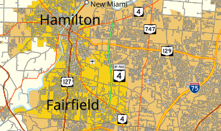
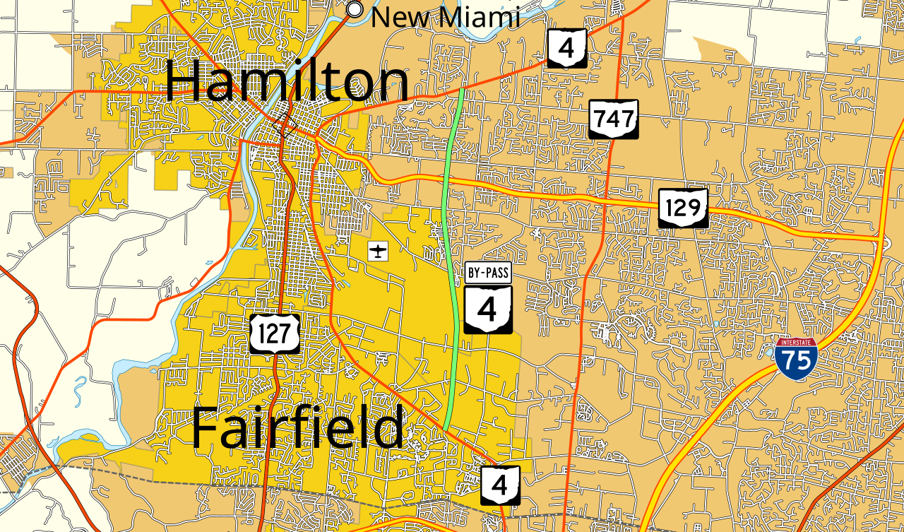
| Description | Map of Ohio State Route 4 Bypass with alternate coloring, based on potential standards mentioned here. Explicitly in public domain so that anyone may upload new versions as new standards evolve. |
| Date | |
| Source |
Own work, data from U.S. Census Bureau This W3C-unspecified vector image was created with Inkscape . |
| Author | Mr. Matté (talk · contribs) |
| Permission (Reusing this file) |
Explicitly released into public domain for any use and free re-upload as needed |
| Other versions | File:OH 4 Bypass map.svg |
Licensing[edit]
| I, the copyright holder of this work, release this work into the public domain. This applies worldwide. In some countries this may not be legally possible; if so: I grant anyone the right to use this work for any purpose, without any conditions, unless such conditions are required by law. |
File history
Click on a date/time to view the file as it appeared at that time.
| Date/Time | Thumbnail | Dimensions | User | Comment | |
|---|---|---|---|---|---|
| current | 18:52, 5 January 2014 | | 1,006 × 592 (1.54 MB) | Mr. Matté (talk | contribs) | =={{int:filedesc}}== {{Information |Description=Map of Ohio State Route 4 Bypass with alternate coloring, based on potential standards [[w:Wikipedia_talk:WikiProject_U.S._Roads#Proposal_to_change_MTF_colors... |
You cannot overwrite this file.
File usage on Commons
There are no pages that use this file.