File:Northern Liberty Market - Washington, D.C..jpg
Jump to navigation
Jump to search
Size of this preview: 800 × 548 pixels. Other resolutions: 320 × 219 pixels | 640 × 438 pixels | 1,024 × 701 pixels | 1,280 × 876 pixels | 1,531 × 1,048 pixels.
Original file (1,531 × 1,048 pixels, file size: 808 KB, MIME type: image/jpeg)
Captions
Captions
Add a one-line explanation of what this file represents
Summary[edit]
| Description |
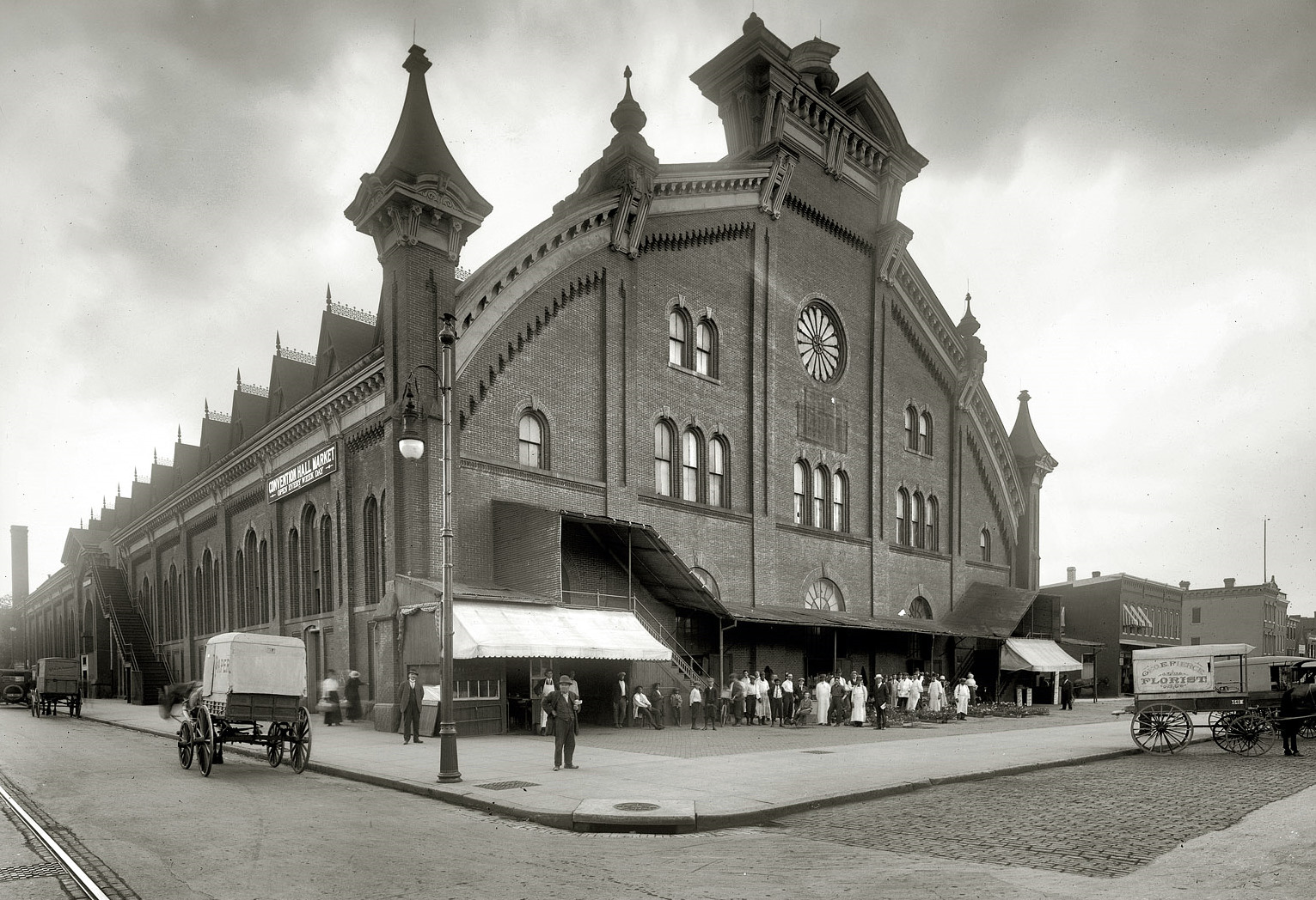
English: The Convention Hall Market, originally named Northern Liberty Market, was located on the east side of 5th Street NW, between K and L, in the present-day Mount Vernon Triangle neighborhood of Washington, D.C. The market opened in January 1875 and was designed by architect James H. McGill. In 1946, a fire resulted in the roof's collapse. The market was reopened, but with a flat roof. The building was painted pink in 1955 and renamed Center Market City. The market finally closed in 1963, and from 1965 to 1974, it was home to the National Historical Wax Museum. The empty building was finally demolished in 1985. |
|||
| Date | ||||
| Source |
|
|||
| Author | National Photo Company | |||
| Permission (Reusing this file) |
|


|
This image is available from the United States Library of Congress's Prints and Photographs division
under the digital ID npcc.32196. This tag does not indicate the copyright status of the attached work. A normal copyright tag is still required. See Commons:Licensing.
|
| Camera location | | View this and other nearby images on: OpenStreetMap |
|---|
File history
Click on a date/time to view the file as it appeared at that time.
| Date/Time | Thumbnail | Dimensions | User | Comment | |
|---|---|---|---|---|---|
| current | 01:40, 9 February 2009 | | 1,531 × 1,048 (808 KB) | APK (talk | contribs) | {{Information |Description={{en|1=The second building in Washington, D.C. to be named Northern Liberty Market was located on 5th Street, NW between K and L (the [http://maps.google.com/maps?q=5th+%26+K+Streets+NW+Washington+DC&ie=UTF8&split=0&gl=us&ei=fIW |
You cannot overwrite this file.
File usage on Commons
The following page uses this file:
File usage on other wikis
The following other wikis use this file:
- Usage on en.wikipedia.org