File:Northern Ireland - Counties mk.png
Jump to navigation
Jump to search

Size of this preview: 705 × 599 pixels. Other resolutions: 282 × 240 pixels | 565 × 480 pixels | 903 × 768 pixels | 1,204 × 1,024 pixels | 1,677 × 1,426 pixels.
Original file (1,677 × 1,426 pixels, file size: 287 KB, MIME type: image/png)
Captions
Captions
Add a one-line explanation of what this file represents
Summary[edit]
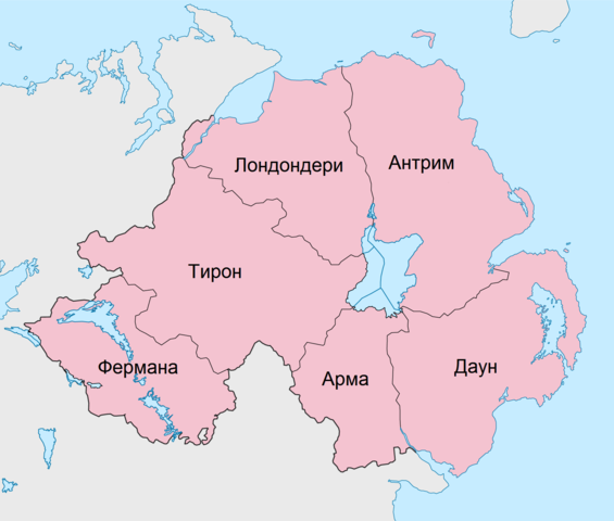
| Description |
Македонски: Карта на грофовиите во Северна Ирска.
English: Map in Macedonian. of the counties of Northern Ireland. |
| Date | (UTC) |
| Source |
This file was derived from: Northern Ireland - Counties.png: |
| Author |
|
| Other versions |
|


| This is a retouched picture, which means that it has been digitally altered from its original version. Modifications: Translated into Macedonian. The original can be viewed here: Northern Ireland - Counties.png:
|
Licensing[edit]
I, the copyright holder of this work, hereby publish it under the following license:
This file is licensed under the Creative Commons Attribution-Share Alike 2.5 Generic license.
- You are free:
- to share – to copy, distribute and transmit the work
- to remix – to adapt the work
- Under the following conditions:
- attribution – You must give appropriate credit, provide a link to the license, and indicate if changes were made. You may do so in any reasonable manner, but not in any way that suggests the licensor endorses you or your use.
- share alike – If you remix, transform, or build upon the material, you must distribute your contributions under the same or compatible license as the original.
Original upload log[edit]
This image is a derivative work of the following images:
- File:Northern_Ireland_-_Counties.png licensed with Cc-by-sa-2.5
- 2009-09-28T18:49:16Z Chumwa 1677x1426 (234643 Bytes) {{Information |Description= {{ de }} Counties von Nordirland {{ en }} Counties of Northern Ireland |Source=Self made, using [[:File:Northern Ireland location map.svg|this map]] by [[User:NordNordWest|NNW]] |Date=2009-09 |Auth
Uploaded with derivativeFX
File history
Click on a date/time to view the file as it appeared at that time.
| Date/Time | Thumbnail | Dimensions | User | Comment | |
|---|---|---|---|---|---|
| current | 07:15, 11 June 2012 | | 1,677 × 1,426 (287 KB) | Bjankuloski06en (talk | contribs) | == {{int:filedesc}} == {{Information |Description={{mk|Карта на грофовиите во Северна Ирска.}} {{en|Map in Macedonian. of the counties of Northern Ireland.}} |Source... |
You cannot overwrite this file.
File usage on Commons
The following 4 pages use this file:
File usage on other wikis
The following other wikis use this file:
- Usage on mk.wikipedia.org