File:Northeast Ohio.png
Jump to navigation
Jump to search
Size of this preview: 551 × 599 pixels. Other resolutions: 221 × 240 pixels | 441 × 480 pixels.
Original file (800 × 870 pixels, file size: 159 KB, MIME type: image/png)
Captions
Captions
Add a one-line explanation of what this file represents
Summary[edit]
{{Information
|description=
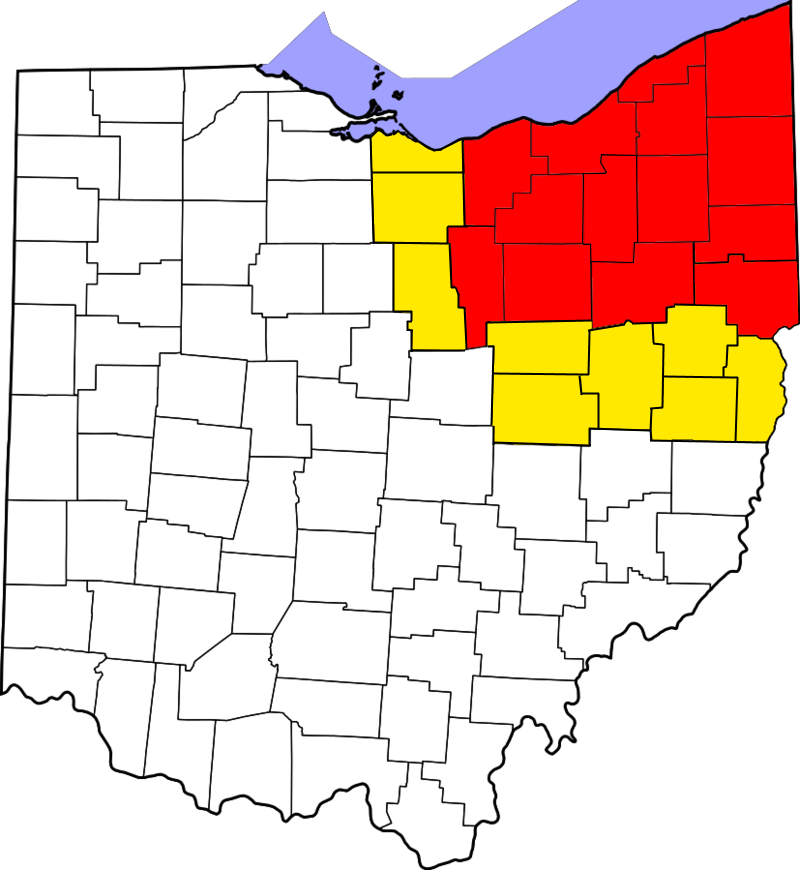
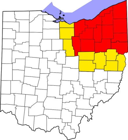
English: This is a locator map showing counties in Northeast Ohio. Specific areas of the Northeastern Region of Ohio are highlighted in red, with areas sometimes included in the region on other lists being highlighted in yellow.
Licensing[edit]
I, the copyright holder of this work, hereby publish it under the following license:
This file is licensed under the Creative Commons Attribution-Share Alike 4.0 International license.
- You are free:
- to share – to copy, distribute and transmit the work
- to remix – to adapt the work
- Under the following conditions:
- attribution – You must give appropriate credit, provide a link to the license, and indicate if changes were made. You may do so in any reasonable manner, but not in any way that suggests the licensor endorses you or your use.
- share alike – If you remix, transform, or build upon the material, you must distribute your contributions under the same or compatible license as the original.
File history
Click on a date/time to view the file as it appeared at that time.
| Date/Time | Thumbnail | Dimensions | User | Comment | |
|---|---|---|---|---|---|
| current | 01:24, 8 August 2018 | | 800 × 870 (159 KB) | 636Buster (talk | contribs) | Colors more visible and lines more definied |
| 00:49, 8 August 2018 |  | 800 × 870 (164 KB) | 636Buster (talk | contribs) | Boundaries corrected | |
| 00:54, 9 February 2017 |  | 827 × 899 (115 KB) | 636Buster (talk | contribs) | User created page with UploadWizard |
You cannot overwrite this file.
File usage on Commons
There are no pages that use this file.
File usage on other wikis
The following other wikis use this file:
- Usage on en.wikipedia.org
- Usage on www.wikidata.org