File:North Korea Topography.png
Jump to navigation
Jump to search

Size of this preview: 583 × 599 pixels. Other resolutions: 233 × 240 pixels | 467 × 480 pixels | 747 × 768 pixels | 996 × 1,024 pixels | 1,705 × 1,753 pixels.
Original file (1,705 × 1,753 pixels, file size: 3.56 MB, MIME type: image/png)
Captions
Captions
Importance
Summary[edit]
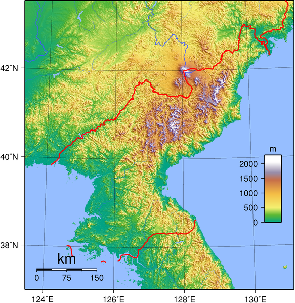
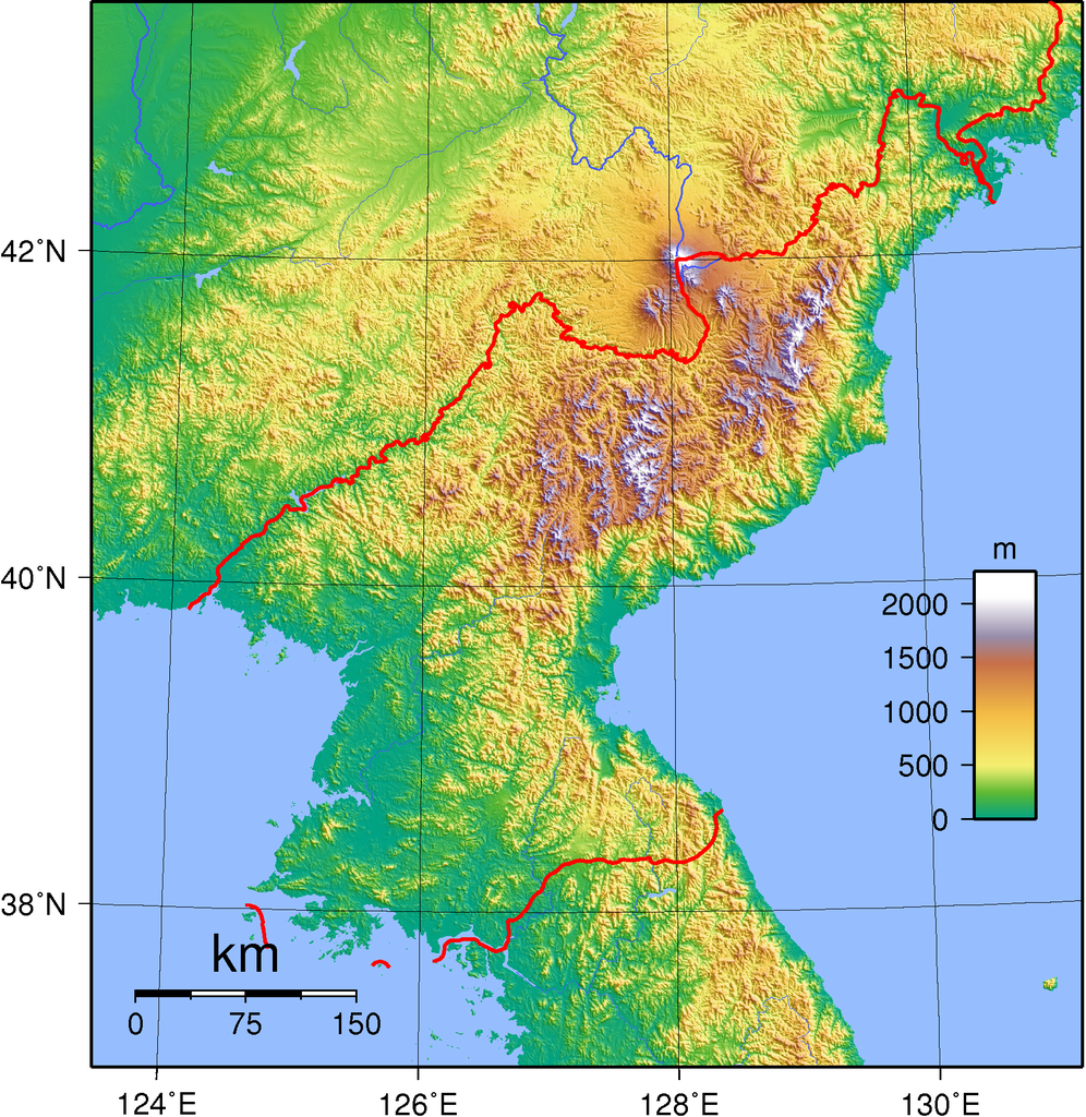
| Description | Topographic map of the territory claimed by North Korea. Created with GMT from SRTM data. |
| Date | |
| Source | Own work |
| Author | Sadalmelik |
| Other versions | Derivative works of this file: Chilbo-san North Korea.jpg |
Licensing[edit]
I, the copyright holder of this work, hereby publish it under the following licenses:

|
Permission is granted to copy, distribute and/or modify this document under the terms of the GNU Free Documentation License, Version 1.2 or any later version published by the Free Software Foundation; with no Invariant Sections, no Front-Cover Texts, and no Back-Cover Texts. A copy of the license is included in the section entitled GNU Free Documentation License. |
This file is licensed under the Creative Commons Attribution-Share Alike 3.0 Unported, 2.5 Generic, 2.0 Generic and 1.0 Generic license.
- You are free:
- to share – to copy, distribute and transmit the work
- to remix – to adapt the work
- Under the following conditions:
- attribution – You must give appropriate credit, provide a link to the license, and indicate if changes were made. You may do so in any reasonable manner, but not in any way that suggests the licensor endorses you or your use.
- share alike – If you remix, transform, or build upon the material, you must distribute your contributions under the same or compatible license as the original.
You may select the license of your choice.
흐화ㅐ ㅜㅜ 할45분
File history
Click on a date/time to view the file as it appeared at that time.
| Date/Time | Thumbnail | Dimensions | User | Comment | |
|---|---|---|---|---|---|
| current | 17:48, 1 September 2007 | | 1,705 × 1,753 (3.56 MB) | Sadalmelik (talk | contribs) | {{Information |Description=Topographic map of North Korea. Created wth GMT from SRTM data. |Source=self-made |Date=Sep 1, 2007 |Author= Sadalmelik }} Category:Topographic maps of Asia Category:Maps of North Korea |
You cannot overwrite this file.
File usage on Commons
The following 2 pages use this file:
File usage on other wikis
The following other wikis use this file:
- Usage on ang.wikipedia.org
- Usage on ar.wikipedia.org
- Usage on ast.wikipedia.org
- Usage on bbc.wikipedia.org
- Usage on be.wikipedia.org
- Usage on bg.wikipedia.org
- Usage on bn.wikipedia.org
- Usage on cy.wikipedia.org
- Usage on el.wikipedia.org
- Usage on en.wikipedia.org
- Usage on es.wikipedia.org
- Usage on eu.wikipedia.org
- Usage on fi.wikipedia.org
- Usage on fi.wikibooks.org
- Usage on fr.wikipedia.org
- Usage on ha.wikipedia.org
- Usage on he.wikipedia.org
- Usage on hr.wikipedia.org
- Usage on hu.wikipedia.org
- Usage on id.wikipedia.org
- Usage on it.wikipedia.org
- Usage on ja.wikipedia.org
- Usage on km.wikipedia.org
- Usage on kn.wikipedia.org
- Usage on ko.wikipedia.org
- Usage on li.wikipedia.org
- Usage on mai.wikipedia.org
- Usage on mk.wikipedia.org
- Usage on mn.wikipedia.org
- Usage on ms.wikipedia.org
- Usage on mt.wikipedia.org
- Usage on no.wikipedia.org
- Usage on pl.wikipedia.org
- Usage on pt.wikipedia.org
View more global usage of this file.