File:Norfolk Southern Railway system map with CSR.png
Jump to navigation
Jump to search
No higher resolution available.
Norfolk_Southern_Railway_system_map_with_CSR.png (605 × 577 pixels, file size: 89 KB, MIME type: image/png)
Captions
Captions
Add a one-line explanation of what this file represents
Summary[edit]
| Description |
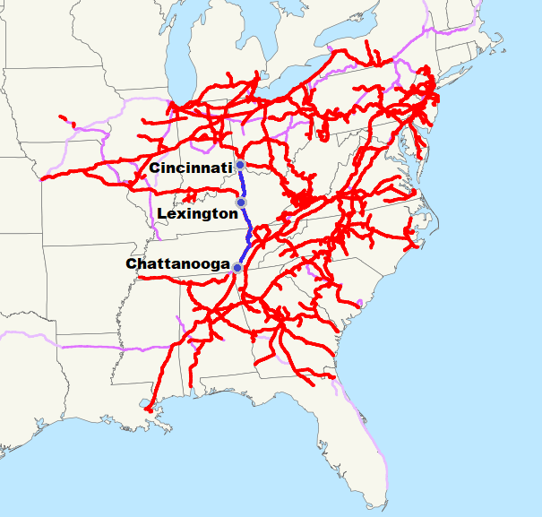
English: Norfolk Southern Railway system map with the Cincinnati Southern Railway in blue (Cincinnati, New Orleans and Texas Pacific Railway) |
| Date | 15 January 2009 (original upload date of the original map) |
| Source |
This file was derived from: Norfolk Southern Railway system map.svg |
| Author | Adaption of map from NE2 |
Licensing[edit]
| I, the copyright holder of this work, release this work into the public domain. This applies worldwide. In some countries this may not be legally possible; if so: I grant anyone the right to use this work for any purpose, without any conditions, unless such conditions are required by law. |
File history
Click on a date/time to view the file as it appeared at that time.
| Date/Time | Thumbnail | Dimensions | User | Comment | |
|---|---|---|---|---|---|
| current | 17:18, 28 May 2019 | | 605 × 577 (89 KB) | Krib (talk | contribs) | more cropped |
| 11:01, 28 May 2019 |  | 606 × 615 (96 KB) | Krib (talk | contribs) | cropped | |
| 10:54, 28 May 2019 |  | 607 × 685 (102 KB) | Krib (talk | contribs) | User created page with UploadWizard |
You cannot overwrite this file.
File usage on Commons
There are no pages that use this file.
File usage on other wikis
The following other wikis use this file:
- Usage on ar.wikipedia.org
- Usage on de.wikipedia.org