File:Nied Gemarkung Karte 1810.jpg
Jump to navigation
Jump to search

Size of this preview: 800 × 478 pixels. Other resolutions: 320 × 191 pixels | 640 × 383 pixels | 1,024 × 612 pixels | 1,428 × 854 pixels.
Original file (1,428 × 854 pixels, file size: 886 KB, MIME type: image/jpeg)
Captions
Captions
Add a one-line explanation of what this file represents
| Description |
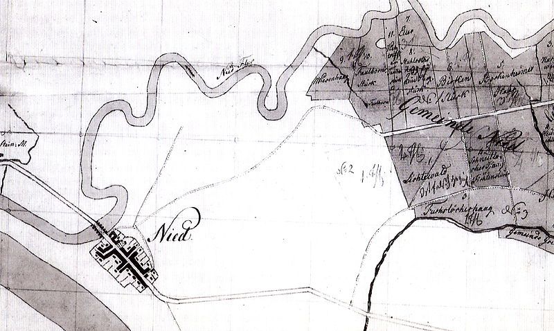
Deutsch: Nied bei Höchst am Main: Lageplan der Gemarkung der Gemeinde, 1810 (Ausschnitt). Angefertigt von Geometer Adam Appel anläßlich der Aufmessung des Nieder Gemeindewaldes. Original im Hauptstaatsarchiv Wiesbaden |
| Date | |
| Source | Scanned from: Nied am Main – Chronik eines Frankfurter Stadtteils von Adalbert Vollert. Heimat- und Geschichtsverein Nied e.V., 1998 |
| Author | Adam Appel, Geometer |
|
This work is in the public domain in its country of origin and other countries and areas where the copyright term is the author's life plus 100 years or fewer. This work is in the public domain in the United States because it was published (or registered with the U.S. Copyright Office) before January 1, 1929. | |
| This file has been identified as being free of known restrictions under copyright law, including all related and neighboring rights. | |
File history
Click on a date/time to view the file as it appeared at that time.
| Date/Time | Thumbnail | Dimensions | User | Comment | |
|---|---|---|---|---|---|
| current | 14:28, 31 July 2012 | | 1,428 × 854 (886 KB) | Frank Behnsen (talk | contribs) | {{Information |Description={{de|1=Nied bei Frankfurt am Main: Lageplan der Gemarkung der Gemeinde, 1870 (Ausschnitt)}} |Source=Scanned from: ''Nied am Main – Chronik eines Frankfurter Stadtteils'' von Adalbert Vollert. Heimat- und Geschichtsverein Ni... |
You cannot overwrite this file.
File usage on Commons
The following page uses this file:
File usage on other wikis
The following other wikis use this file:
- Usage on de.wikipedia.org
- Usage on ru.wikipedia.org