File:New Jersey Legislative Districts 2001 by 2004 2005 assembly party.svg
Jump to navigation
Jump to search

Size of this PNG preview of this SVG file: 316 × 600 pixels. Other resolutions: 126 × 240 pixels | 253 × 480 pixels | 404 × 768 pixels | 539 × 1,024 pixels | 1,079 × 2,048 pixels | 512 × 972 pixels.
Original file (SVG file, nominally 512 × 972 pixels, file size: 1.33 MB)
Captions
Captions
Add a one-line explanation of what this file represents
Summary[edit]
| Description |
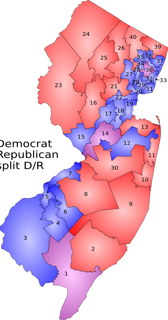
New Jersey state legislative districts, based upon 2000 U.S. census, went into effect 2001. Colored by party of NJ State Assembly representatives for 2004 to 2005 term. Sources:
|
| Date | 8 November 2005 (original upload date) |
| Source | No machine-readable source provided. Own work assumed (based on copyright claims). |
| Author | No machine-readable author provided. ChrisRuvolo assumed (based on copyright claims). |
Licensing[edit]
| I, the copyright holder of this work, release this work into the public domain. This applies worldwide. In some countries this may not be legally possible; if so: I grant anyone the right to use this work for any purpose, without any conditions, unless such conditions are required by law. |
File history
Click on a date/time to view the file as it appeared at that time.
| Date/Time | Thumbnail | Dimensions | User | Comment | |
|---|---|---|---|---|---|
| current | 21:00, 8 November 2005 | | 512 × 972 (1.33 MB) | ChrisRuvolo (talk | contribs) | New Jersey state legislative districts, based upon 2000 U.S. census, went into effect 2001. Colored by party of NJ State Assembly representatives for 2004 to 2005 term. Sources: *Outline maps came from: [http://www.state.nj.us/transportation/gis/map.sht |
You cannot overwrite this file.
File usage on Commons
There are no pages that use this file.