File:New Bridge, Burstwick - geograph.org.uk - 978727.jpg
Jump to navigation
Jump to search
No higher resolution available.
New_Bridge,_Burstwick_-_geograph.org.uk_-_978727.jpg (640 × 472 pixels, file size: 103 KB, MIME type: image/jpeg)
Captions
Captions
Add a one-line explanation of what this file represents
Summary[edit]
| Description |
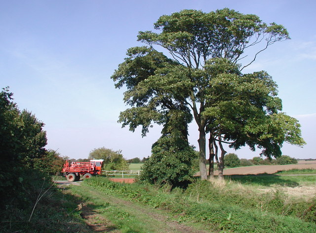
English: New Bridge, Burstwick, East Riding of Yorkshire, England. The small brick bridge (between the crop sprayer and the sycamore trees in the picture) where the road to Totley's Farm and Burstwick Grange crosses East Carr Drain. The bridge was built by the Keyingham Level Drainage Board in the mid 19th century, possibly in 1832 (I had trouble making out the numbers on the bridge's date stone). |
| Date | |
| Source | From geograph.org.uk |
| Author | Paul Glazzard |
| Permission (Reusing this file) |
Creative Commons Attribution Share-alike license 2.0 |
| Attribution (required by the license) | Paul Glazzard / New Bridge, Burstwick / |
| Camera location | | View this and other nearby images on: OpenStreetMap |
|---|
_heading:0.00&language=en)
| Object location | | View this and other nearby images on: OpenStreetMap |
|---|
_heading:0.00&language=en)
Licensing[edit]

|
This image was taken from the Geograph project collection. See this photograph's page on the Geograph website for the photographer's contact details. The copyright on this image is owned by Paul Glazzard and is licensed for reuse under the Creative Commons Attribution-ShareAlike 2.0 license.
|
This file is licensed under the Creative Commons Attribution-Share Alike 2.0 Generic license.
Attribution: Paul Glazzard
- You are free:
- to share – to copy, distribute and transmit the work
- to remix – to adapt the work
- Under the following conditions:
- attribution – You must give appropriate credit, provide a link to the license, and indicate if changes were made. You may do so in any reasonable manner, but not in any way that suggests the licensor endorses you or your use.
- share alike – If you remix, transform, or build upon the material, you must distribute your contributions under the same or compatible license as the original.
File history
Click on a date/time to view the file as it appeared at that time.
| Date/Time | Thumbnail | Dimensions | User | Comment | |
|---|---|---|---|---|---|
| current | 20:57, 22 February 2011 | | 640 × 472 (103 KB) | GeographBot (talk | contribs) | == {{int:filedesc}} == {{Information |description={{en|1=New Bridge, Burstwick The small brick bridge (between the crop sprayer and the sycamore trees in the picture) where the road to Totley's Farm and Burstwick Grange crosses East Carr Drain. The bridge |
You cannot overwrite this file.
File usage on Commons
There are no pages that use this file.
Metadata
Categories:
- Files with coordinates missing SDC location of creation (53° N, -1°E)
- Burstwick
- Self-propelled field sprayers
- Agricultural vehicles in the East Riding of Yorkshire
- Trees in the East Riding of Yorkshire
- Drainage channels in the East Riding of Yorkshire
- Road bridges in the East Riding of Yorkshire
- Fields in the East Riding of Yorkshire
- September 2008 in the East Riding of Yorkshire