File:Natural Resource Condition Assessment for Cumberland Gap National Historical Park (page 102 crop).jpg
Jump to navigation
Jump to search

Size of this preview: 769 × 600 pixels. Other resolutions: 308 × 240 pixels | 616 × 480 pixels | 985 × 768 pixels | 1,280 × 998 pixels | 2,391 × 1,865 pixels.
Original file (2,391 × 1,865 pixels, file size: 221 KB, MIME type: image/jpeg)
Captions
Captions
Add a one-line explanation of what this file represents
Summary[edit]
| Description |
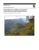
English: NPS Map of rare vegetation communities within the Cumberland Gap National Historical Park |
| Date | |
| Source | Document taken from NPS website at https://irma.nps.gov/DataStore/DownloadFile/463305 |
| Author | National Park Service |
| Other versions |
.jpg&action=edit§ion=1)
Licensing[edit]
.jpg&action=edit§ion=2)
| This image or media file contains material based on a work of a National Park Service employee, created as part of that person's official duties. As a work of the U.S. federal government, such work is in the public domain in the United States. See the NPS website and NPS copyright policy for more information. |
File history
Click on a date/time to view the file as it appeared at that time.
| Date/Time | Thumbnail | Dimensions | User | Comment | |
|---|---|---|---|---|---|
| current | 17:07, 20 April 2018 | | 2,391 × 1,865 (221 KB) | GreenMeansGo (talk | contribs) | File:Natural Resource Condition Assessment for Cumberland Gap National Historical Park.pdf cropped 28 % horizontally, 27 % vertically using CropTool with precise mode. |
You cannot overwrite this file.
File usage on Commons
The following 2 pages use this file:
.jpg&oldid=297745753)