File:NatGeo world hemispheres 1943.jpg
Jump to navigation
Jump to search

Size of this preview: 800 × 420 pixels. Other resolutions: 320 × 168 pixels | 640 × 336 pixels | 1,024 × 538 pixels | 1,280 × 672 pixels | 2,560 × 1,345 pixels | 4,917 × 2,583 pixels.
Original file (4,917 × 2,583 pixels, file size: 5.46 MB, MIME type: image/jpeg)
Captions
Captions
Add a one-line explanation of what this file represents
Summary[edit]
| Description |
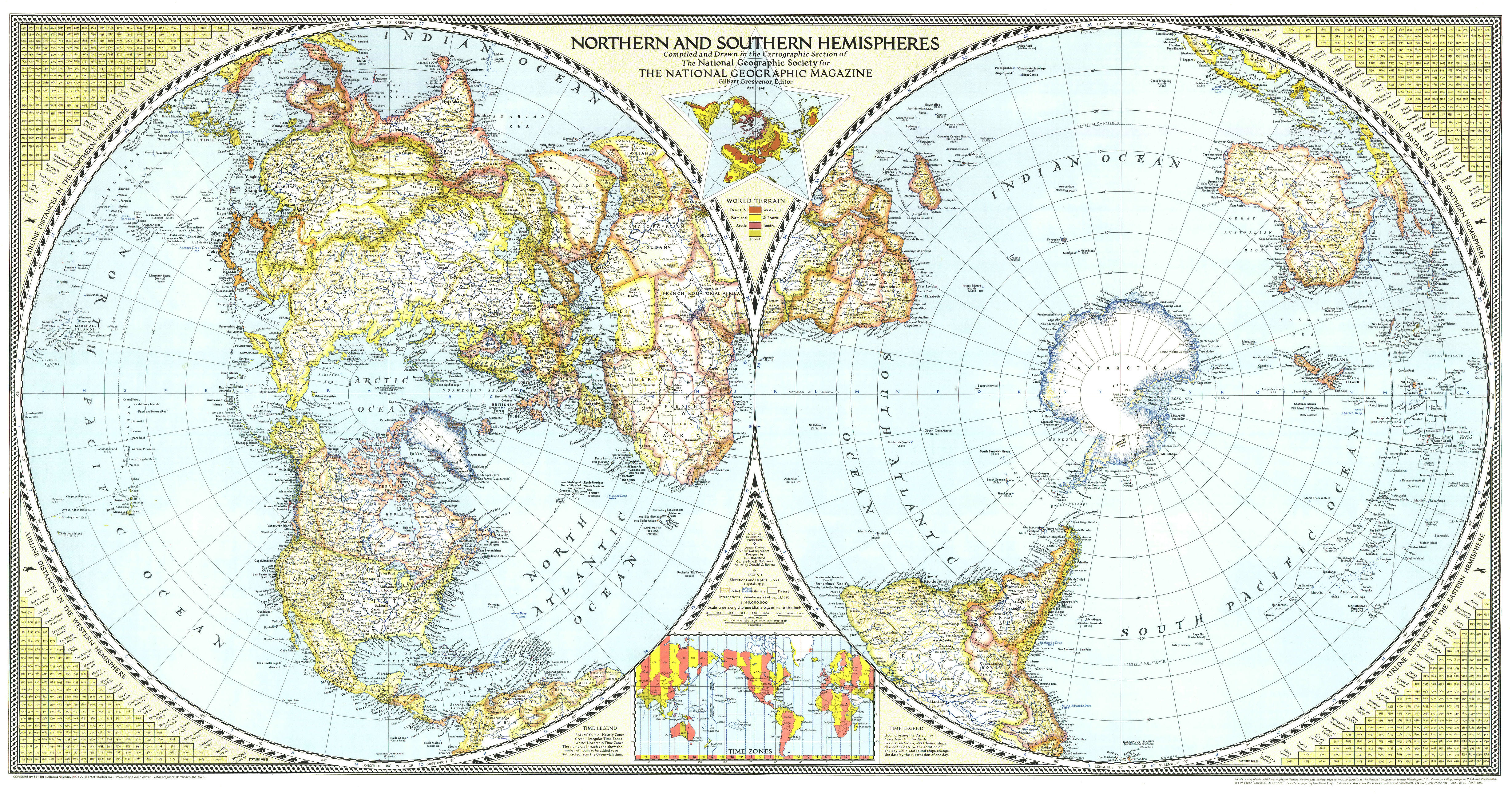
English: Map of the Northern and Southern hemispheres in 1943, drawn with Azimuthal equidistant projection. Scale along the meridians: 1 inch = 632 miles (1: 40,000,000). Extra maps: World terrain and time zones Includes airline distances. |
| Date | |
| Source | https://live.staticflickr.com/3265/3149211098_e898bd9aaf_5k.jpg |
| Author | National Geographic Society |
Licensing[edit]
This work is in the public domain because it was published in the United States between 1929 and 1963, and although there may or may not have been a copyright notice, the copyright was not renewed. For further explanation, see Commons:Hirtle chart and the copyright renewal logs. Note that it may still be copyrighted in jurisdictions that do not apply the rule of the shorter term for US works (depending on the date of the author's death), such as Canada (70 years p.m.a.), Mainland China (50 years p.m.a., not Hong Kong or Macao), Germany (70 years p.m.a.), Mexico (100 years p.m.a.), Switzerland (70 years p.m.a.), and other countries with individual treaties.
|
 |
File history
Click on a date/time to view the file as it appeared at that time.
| Date/Time | Thumbnail | Dimensions | User | Comment | |
|---|---|---|---|---|---|
| current | 19:36, 14 August 2022 | | 4,917 × 2,583 (5.46 MB) | Universalis (talk | contribs) | Uploaded a work by National Geographic Society from https://live.staticflickr.com/3265/3149211098_e898bd9aaf_5k.jpg with UploadWizard |
You cannot overwrite this file.
File usage on Commons
There are no pages that use this file.