File:NPS sandy-hook-historic-building-map.jpg
Jump to navigation
Jump to search

Size of this preview: 396 × 600 pixels. Other resolutions: 158 × 240 pixels | 317 × 480 pixels | 507 × 768 pixels | 676 × 1,024 pixels | 1,962 × 2,972 pixels.
Original file (1,962 × 2,972 pixels, file size: 816 KB, MIME type: image/jpeg)
Captions
Captions
Add a one-line explanation of what this file represents
Summary[edit]
| Description |
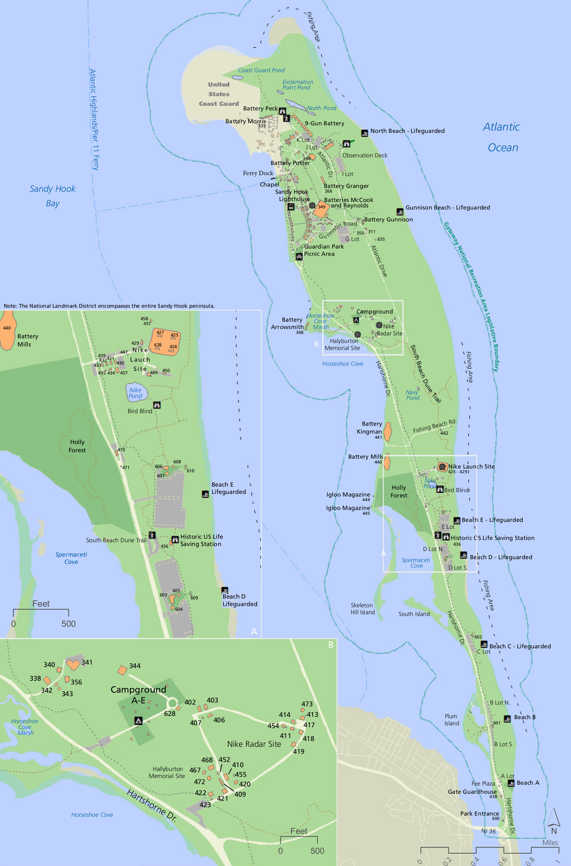
English: Sandy Hook historic buildings map, labeling and identifying many historic structures not just in Fort Hancock but throughout the rest of Sandy Hook unit too. |
| Date | |
| Source | U.S. National Park Service (http://npmaps.com/wp-content/uploads/sandy-hook-historic-building-map.jpg) |
| Author | U.S. National Park Service, restoration/cleanup by Matt Holly |
Licensing[edit]
| This image or media file contains material based on a work of a National Park Service employee, created as part of that person's official duties. As a work of the U.S. federal government, such work is in the public domain in the United States. See the NPS website and NPS copyright policy for more information. |
File history
Click on a date/time to view the file as it appeared at that time.
| Date/Time | Thumbnail | Dimensions | User | Comment | |
|---|---|---|---|---|---|
| current | 21:33, 16 May 2017 | | 1,962 × 2,972 (816 KB) | RKBot (talk | contribs) | =={{int:filedesc}}== {{Information |description= {{en|1=Sandy Hook historic buildings map, labeling and identifying many historic structures not just in Fort Hancock but throughout the rest of Sandy Hook unit too.}} |date= 2016-06-18 |source= U.S. Nati... |
You cannot overwrite this file.
File usage on Commons
The following page uses this file: