File:NPS joshua-tree-lost-palms-oasis-mastadon-peak-trail-map.gif
Jump to navigation
Jump to search

Size of this preview: 800 × 570 pixels. Other resolutions: 320 × 228 pixels | 640 × 456 pixels | 992 × 707 pixels.
Original file (992 × 707 pixels, file size: 56 KB, MIME type: image/gif, 0.1 s)
Captions
Captions
Add a one-line explanation of what this file represents
Summary[edit]
| Description |
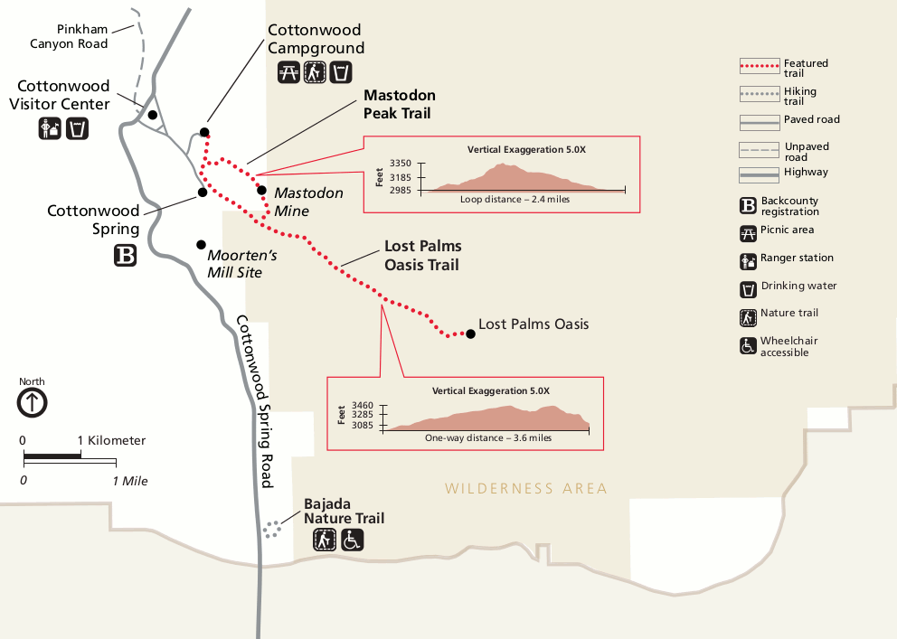
English: Lost Palms Oasis trail map, also showing the Mastadon Peak trail to Mastadon Mine from Cottonwood Spring. You can get to these from the Cottonwood Visitor Center area in the southern part of the park. |
| Date | |
| Source | U.S. National Park Service (http://npmaps.com/wp-content/uploads/joshua-tree-lost-palms-oasis-mastadon-peak-trail-map.gif) |
| Author | U.S. National Park Service, restoration/cleanup by Matt Holly |
Licensing[edit]
| This image or media file contains material based on a work of a National Park Service employee, created as part of that person's official duties. As a work of the U.S. federal government, such work is in the public domain in the United States. See the NPS website and NPS copyright policy for more information. |
File history
Click on a date/time to view the file as it appeared at that time.
| Date/Time | Thumbnail | Dimensions | User | Comment | |
|---|---|---|---|---|---|
| current | 00:21, 17 May 2017 | | 992 × 707 (56 KB) | RKBot (talk | contribs) | =={{int:filedesc}}== {{Information |description= {{en|1=Lost Palms Oasis trail map, also showing the Mastadon Peak trail to Mastadon Mine from Cottonwood Spring. You can get to these from the Cottonwood Visitor Center area in the southern part of the p... |
You cannot overwrite this file.
File usage on Commons
The following page uses this file: