File:NPS Regions.JPG
Jump to navigation
Jump to search
No higher resolution available.
NPS_Regions.JPG (543 × 415 pixels, file size: 43 KB, MIME type: image/jpeg)
Captions
Captions
Add a one-line explanation of what this file represents
Summary[edit]
| Description |
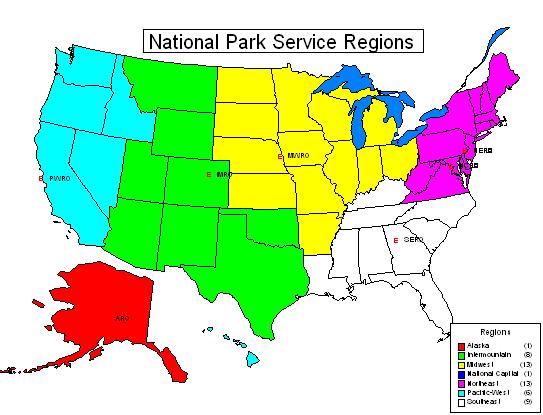
English: Map showing the administrative regions of the National Park Service.
Alaska
Intermountain
Midwest
National Capital
Northeast
Pacific-West
Southeast |
| Date | |
| Source | Department of the Interior, National Park Service |
| Author | Department of the Interior, National Park Service |


Licensing[edit]
| This image or media file contains material based on a work of a National Park Service employee, created as part of that person's official duties. As a work of the U.S. federal government, such work is in the public domain in the United States. See the NPS website and NPS copyright policy for more information. |
Original upload log[edit]
Transferred from en.wikipedia to Commons by Magnus Manske using CommonsHelper.
The original description page was here. All following user names refer to en.wikipedia.
- 2008-11-17 21:51 Chris Light 543×415× (44455 bytes) {{Information |Description=Map showing the regions of the National Park Service |Source=Department of the Interior, National Park Service |Date=2007 |Author=n/a |Permission=Public Domain |other_versions= }}
File history
Click on a date/time to view the file as it appeared at that time.
| Date/Time | Thumbnail | Dimensions | User | Comment | |
|---|---|---|---|---|---|
| current | 03:02, 20 February 2011 | | 543 × 415 (43 KB) | File Upload Bot (Magnus Manske) (talk | contribs) | {{BotMoveToCommons|en.wikipedia|year={{subst:CURRENTYEAR}}|month={{subst:CURRENTMONTHNAME}}|day={{subst:CURRENTDAY}}}} {{Information |Description={{en|Map showing the regions of the National Park Service}} |Source=Transferred from [http://en.wikipedia.or |
You cannot overwrite this file.
File usage on Commons
There are no pages that use this file.
File usage on other wikis
The following other wikis use this file:
- Usage on en.wikipedia.org