File:NL-HaNA 4.MIKO 4024.2-groot.jpg
Jump to navigation
Jump to search
Size of this preview: 542 × 600 pixels. Other resolutions: 217 × 240 pixels | 434 × 480 pixels | 694 × 768 pixels | 926 × 1,024 pixels | 1,851 × 2,048 pixels | 4,520 × 5,000 pixels.
Original file (4,520 × 5,000 pixels, file size: 2.39 MB, MIME type: image/jpeg)
Captions
Captions
Add a one-line explanation of what this file represents
Summary[edit]
| Author |
Door W.C.B. von Schierbrand, 2e luit. adj. der genie |
|||||||||||||||||||||||
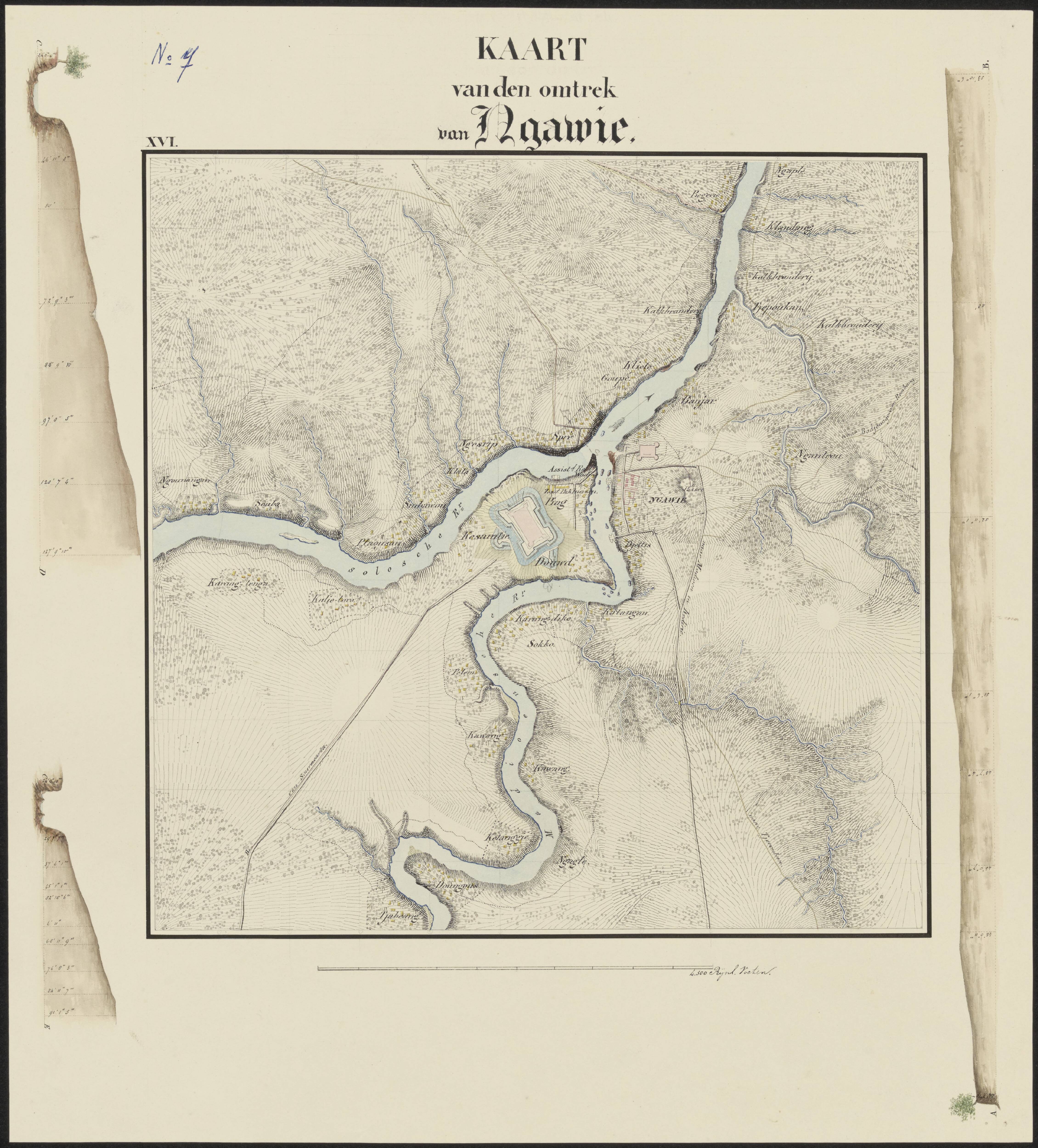
| Description |
Nederlands: 'Kaart van den omtrek van Ngawie.' Topografische kaart met hoogteaanduiding. Tweede exemplaar
N.B. Met daarop Fort van den Bosch te Ngawi afgebeeld. |
|||||||||||||||||||||||
| Date | ca. 1845 | |||||||||||||||||||||||
| Medium |
Nederlands: Kaart, Oostindische inkt en aquarel, Manuscript |
|||||||||||||||||||||||
| Dimensions | 44.9 cm x 39.9 cm | |||||||||||||||||||||||
| Collection |
|
|||||||||||||||||||||||
| Accession number |
NL-HaNA 4.MIKO 4024.2 |
|||||||||||||||||||||||
| Source |
Nationaal Archief |
|||||||||||||||||||||||

This is an image from the Nationaal Archief, the Dutch National Archives, donated in the context of a partnership program. This tag does not indicate the copyright status of the attached work. A normal copyright tag is still required. See Commons:Licensing.
|
Licensing[edit]
| This file is made available under the Creative Commons CC0 1.0 Universal Public Domain Dedication. | |
| The person who associated a work with this deed has dedicated the work to the public domain by waiving all of their rights to the work worldwide under copyright law, including all related and neighboring rights, to the extent allowed by law. You can copy, modify, distribute and perform the work, even for commercial purposes, all without asking permission.
|
File history
Click on a date/time to view the file as it appeared at that time.
| Date/Time | Thumbnail | Dimensions | User | Comment | |
|---|---|---|---|---|---|
| current | 14:07, 31 July 2023 | | 4,520 × 5,000 (2.39 MB) | WikiMaxiBo (talk | contribs) | Uploaded a work by Getekend door W.C.B. von Schierbrand, 2e luit. adj. der genie from https://www.nationaalarchief.nl/onderzoeken/archief/4.MIKO/invnr/4024.2/file/NL-HaNA_4.MIKO_4024.2 with UploadWizard |
You cannot overwrite this file.
File usage on Commons
The following page uses this file: