File:NASA's Boeing OFT-2 Rollout to Pad for Launch (KSC-20210729-PH-JBP01 0002).jpg
Jump to navigation
Jump to search

Size of this preview: 800 × 449 pixels. Other resolutions: 320 × 180 pixels | 640 × 359 pixels | 1,024 × 575 pixels | 1,280 × 718 pixels | 2,560 × 1,437 pixels | 6,016 × 3,376 pixels.
Original file (6,016 × 3,376 pixels, file size: 8.42 MB, MIME type: image/jpeg)
Captions
Captions
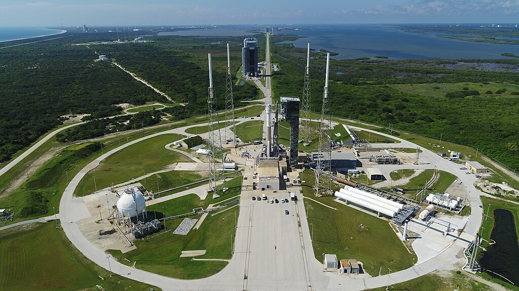
On July 29, 2021, Boeing’s CST-100 Starliner spacecraft and the United Launch Alliance Atlas V rocket rolled out of the Vertical Integration Facility to the launch pad at Space Launch Complex-41 on Cape Canaveral Space Force Station in Florida.
Summary[edit]
.jpg&action=edit§ion=1)
| Description |
English: On July 29, 2021, Boeing’s CST-100 Starliner spacecraft and the United Launch Alliance Atlas V rocket rolled out of the Vertical Integration Facility to the launch pad at Space Launch Complex-41 on Cape Canaveral Space Force Station in Florida. Starliner will launch on the Atlas V for Boeing’s second uncrewed Orbital Flight Test (OFT-2) for NASA’s Commercial Crew Program. OFT-2 is an important uncrewed mission designed to test the end-to-end capabilities of the new system for NASA’s Commercial Crew Program. |
||
| Date | Taken on 29 July 2021 | ||
| Source |
|
||
| Author | NASA Kennedy Space Center / NASA/Jamie Peer |
Licensing[edit]
.jpg&action=edit§ion=2)
| This file is in the public domain in the United States because it was solely created by NASA. NASA copyright policy states that "NASA material is not protected by copyright unless noted". (See Template:PD-USGov, NASA copyright policy page or JPL Image Use Policy.) | ||
 |
Warnings:
|
File history
Click on a date/time to view the file as it appeared at that time.
| Date/Time | Thumbnail | Dimensions | User | Comment | |
|---|---|---|---|---|---|
| current | 18:43, 2 September 2023 | | 6,016 × 3,376 (8.42 MB) | OptimusPrimeBot (talk | contribs) | #Spacemedia - Upload of http://images-assets.nasa.gov/image/KSC-20210729-PH-JBP01_0002/KSC-20210729-PH-JBP01_0002~orig.JPG via Commons:Spacemedia |
You cannot overwrite this file.
File usage on Commons
There are no pages that use this file.
.jpg&oldid=843547529)