File:My Public Lands Roadtrip- The Hole-in-the-Wall and Middle Fork of the Powder River Recreation Areas (19863061002).jpg
Original file (2,592 × 1,944 pixels, file size: 3.93 MB, MIME type: image/jpeg)
Captions
Captions
Summary[edit]
.jpg&action=edit§ion=1)
| Description |
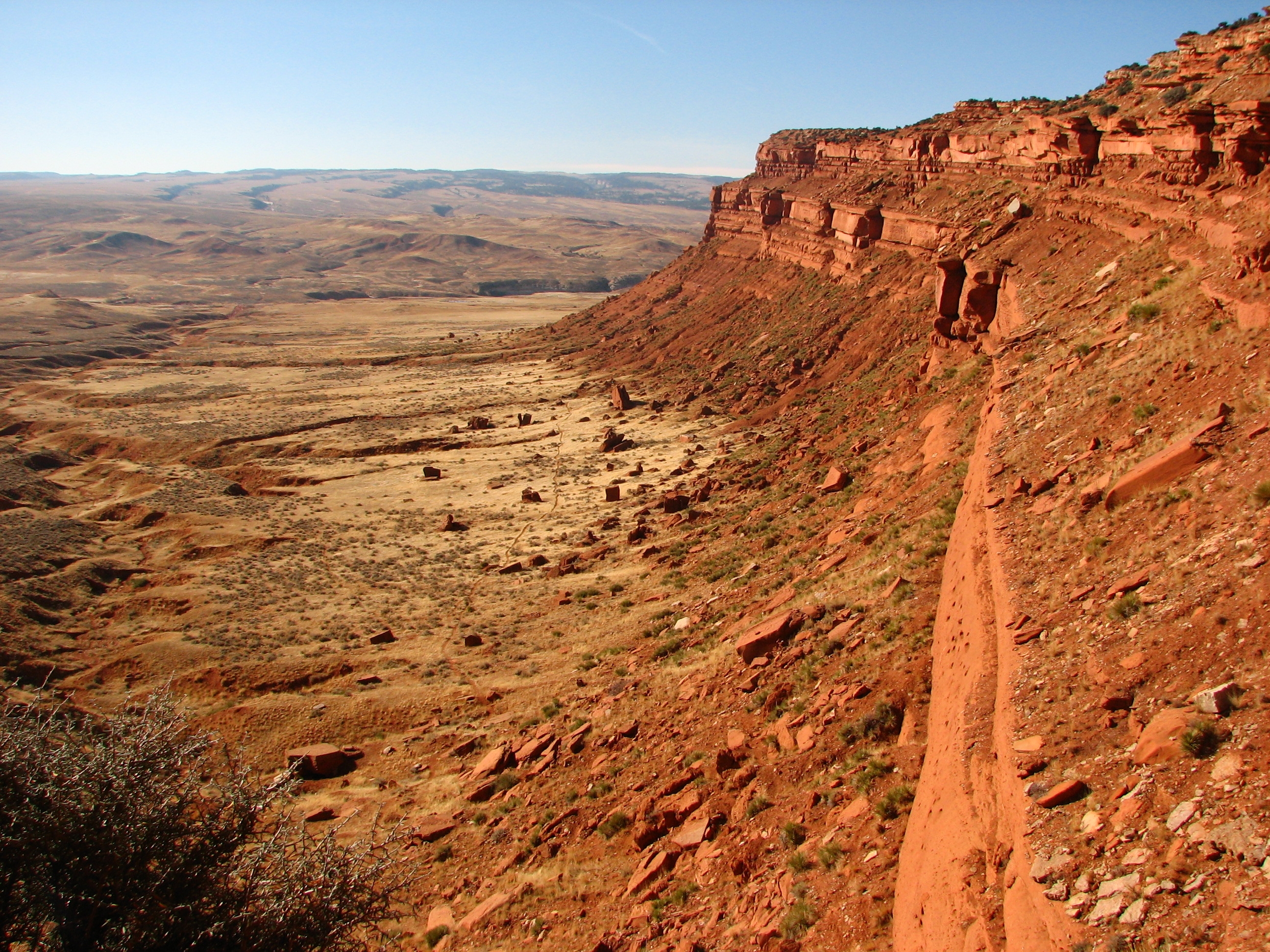
The Hole-in-the-Wall is a spectacularly scenic part of the Old West. A red sandstone escarpment dominates the area which is rich in legend of outlaw activity in the late 1800s. It was a favorite hiding place for the infamous Butch Cassidy and the Wild Bunch Gang. The "hole" is a gap in the Red Wall that, legend has it, was used secretly by outlaws to move horses and cattle from the area. This remote area is located about 40 miles southwest of Kaycee, Wyo. The Middle Fork Powder River is located about 20 miles southwest of Kaycee, Wyoming. The Middle Fork Powder River Management Area contains such notable sites as Outlaw Cave, rumored to have been used as a hideout by various folks attempting to avoid the law, including Butch Cassidy and the Sundance Kid. The region contains diverse topography and vegetation, ranging in elevation from 5,000 to over 8,000 feet with numerous steep incised canyons, a red sandstone escarpment known as the Red Wall, and open grassland parks interspersed with ponderosa pine, Douglas-fir, and limber pine forests. The wildlife found here are equally diverse: elk, mule deer, antelope, mountain lions, eagles, among other small mammals and rodents. The Middle Fork of the Powder River lies at the bottom of a fairly steep canyon. But, if you can make your way down, the fishing at the bottom is excellent! This is a "blue ribbon" trout stream containing brown and rainbow trout. Only artificial flies and lures are allowed; no natural bait. Other fishable streams in the area include Blue Creek, Buffalo Creek, and Eagle Creek. Cumulatively, the Hole-in-the-Wall and Middle Fork region contain approximately 80,000 acres of public land, including lands managed by the State of Wyoming and Wyoming Game and Fish Department. Photo by Claire Nicholson Taylor, Chicago Botanic Garden Intern |
| Date | |
| Source | My Public Lands Roadtrip: The Hole-in-the-Wall and Middle Fork of the Powder River Recreation Areas |
| Author | Bureau of Land Management |
Licensing[edit]
.jpg&action=edit§ion=2)
- You are free:
- to share – to copy, distribute and transmit the work
- to remix – to adapt the work
- Under the following conditions:
- attribution – You must give appropriate credit, provide a link to the license, and indicate if changes were made. You may do so in any reasonable manner, but not in any way that suggests the licensor endorses you or your use.
| This image was originally posted to Flickr by mypubliclands at https://flickr.com/photos/91981596@N06/19863061002. It was reviewed on 5 August 2015 by FlickreviewR and was confirmed to be licensed under the terms of the cc-by-2.0. |
| This image is a work of a Bureau of Land Management* employee, taken or made as part of that person's official duties. As a work of the U.S. federal government, the image is in the public domain in the United States. *or predecessor organization |
File history
Click on a date/time to view the file as it appeared at that time.
| Date/Time | Thumbnail | Dimensions | User | Comment | |
|---|---|---|---|---|---|
| current | 18:16, 4 August 2015 | | 2,592 × 1,944 (3.93 MB) | Wilfredor (talk | contribs) | Transferred from Flickr via Flickr2Commons |
You cannot overwrite this file.
File usage on Commons
There are no pages that use this file.
.jpg&oldid=492677280)