File:Municipio Garupá en departamento Capital.png
Jump to navigation
Jump to search

Size of this preview: 419 × 599 pixels. Other resolutions: 168 × 240 pixels | 336 × 480 pixels | 537 × 768 pixels | 716 × 1,024 pixels | 1,355 × 1,937 pixels.
Original file (1,355 × 1,937 pixels, file size: 119 KB, MIME type: image/png)
Captions
Captions
Add a one-line explanation of what this file represents
Summary[edit]
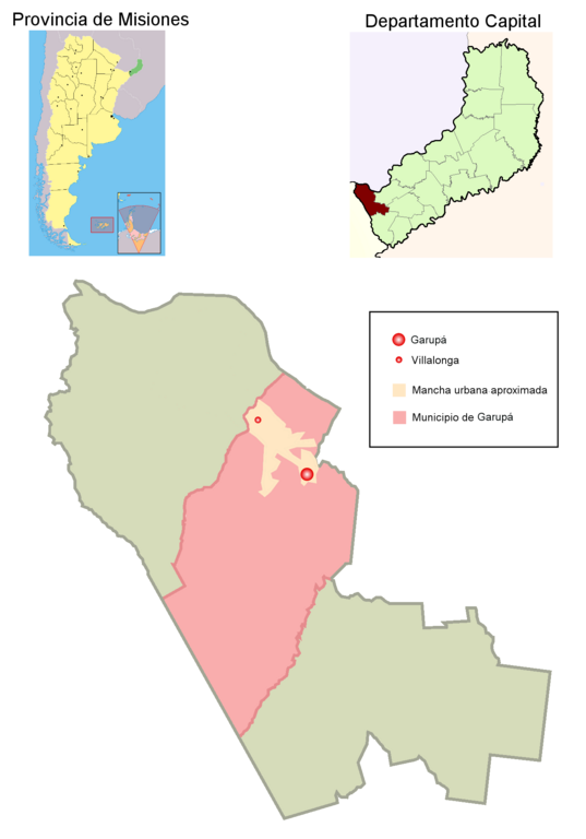
| Description | A map showing municipio of Garupá in Capital departament, Misiones province, Argentina. Also shows Garupá town location, Villalonga town location, and their urban sector; Villalonga is also known as "Expansión de Posadas". Created with GIMP. |
| Date | |
| Source | Own creation |
| Author | User Pertile in es.wikipedia |
| Permission (Reusing this file) |
Public domain |
Licensing[edit]
| I, the copyright holder of this work, release this work into the public domain. This applies worldwide. In some countries this may not be legally possible; if so: I grant anyone the right to use this work for any purpose, without any conditions, unless such conditions are required by law. |
File history
Click on a date/time to view the file as it appeared at that time.
| Date/Time | Thumbnail | Dimensions | User | Comment | |
|---|---|---|---|---|---|
| current | 15:03, 10 May 2007 | | 1,355 × 1,937 (119 KB) | Pertile (talk | contribs) | |
| 23:30, 7 May 2007 |  | 1,355 × 1,937 (117 KB) | Pertile (talk | contribs) | {{Information |Description=A map showing municipio of Garupá in Capital departament, Misiones province, Argentina. Also shows Garupá town location and its urban sector. Created with GIMP. |Source= Own creation |Date= 2007.05.07 |Author= [http://es.wikip |
You cannot overwrite this file.
File usage on Commons
There are no pages that use this file.
File usage on other wikis
The following other wikis use this file:
- Usage on es.wikipedia.org
- Usage on it.wikipedia.org
- Usage on pt.wikipedia.org