File:Mtnf map.jpg
Jump to navigation
Jump to search
No higher resolution available.
Mtnf_map.jpg (579 × 589 pixels, file size: 61 KB, MIME type: image/jpeg)
Captions
Captions
Add a one-line explanation of what this file represents

|
This map image could be re-created using vector graphics as an SVG file. This has several advantages; see Commons:Media for cleanup for more information. If an SVG form of this image is available, please upload it and afterwards replace this template with
{{vector version available|new image name}}.
It is recommended to name the SVG file “Mtnf map.svg”—then the template Vector version available (or Vva) does not need the new image name parameter. |


Summary[edit]
| Description |
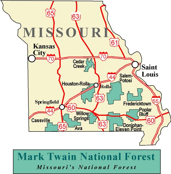
English: A map of Mark Twain National Forest. |
| Source | USFS website. Transferred from en.wikipedia to Commons by User:Quadell using CommonsHelper. |
| Author | United States Forest Service |
Licensing[edit]
This image is a work of the Forest Service of the United States Department of Agriculture. As a work of the U.S. federal government, the image is in the public domain.
|
Original upload log[edit]
The original description page was here. All following user names refer to en.wikipedia.
- 2006-02-04 23:41 Dwmartin 579×589× (62167 bytes) From the USFS website.
File history
Click on a date/time to view the file as it appeared at that time.
| Date/Time | Thumbnail | Dimensions | User | Comment | |
|---|---|---|---|---|---|
| current | 14:58, 9 September 2011 | | 579 × 589 (61 KB) | File Upload Bot (Magnus Manske) (talk | contribs) | {{BotMoveToCommons|en.wikipedia|year={{subst:CURRENTYEAR}}|month={{subst:CURRENTMONTHNAME}}|day={{subst:CURRENTDAY}}}} {{Information |Description={{en|From the USFS website.}} |Source=Transferred from [http://en.wikipedia.org en.wikipedia]; transferred t |
You cannot overwrite this file.
File usage on Commons
The following 2 pages use this file:
File usage on other wikis
The following other wikis use this file:
- Usage on en.wikipedia.org
- Usage on es.wikipedia.org
- Usage on fa.wikipedia.org
- Usage on ro.wikipedia.org
- William Clark (explorator)
- Missouri
- Categorie:Statul Missouri, SUA
- Format:Missouri stat SUA
- Saint Louis
- Jefferson City, Missouri
- Categorie:Formate Missouri
- Nevada, Missouri
- Categorie:Liste Missouri
- Categorie:Comitate din statul Missouri, SUA
- Hannibal, Missouri
- Comitatul Phelps, Missouri
- Categorie:Comitatul Phelps, Missouri
- Listă de oameni din statul Missouri
- Categorie:Guvernul statului Missouri
- Listă de comitate din statul Missouri
- Categorie:Sedii de comitate din Missouri
- Butler, Missouri
- Categorie:Comitatul Washington, Missouri
- Listă de orașe din statul Kentucky
- Listă de orașe din statul Missouri
- Categorie:Comitatul Wayne, Missouri
- Categorie:Zone metropolitane din Missouri
- Categorie:Zone micropolitane din Missouri
- Categorie:Comitatul Clark, Missouri
- Categorie:Comitatul Benton, Missouri
- Categorie:Comitatul Adair, Missouri
- Categorie:Comitatul Pike, Missouri
- Categorie:Comitatul Webster, Missouri
- Categorie:Comitatul Warren, Missouri
- Categorie:Comitatul Cass, Missouri
- Categorie:Comitatul Lafayette, Missouri
- Categorie:Comitatul Saint Clair, Missouri
- Categorie:Comitatul Lincoln, Missouri
- Categorie:Comitatul Douglas, Missouri
- Categorie:Comitatul Wright, Missouri
- Categorie:Comitatul Worth, Missouri
- Categorie:Comitatul Vernon, Missouri
- Categorie:Comitatul Texas, Missouri
- Categorie:Comitatul Taney, Missouri
- Categorie:Localități din Missouri
- Categorie:Comitatul Shelby, Missouri
- Categorie:Comitatul Scott, Missouri
- Categorie:Comitatul Madison, Missouri
- Categorie:Comitatul Howell, Missouri
- Categorie:Comitatul Andrew, Missouri
- Categorie:Comitatul Audrain, Missouri
View more global usage of this file.