File:Mt Pleasant Bridge 1.JPG
Jump to navigation
Jump to search
Size of this preview: 799 × 599 pixels. Other resolutions: 320 × 240 pixels | 640 × 480 pixels | 1,024 × 768 pixels | 1,280 × 960 pixels | 2,329 × 1,747 pixels.
Original file (2,329 × 1,747 pixels, file size: 2.46 MB, MIME type: image/jpeg)
Captions
Captions
Add a one-line explanation of what this file represents
|
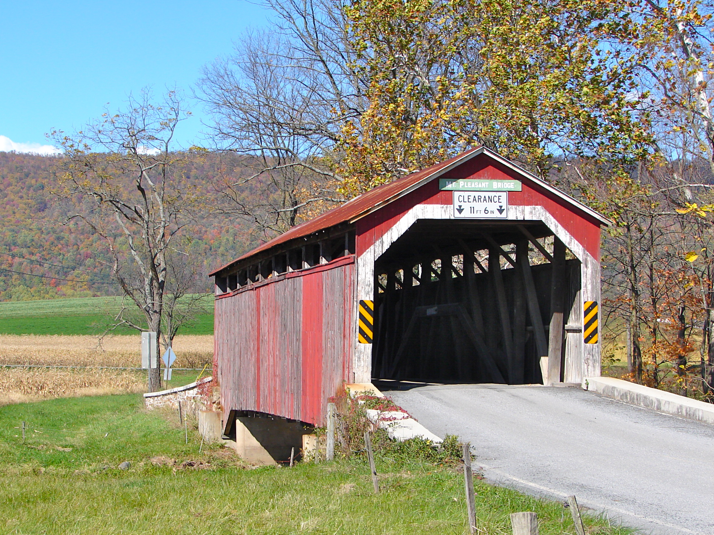
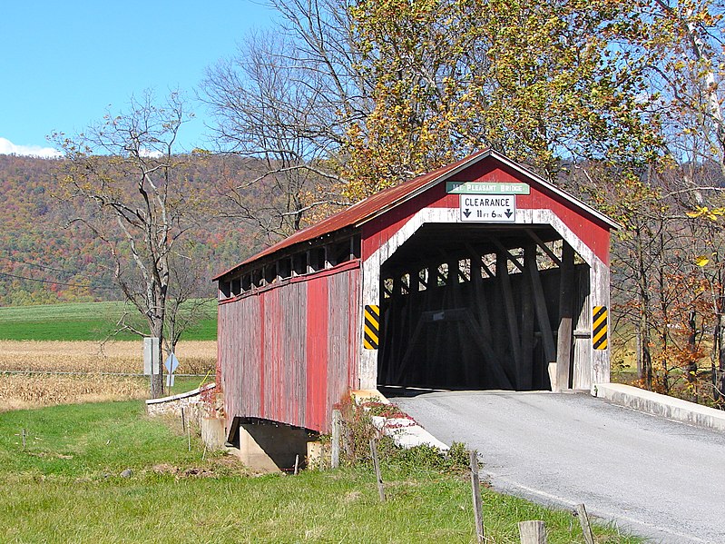
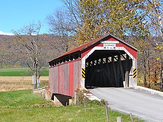
This is an image of a place or building that is listed on the National Register of Historic Places in the United States of America. Its reference number is 80003599. |
Summary[edit]
| Description | Mt. Pleasant Covered Bridge on the NRHP since August 25, 1980. South east of New Germantown on Township 304 (Mt. Pleasant Road), in Jackson Township, Perry County, Pennsylvania. |
| Date | |
| Source | Own work |
| Author | Smallbones |
| Object location | | View this and other nearby images on: OpenStreetMap |
|---|
Licensing[edit]
| I, the copyright holder of this work, release this work into the public domain. This applies worldwide. In some countries this may not be legally possible; if so: I grant anyone the right to use this work for any purpose, without any conditions, unless such conditions are required by law. |
File history
Click on a date/time to view the file as it appeared at that time.
| Date/Time | Thumbnail | Dimensions | User | Comment | |
|---|---|---|---|---|---|
| current | 20:16, 23 October 2010 | | 2,329 × 1,747 (2.46 MB) | Smallbones (talk | contribs) | {{Information |Description=Mt. Pleasant Covered Bridge on the NRHP since August 25, 1980. South east of New Germantown on Township 304 (Mt. Pleasant Road), in Jackson Township, Perry County, Pennsylvania. |Source={{own}} |Date=2010-10-21 |Author= [[User:S |
You cannot overwrite this file.
File usage on Commons
There are no pages that use this file.
File usage on other wikis
The following other wikis use this file:
- Usage on en.wikipedia.org
- Usage on www.wikidata.org