File:Mt. Bessan, Mt. Masago (Tateyama mountain range) and Raichozawa Campsite 001.jpg
Jump to navigation
Jump to search
Size of this preview: 800 × 450 pixels. Other resolutions: 320 × 180 pixels | 640 × 360 pixels | 1,024 × 576 pixels | 1,280 × 720 pixels | 2,560 × 1,440 pixels | 3,840 × 2,160 pixels.
Original file (3,840 × 2,160 pixels, file size: 1.68 MB, MIME type: image/jpeg)
Captions
Captions
Add a one-line explanation of what this file represents
Summary[edit]
_and_Raichozawa_Campsite_001.jpg&action=edit§ion=1)
| Description |
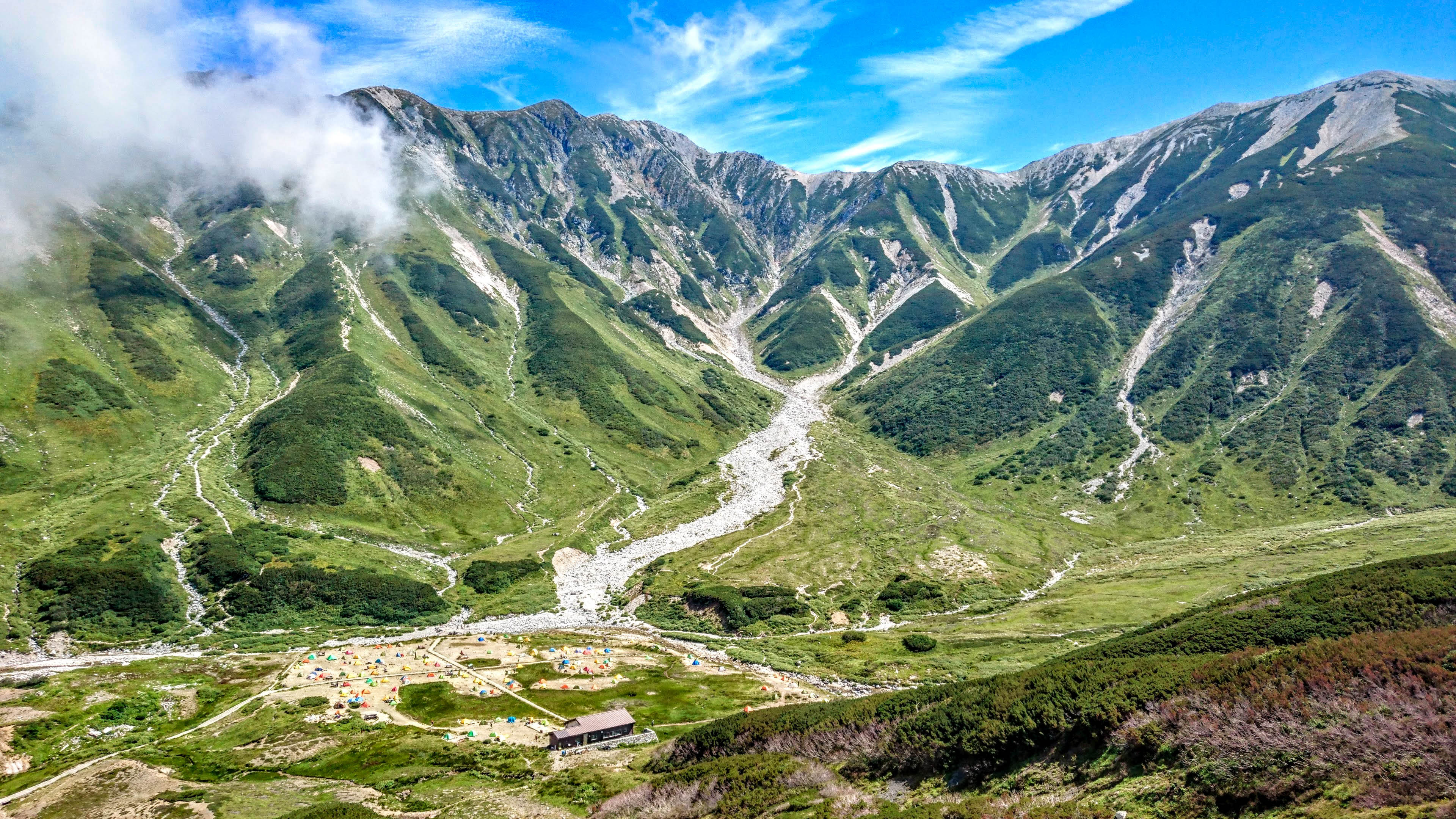
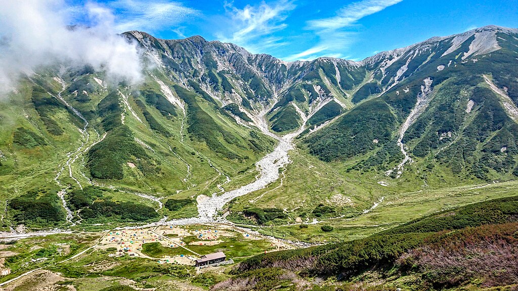
日本語: 富山県中新川郡立山町の立山連峰眼前にある雷鳥荘付近から見た、立山連峰の別山(左)、真砂岳(右)とカラフルなテントが立つ雷鳥沢キャンプ場(左下)
English: Mt. Bessan, Mt. Masago of the Tateyama mountain range and the Raichozawa Campsite with colorful tents in Tateyama town, Nakaniikawa-gun, Toyama prefecture, Japan. |
| Date | |
| Source | Own work |
| Author | Naokijp |
| Camera location | | View this and other nearby images on: OpenStreetMap |
|---|
_and_Raichozawa_Campsite_001.jpg¶ms=036.584633_N_0137.598512_E_globe:Earth_type:camera__&language=en)
Licensing[edit]
_and_Raichozawa_Campsite_001.jpg&action=edit§ion=2)
I, the copyright holder of this work, hereby publish it under the following license:
This file is licensed under the Creative Commons Attribution-Share Alike 4.0 International license.
- You are free:
- to share – to copy, distribute and transmit the work
- to remix – to adapt the work
- Under the following conditions:
- attribution – You must give appropriate credit, provide a link to the license, and indicate if changes were made. You may do so in any reasonable manner, but not in any way that suggests the licensor endorses you or your use.
- share alike – If you remix, transform, or build upon the material, you must distribute your contributions under the same or compatible license as the original.
File history
Click on a date/time to view the file as it appeared at that time.
| Date/Time | Thumbnail | Dimensions | User | Comment | |
|---|---|---|---|---|---|
| current | 05:42, 22 October 2022 | | 3,840 × 2,160 (1.68 MB) | Naokijp (talk | contribs) | Uploaded own work with UploadWizard |
You cannot overwrite this file.
File usage on Commons
The following 3 pages use this file:
File usage on other wikis
The following other wikis use this file:
- Usage on ja.wikipedia.org
_and_Raichozawa_Campsite_001.jpg&oldid=706913338)