File:Mount Vernon Site, GE Mound.jpg
Jump to navigation
Jump to search

Size of this preview: 800 × 600 pixels. Other resolutions: 320 × 240 pixels | 640 × 480 pixels | 1,024 × 768 pixels | 1,280 × 960 pixels | 2,560 × 1,920 pixels | 2,816 × 2,112 pixels.
Original file (2,816 × 2,112 pixels, file size: 2.32 MB, MIME type: image/jpeg)
Captions
Captions
Add a one-line explanation of what this file represents
|
This is an image of a place or building that is listed on the National Register of Historic Places in the United States of America. Its reference number is 95001542. |
| Camera location | | View this and other nearby images on: OpenStreetMap |
|---|
| Description |
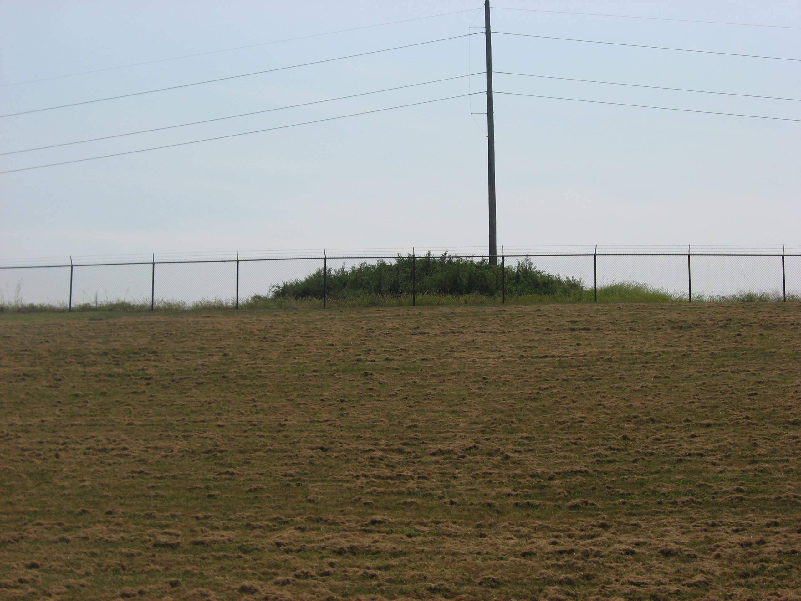
English: Fenceline and the peak of a hill on the northern edge of the General Electric plant near Mount Vernon in Black Township, Posey County, Indiana, United States. The hill is an archaeological site known as the Mount Vernon Site or the "GE Mound"; discovered by accident in 1988 and heavily looted, it was the center of a pioneer Archaeological Resources Protection Act of 1979 criminal prosecution. Despite the damage, it remains a significant archaeological site and is thus listed on the National Register of Historic Places. |
||
| Date | Taken on 3 September 2011 | ||
| Source | Own work | ||
| Author | Nyttend | ||
| Permission (Reusing this file) |
|
File history
Click on a date/time to view the file as it appeared at that time.
| Date/Time | Thumbnail | Dimensions | User | Comment | |
|---|---|---|---|---|---|
| current | 05:25, 9 September 2011 | | 2,816 × 2,112 (2.32 MB) | Nyttend (talk | contribs) | {{Location|37|54|48|N|87|56|23|W}} {{Information |Description={{en|Fenceline and the peak of a hill on the northern edge of the {{w|General Electric}} plant near {{w|Mount Vernon, Indiana|Mount Vernon}} in {{w|Black Township, Posey County, Indiana|Black T |
You cannot overwrite this file.
File usage on Commons
There are no pages that use this file.
File usage on other wikis
The following other wikis use this file: