File:Mount Mitchell highest elevation in North Carolina and highest elevation in the Blue Ridge at 6,684 feet.jpg
Jump to navigation
Jump to search

Size of this preview: 600 × 600 pixels. Other resolutions: 240 × 240 pixels | 480 × 480 pixels | 768 × 768 pixels | 1,024 × 1,024 pixels | 2,048 × 2,048 pixels | 3,264 × 3,264 pixels.
Original file (3,264 × 3,264 pixels, file size: 2.88 MB, MIME type: image/jpeg)
Captions
Captions
Add a one-line explanation of what this file represents
Summary[edit]
| Description |
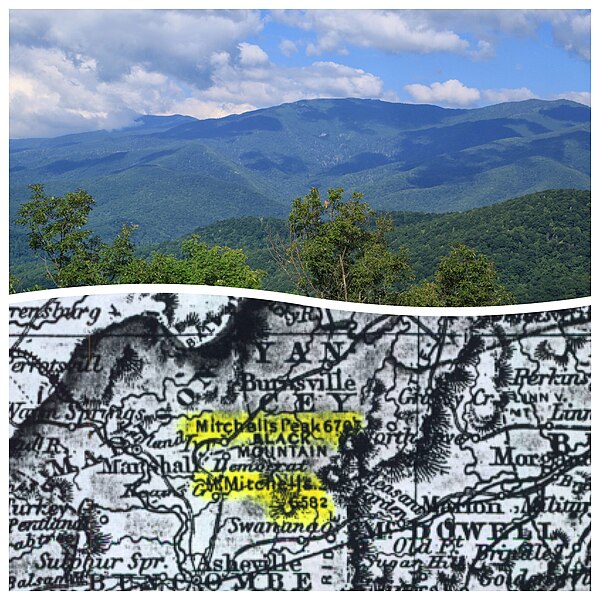
English: Mount Mitchell — This land feature is the highest elevation in North Carolina and highest elevation in the Blue Ridge at 6,684 feet. It also happens to be the highest elevation east of the Mississippi River. Mount Mitchell was named for University of North Carolina Professor Elisha Mitchell (d. 1857), who is believed to have ascended this summit in 1835.
Top: View of Mount Mitchell in North Carolina (credit: Alan Cressler @alan_cressler on Flickr). Bottom: Snapshot from the 1855 support document submitted by J.H. Colton & Co. to the U.S. Board on Geographical Names. View the original records at on.doi.gov/MountMitchell Thanks to Alan Cressler for submitting his photo to our USGS Science In Action Flickr Group! Submit your photo for a chance to be featured! bit.ly/USGSPhotoPool |
| Date | |
| Source | https://www.flickr.com/photos/27784370@N05/15243914306/ |
| Author | U.S. Geological Survey |
Licensing[edit]
This file is licensed under the Creative Commons Attribution 2.0 Generic license.
- You are free:
- to share – to copy, distribute and transmit the work
- to remix – to adapt the work
- Under the following conditions:
- attribution – You must give appropriate credit, provide a link to the license, and indicate if changes were made. You may do so in any reasonable manner, but not in any way that suggests the licensor endorses you or your use.
| This image was originally posted to Flickr by U.S. Geological Survey at https://flickr.com/photos/27784370@N05/15243914306. It was reviewed on 19 January 2022 by FlickreviewR 2 and was confirmed to be licensed under the terms of the cc-by-2.0. |
File history
Click on a date/time to view the file as it appeared at that time.
| Date/Time | Thumbnail | Dimensions | User | Comment | |
|---|---|---|---|---|---|
| current | 01:56, 19 January 2022 | | 3,264 × 3,264 (2.88 MB) | Ooligan (talk | contribs) | Uploaded a work by U.S. Geological Survey from https://www.flickr.com/photos/27784370@N05/15243914306/ with UploadWizard |
You cannot overwrite this file.
File usage on Commons
There are no pages that use this file.