File:Mount Kurakake 2011918.jpg
Jump to navigation
Jump to search

Size of this preview: 800 × 600 pixels. Other resolutions: 320 × 240 pixels | 640 × 480 pixels | 1,000 × 750 pixels.
Original file (1,000 × 750 pixels, file size: 143 KB, MIME type: image/jpeg)
Captions
Captions
Add a one-line explanation of what this file represents
Summary[edit]
| Description | |||
| Date | |||
| Source | Own work | ||
| Author | Batholith | ||
| Permission (Reusing this file) |
|
| Camera location | | View this and other nearby images on: OpenStreetMap |
|---|
File history
Click on a date/time to view the file as it appeared at that time.
| Date/Time | Thumbnail | Dimensions | User | Comment | |
|---|---|---|---|---|---|
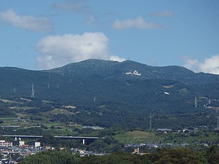
| current | 06:46, 29 September 2011 | | 1,000 × 750 (143 KB) | Batholith (talk | contribs) | {{Information |Description={{en|The Mount Krakake (鞍掛山) is located in between Kannami town and Hakone town.}}{{ja|静岡県[[:ja:函南町|函南� |
You cannot overwrite this file.
File usage on Commons
The following 2 pages use this file:
File usage on other wikis
The following other wikis use this file:
- Usage on ceb.wikipedia.org
- Usage on ja.wikipedia.org
- Usage on www.wikidata.org