File:Montgomery County Ohio Kettering highlighted.png
Jump to navigation
Jump to search
Size of this preview: 800 × 400 pixels. Other resolutions: 320 × 160 pixels | 640 × 320 pixels | 1,024 × 512 pixels | 1,280 × 640 pixels | 2,200 × 1,100 pixels.
Original file (2,200 × 1,100 pixels, file size: 103 KB, MIME type: image/png)
Captions
Captions
Add a one-line explanation of what this file represents
Summary[edit]
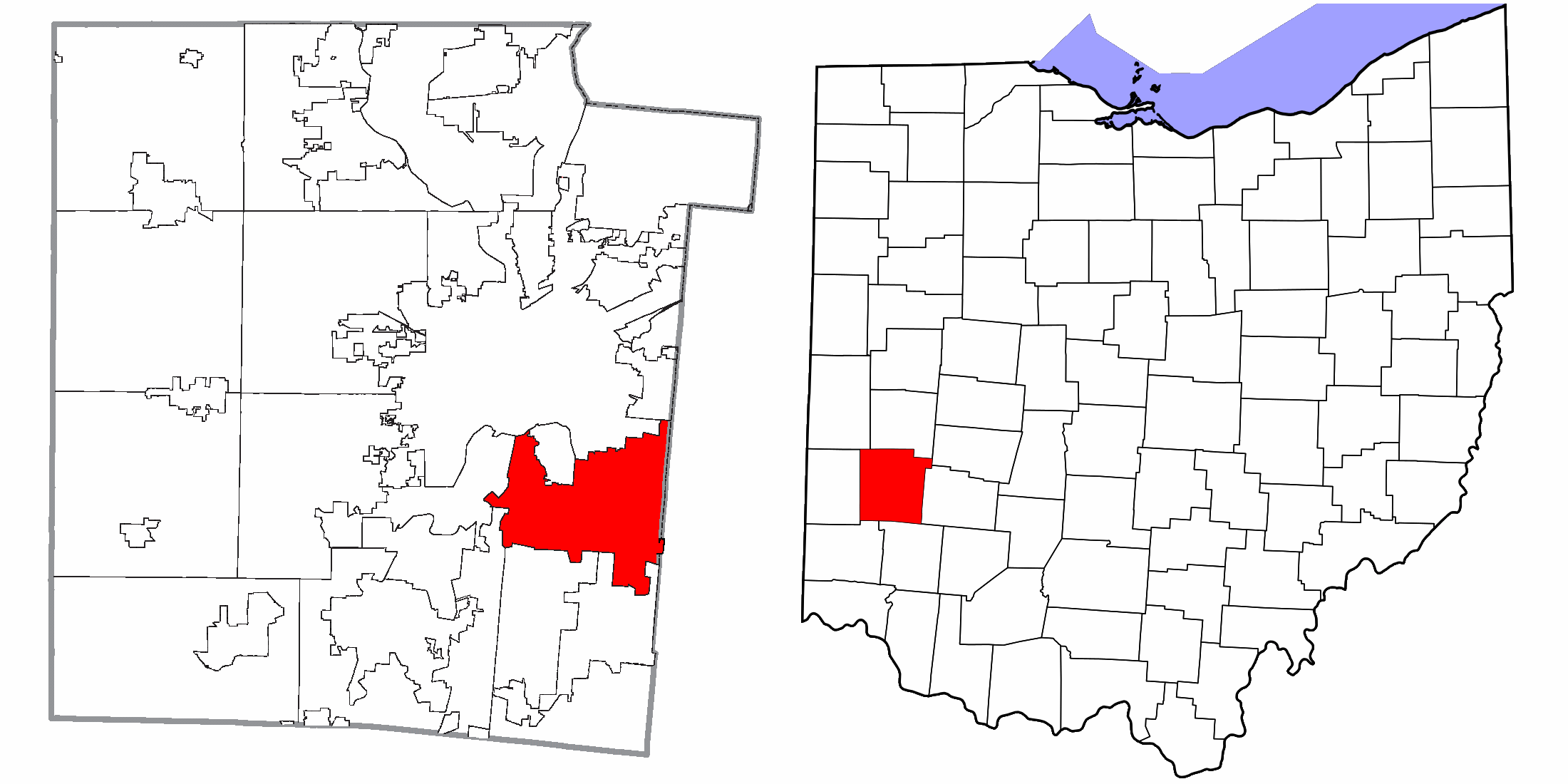
| Description | Map highlighting City of Kettering, Montgomery County, Ohio, United States. |
| Date | |
| Source |
I, Yassie, merged these two files into one. |
| Author | Ruhrfisch, Nyttend, Dbenbenn, and Yassie |
| Permission (Reusing this file) |
File:Map of Montgomery County Ohio Highlighting Kettering City.png has been released under CC-BY-SA-3.0 by Nyttend. File:Map of Ohio highlighting Montgomery County.svg has been released into public domain by Dbenbenn. Thus, I hereby release this merged work under CC-BY-SA-3.0 license. |
Licensing[edit]
This file is licensed under the Creative Commons Attribution-Share Alike 3.0 Unported license.
- You are free:
- to share – to copy, distribute and transmit the work
- to remix – to adapt the work
- Under the following conditions:
- attribution – You must give appropriate credit, provide a link to the license, and indicate if changes were made. You may do so in any reasonable manner, but not in any way that suggests the licensor endorses you or your use.
- share alike – If you remix, transform, or build upon the material, you must distribute your contributions under the same or compatible license as the original.
File history
Click on a date/time to view the file as it appeared at that time.
| Date/Time | Thumbnail | Dimensions | User | Comment | |
|---|---|---|---|---|---|
| current | 16:44, 8 December 2015 | | 2,200 × 1,100 (103 KB) | Yassie (talk | contribs) | {{Information |Description= Map highlighting City of Kettering, Montgomery County, Ohio, United States. |Source= I, Yassie, merged these two files into one. * File:Map of Montgomery County Ohio Highlighting Kettering City.png * [[:... |
You cannot overwrite this file.
File usage on Commons
There are no pages that use this file.