File:Monasterio de la Visitación (Madrid) 01.jpg
Jump to navigation
Jump to search

Size of this preview: 800 × 508 pixels. Other resolutions: 320 × 203 pixels | 640 × 407 pixels | 1,024 × 651 pixels | 1,280 × 813 pixels | 2,560 × 1,627 pixels | 4,320 × 2,745 pixels.
Original file (4,320 × 2,745 pixels, file size: 2.16 MB, MIME type: image/jpeg)
Captions
Captions
Add a one-line explanation of what this file represents
| Description |
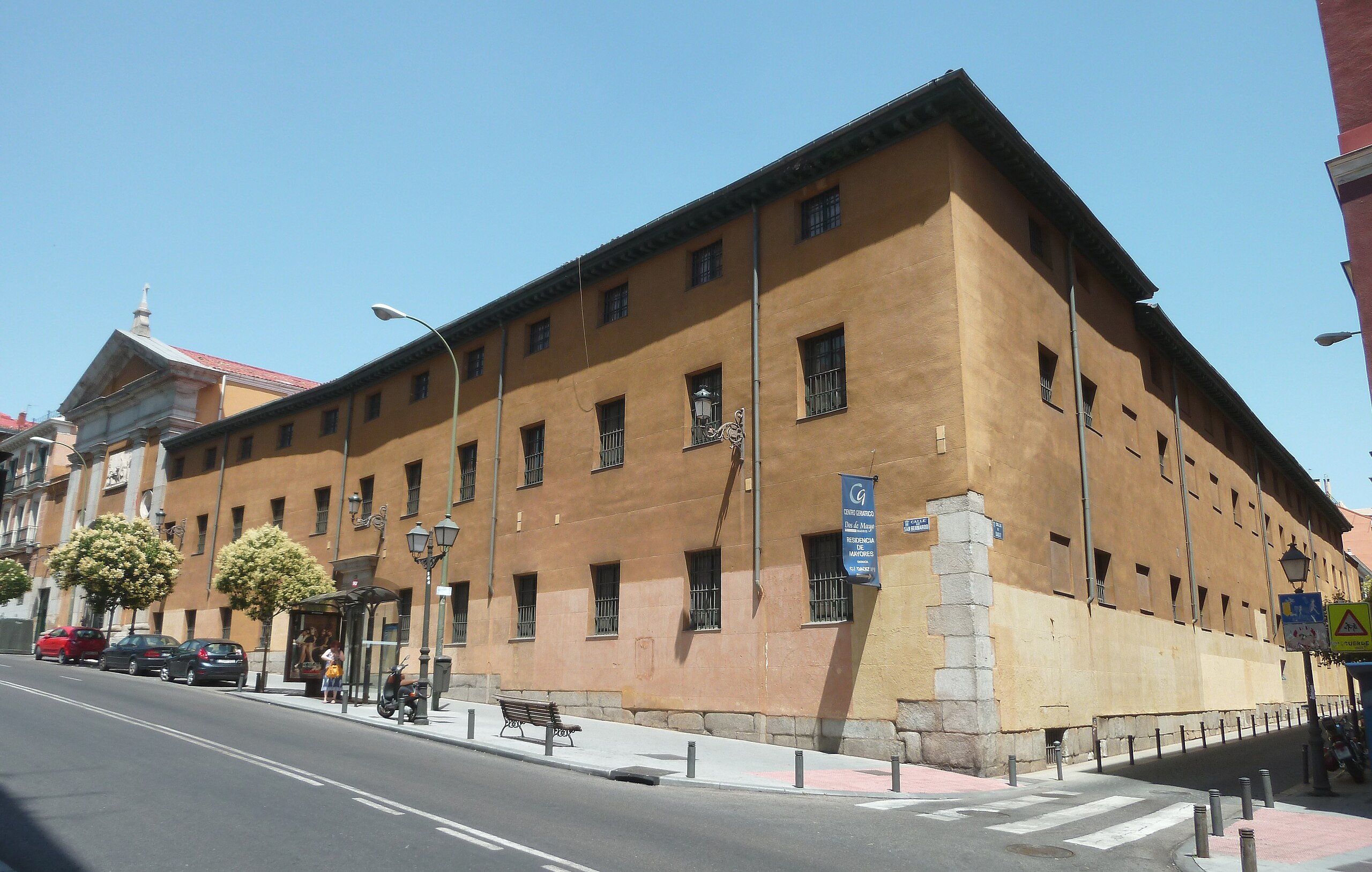
English: Façade of the Monastery of the Visitation and Church of St. Francis de Sales in Madrid (Spain), at 72 Calle de San Bernardo (street) in Centro district. Building was projected in 1794 by Manuel Bradi and built between 1798 and 1801.
Español: Fachada del Monasterio de la Visitación e Iglesia de San Francisco de Sales de Madrid (España), en el nº 72 de la Calle de San Bernardo, en el distrito Centro. El edificio fue proyectado en 1794 por Manuel Bradi y construido entre 1798 y 1801. |
||
| Date | |||
| Source | Own work | ||
| Author | Luis García (Zaqarbal) | ||
| Permission (Reusing this file) |
I, the copyright holder of this work, hereby publish it under the following licenses:
This file is licensed under the Creative Commons Attribution-Share Alike 3.0 Unported license. Attribution: Luis García
You may select the license of your choice. |
||
| Other versions |
_02.jpg) |

| Object location | | View this and other nearby images on: OpenStreetMap |
|---|
_01.jpg¶ms=040.427429_N_-003.706159_E_globe:Earth_class:object_type:landmark_region:ES_&language=en)
File history
Click on a date/time to view the file as it appeared at that time.
| Date/Time | Thumbnail | Dimensions | User | Comment | |
|---|---|---|---|---|---|
| current | 09:56, 20 July 2011 | | 4,320 × 2,745 (2.16 MB) | Zaqarbal (talk | contribs) | Photo taken by Luis García (Zaqarbal) on June 28, 2011. Hereby published under GFDL and Cc-by-sa-3.0 licenses. |
You cannot overwrite this file.
File usage on Commons
The following page uses this file:
File usage on other wikis
The following other wikis use this file:
- Usage on es.wikipedia.org
_01.jpg&oldid=687932055)