File:Mojave Sonoran deserts.jpg
Jump to navigation
Jump to search
Size of this preview: 379 × 600 pixels. Other resolutions: 151 × 240 pixels | 632 × 1,000 pixels.
Original file (632 × 1,000 pixels, file size: 192 KB, MIME type: image/jpeg)
Captions
Captions
Add a one-line explanation of what this file represents
Summary[edit]
| Description | |||
| Date | (UTC) | ||
| Source |
|
||
| Author |
|

Licensing[edit]
This image is in the public domain in the United States because it only contains materials that originally came from the United States Geological Survey, an agency of the United States Department of the Interior. For more information, see the official USGS copyright policy.
|
Original upload log[edit]
This image is a derivative work of the following images:
- File:Mojave-sonoran deserts.png licensed with PD-USGov-USGS
- 2015-12-30T23:31:41Z WikiKiwi 632x1000 (316172 Bytes) oops, typo
- 2015-12-30T23:28:33Z WikiKiwi 632x1000 (316021 Bytes) Higher quality, better font
- 2010-11-07T22:34:39Z File Upload Bot (Magnus Manske) 223x343 (58420 Bytes) {{BotMoveToCommons|en.wikipedia|year={{subst:CURRENTYEAR}}|month={{subst:CURRENTMONTHNAME}}|day={{subst:CURRENTDAY}}}} {{Information |Description={{en|From: [http://wwwpaztcn.wr.usgs.gov/rsch_highlight/articles/200508.html h
Uploaded with derivativeFX
File history
Click on a date/time to view the file as it appeared at that time.
| Date/Time | Thumbnail | Dimensions | User | Comment | |
|---|---|---|---|---|---|
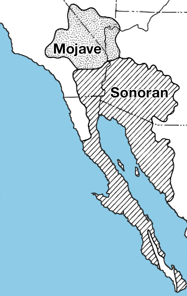
| current | 15:04, 21 January 2022 | | 632 × 1,000 (192 KB) | Hike395 (talk | contribs) | == {{int:filedesc}} == {{Information |Description={{en|Locator map of the {{w|Mojave Desert|Mojave}} and {{w|Sonoran Desert|Sonoran Deserts}}.}} |Source={{Compressed version|Mojave-sonoran deserts.png}} |Date=2022-01-21 14:59 (UTC) |Author=* File:Mojave-sonoran deserts.png: USGS * conversion to JPG: [[User:{{subst:REVISIONUSER}}|{{subst:REVISIONUSER}}]] |Permission= |other_versions= }} == {{int:license-header}} == {{PD-USGov-USGS}} == {{Original upload l... |
You cannot overwrite this file.
File usage on Commons
The following page uses this file: