File:Mittlerer Teil der Hohen Tauern (Karte).png
Jump to navigation
Jump to search

Size of this preview: 622 × 599 pixels. Other resolutions: 249 × 240 pixels | 498 × 480 pixels | 797 × 768 pixels | 1,063 × 1,024 pixels | 2,125 × 2,048 pixels | 2,732 × 2,633 pixels.
Original file (2,732 × 2,633 pixels, file size: 6.34 MB, MIME type: image/png)
Captions
Captions
Add a one-line explanation of what this file represents
| Description |
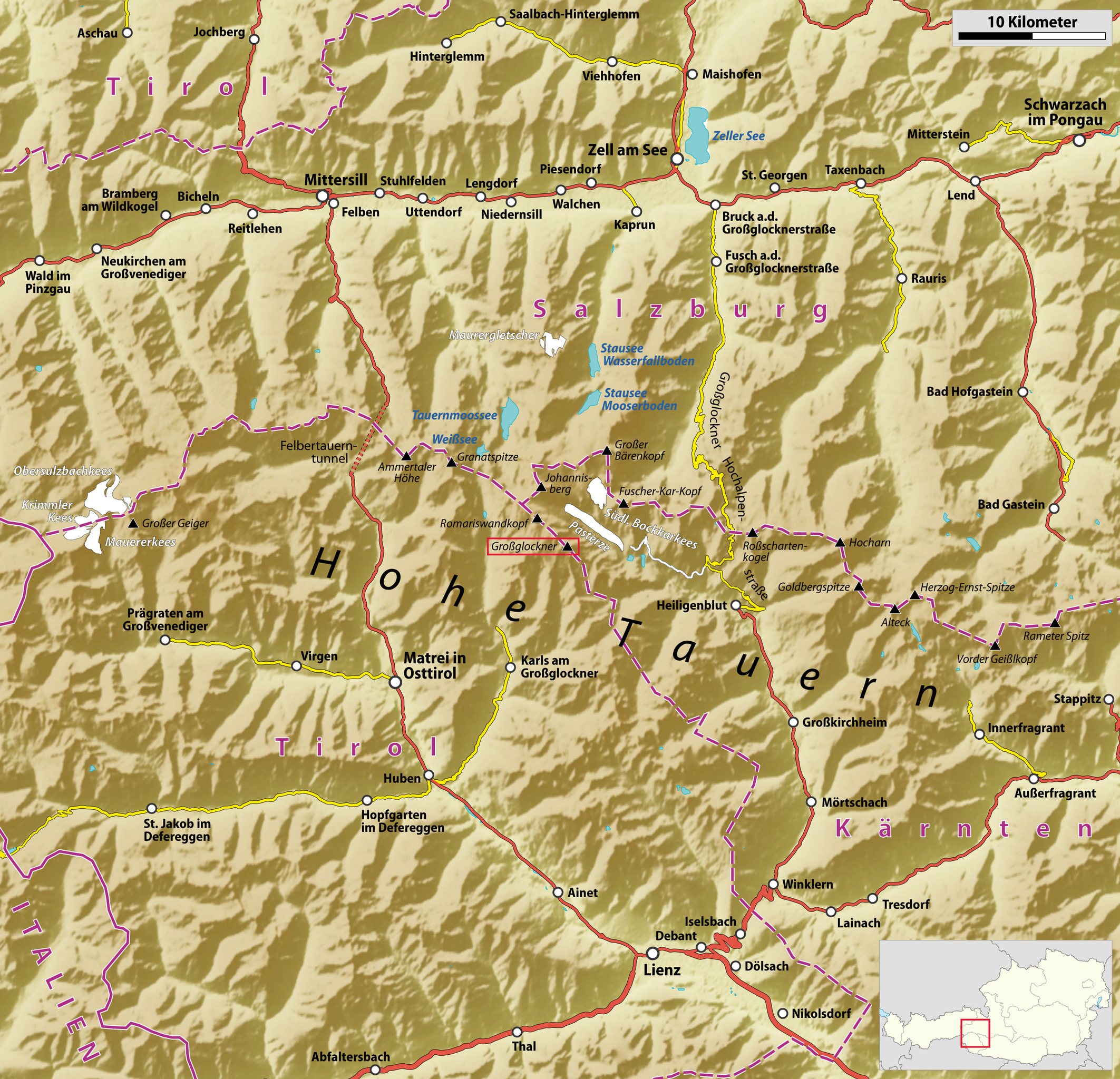
Deutsch: Karte des mittleren Teils der Hohen Tauern mit Hervorhebung des Großglockners |
| Date | see file history |
| Source |
own work, using
|
| Author | Maximilian Dörrbecker (Chumwa) |
| Permission (Reusing this file) |
All OpenStreetMap data and maps are Creative Commons "CC-BY-SA 2.0" licensed This file is licensed under the Creative Commons Attribution-Share Alike 2.0 Generic license.
|
| Other versions |
|
.png)
.png)
File history
Click on a date/time to view the file as it appeared at that time.
| Date/Time | Thumbnail | Dimensions | User | Comment | |
|---|---|---|---|---|---|
| current | 20:53, 14 July 2009 | | 2,732 × 2,633 (6.34 MB) | Chumwa (talk | contribs) | {{Information |Description={{de|Karte des mittleren Teils der Hohen Tauern mit Hervorhebung des Großglockners}} |Author=Maximilian Dörrbecker (Chumwa) |Source=own work, using * a GMT file provided by [[:de:User:Le |
You cannot overwrite this file.
File usage on Commons
The following 3 pages use this file:
File usage on other wikis
The following other wikis use this file:
- Usage on de.wikipedia.org
.png&oldid=498807469)