File:Mississippi Yazoo Delta.jpg
Jump to navigation
Jump to search
Size of this preview: 456 × 599 pixels. Other resolutions: 183 × 240 pixels | 365 × 480 pixels | 936 × 1,229 pixels.
Original file (936 × 1,229 pixels, file size: 206 KB, MIME type: image/jpeg)
Captions
Captions
Add a one-line explanation of what this file represents
Also see here for an annotated image found on this NPR story.
Summary[edit]
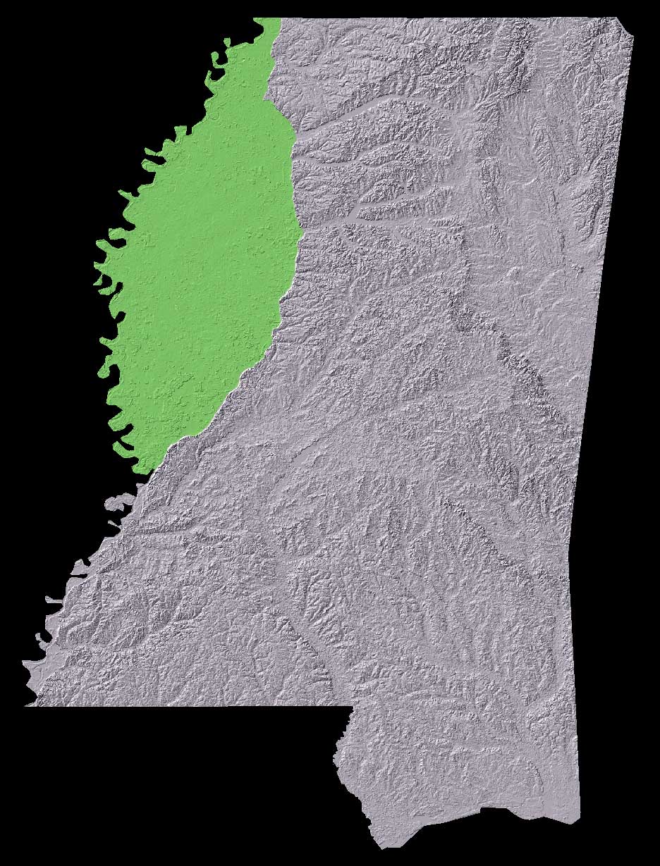
The Mississippi Delta region lies in the very fertile flood plain between the Yazoo and Mississippi Rivers, and is commonly considered to be bounded by Memphis, Tennessee in the north, and Vicksburg, Mississippi in the south.
Licensing[edit]
data source: The National Map, USGS
This work is in the public domain in the United States because it is a work prepared by an officer or employee of the United States Government as part of that person’s official duties under the terms of Title 17, Chapter 1, Section 105 of the US Code.
Note: This only applies to original works of the Federal Government and not to the work of any individual U.S. state, territory, commonwealth, county, municipality, or any other subdivision. This template also does not apply to postage stamp designs published by the United States Postal Service since 1978. (See § 313.6(C)(1) of Compendium of U.S. Copyright Office Practices). It also does not apply to certain US coins; see The US Mint Terms of Use.
|
 | |
| This file has been identified as being free of known restrictions under copyright law, including all related and neighboring rights. | ||
File history
Click on a date/time to view the file as it appeared at that time.
| Date/Time | Thumbnail | Dimensions | User | Comment | |
|---|---|---|---|---|---|
| current | 15:18, 17 April 2006 | | 936 × 1,229 (206 KB) | Vercingetorix~commonswiki (talk | contribs) | Also see [http://www.npr.org/programs/atc/features/2005/jun/delta/mississippi_delta.jpg here] for an annotated image found on [http://www.npr.org/templates/story/story.php?storyId=4675562 this NPR story]. == Summary == The Mississippi Delta region li |
You cannot overwrite this file.
File usage on Commons
There are no pages that use this file.
File usage on other wikis
The following other wikis use this file:
- Usage on ar.wikipedia.org
- Usage on de.wikipedia.org
- Usage on en.wikipedia.org
- Usage on eo.wikipedia.org
- Usage on es.wikipedia.org
- Usage on it.wikipedia.org
- Usage on ja.wikipedia.org
- Usage on ms.wikipedia.org
- Usage on no.wikipedia.org
- Usage on pl.wikipedia.org
- Usage on ru.wikipedia.org
- Usage on simple.wikipedia.org
- Usage on uk.wikipedia.org
- Usage on www.wikidata.org