File:Minn610 zoomed.svg
Jump to navigation
Jump to search

Size of this PNG preview of this SVG file: 800 × 471 pixels. Other resolutions: 320 × 189 pixels | 640 × 377 pixels | 1,024 × 603 pixels | 1,280 × 754 pixels | 2,560 × 1,508 pixels | 1,358 × 800 pixels.
Original file (SVG file, nominally 1,358 × 800 pixels, file size: 2.41 MB)
Captions
Captions
Add a one-line explanation of what this file represents
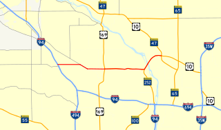
| Description | Zoomed-in map of Minnesota State Highway 610. Created in QuantamGIS and finished in Inkscape |
| Date | |
| Source | Own work |
| Author | Fredddie |
| I, the copyright holder of this work, release this work into the public domain. This applies worldwide. In some countries this may not be legally possible; if so: I grant anyone the right to use this work for any purpose, without any conditions, unless such conditions are required by law. |
File history
Click on a date/time to view the file as it appeared at that time.
| Date/Time | Thumbnail | Dimensions | User | Comment | |
|---|---|---|---|---|---|
| current | 02:08, 12 January 2017 | | 1,358 × 800 (2.41 MB) | Fredddie (talk | contribs) | found the issue, the line stroke was one-tenth of what it should have been |
| 04:49, 10 December 2016 |  | 1,358 × 800 (2.14 MB) | Imzadi1979 (talk | contribs) | updating to account for segment opening on December 9, 2016 | |
| 01:23, 11 February 2016 |  | 800 × 471 (175 KB) | Vcap36 (talk | contribs) | Fixes in routing for MN-47 and MN-65 | |
| 18:25, 30 September 2013 |  | 1,358 × 800 (2.06 MB) | Imzadi1979 (talk | contribs) | updating map based on routing shown at public information meeting and http://maplegrovemn.gov/departments/engineering/current-projects/highway-610-project-information | |
| 20:13, 19 August 2011 |  | 1,358 × 800 (2.35 MB) | Imzadi1979 (talk | contribs) | updating to reflect the section of roadway opened on August 19, 2011 | |
| 06:41, 20 May 2010 |  | 1,358 × 800 (2.35 MB) | Fredddie (talk | contribs) | {{Information |Description=Zoomed-in map of Minnesota State Highway 610. Created in QuantamGIS and finished in Inkscape |Source={{own}} |Date=2010-05-20 |Author= Fredddie |Permission= |other_versions= }} [[Category:Road maps of Minnesot |
You cannot overwrite this file.
File usage on Commons
The following 10 pages use this file:
- User:Chumwa/OgreBot/Potential transport maps/2016 December 1-10
- User:Chumwa/OgreBot/Potential transport maps/2016 February 10-19
- User:Chumwa/OgreBot/Potential transport maps/2017 January 11-20
- User:Chumwa/OgreBot/Transport Maps/2016 December 1-10
- User:Chumwa/OgreBot/Transport Maps/2016 February 10-19
- User:Chumwa/OgreBot/Transport Maps/2017 January 11-20
- User:Chumwa/OgreBot/Travel and communication maps/2016 December 1-10
- User:Chumwa/OgreBot/Travel and communication maps/2016 February 10-19
- User:Chumwa/OgreBot/Travel and communication maps/2017 January 11-20
- Category:Minnesota State Highway 610
File usage on other wikis
The following other wikis use this file:
- Usage on www.wikidata.org