File:Michigan 1920 Hi-Way Map.jpg
Jump to navigation
Jump to search
Size of this preview: 477 × 599 pixels. Other resolutions: 191 × 240 pixels | 382 × 480 pixels | 611 × 768 pixels | 815 × 1,024 pixels | 1,630 × 2,048 pixels | 5,771 × 7,250 pixels.
Original file (5,771 × 7,250 pixels, file size: 9.83 MB, MIME type: image/jpeg)
Captions
Captions
Add a one-line explanation of what this file represents
| Description |
English:
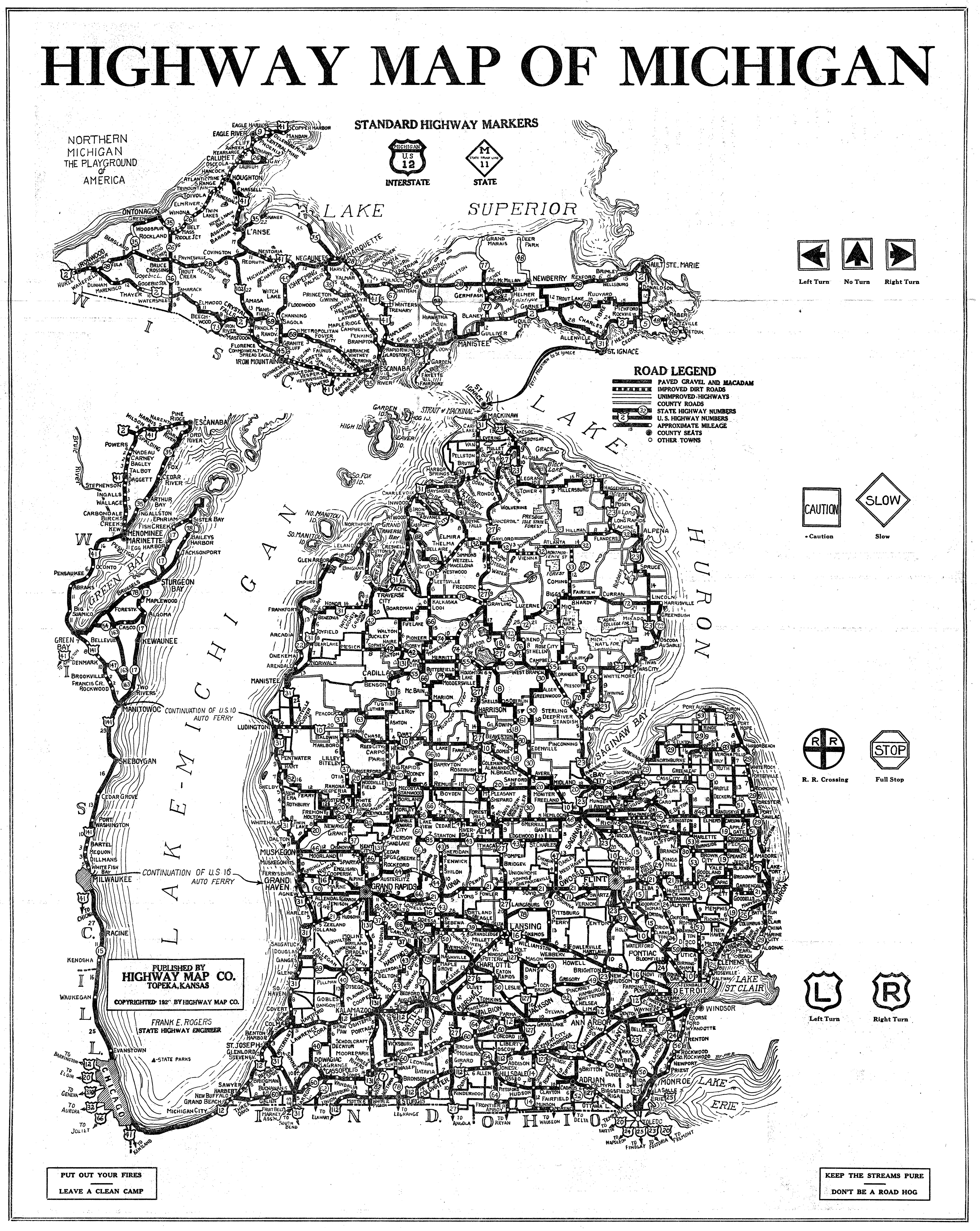
This one is definitely one that must be viewed large to see anything. Michigan Hi-Way map printed in Topeka, Kansas around 1920. These would become the majority of Michigan's first paved roads (but not all highway's were paved then). Expressways sure made a mess, didn't they? A part of: Overnight Photo Trip 2007 Flickr data on 2011-08-29:
|
||
| Date | |||
| Source | Flickr: Michigan 1920 Hi-Way Map | ||
| Author | Marty Hogan | ||
| Permission (Reusing this file) |
|
File history
Click on a date/time to view the file as it appeared at that time.
| Date/Time | Thumbnail | Dimensions | User | Comment | |
|---|---|---|---|---|---|
| current | 21:32, 29 August 2011 | | 5,771 × 7,250 (9.83 MB) | Flickr upload bot (talk | contribs) | Uploaded from http://flickr.com/photo/42533999@N00/1618300371 using Flickr upload bot |
You cannot overwrite this file.
File usage on Commons
There are no pages that use this file.