File:Michigan.svg
Jump to navigation
Jump to search

Size of this PNG preview of this SVG file: 726 × 600 pixels. Other resolutions: 291 × 240 pixels | 581 × 480 pixels | 930 × 768 pixels | 1,240 × 1,024 pixels | 2,480 × 2,048 pixels | 741 × 612 pixels.
Original file (SVG file, nominally 741 × 612 pixels, file size: 141 KB)
Captions
Captions
Add a one-line explanation of what this file represents
| Description |
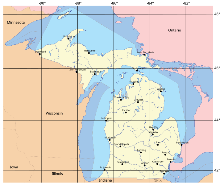
English: Michigan, showing borders and nearby states and provinces, with some principal cities. Category:Michigan maps |
| Date | 8 May 2009 (original upload date) |
| Source | self-made by Phizzy (talk). |
| Author | Phizzy (talk) |
Licensing[edit]
| This file is licensed under the Creative Commons Attribution-Share Alike 3.0 Unported license. | ||
| ||
| This licensing tag was added to this file as part of the GFDL licensing update. |
I, the copyright holder of this work, hereby publish it under the following license:

|
Permission is granted to copy, distribute and/or modify this document under the terms of the GNU Free Documentation License, Version 1.2 or any later version published by the Free Software Foundation; with no Invariant Sections, no Front-Cover Texts, and no Back-Cover Texts. A copy of the license is included in the section entitled GNU Free Documentation License. |
Original upload log[edit]
The original description page was here. All following user names refer to en.wikipedia.
- 2009-05-08 23:07 Phizzy 741×612× (144186 bytes) Reverted to version as of 18:17, 11 July 2008
- 2009-05-08 23:06 Phizzy 562×606× (94959 bytes) {{Move to Commons}} == {{int:license}} == {{GFDL-self}} [[Category:Michigan maps]] == Information == {{Information |Description=Map of Michigan. |Source=self-made |Date= |Author=[[User:Phizzy|Phizzy]] ([[User talk:Phizzy|talk]]) |other_versions= }}
- 2008-07-11 18:17 Phizzy 741×612× (144186 bytes)
- 2008-07-11 18:16 Phizzy 748×1218× (218660 bytes)
- 2008-05-20 23:29 Phizzy 720×605× (141028 bytes)
- 2008-05-20 23:12 Phizzy 720×605× (141089 bytes)
- 2008-05-20 23:06 Phizzy 720×605× (141616 bytes)
- 2008-05-20 22:59 Phizzy 788×605× (143836 bytes) {{Information |Description= |Source=self-made |Date= |Author=~~~ |other_versions= }}
File history
Click on a date/time to view the file as it appeared at that time.
| Date/Time | Thumbnail | Dimensions | User | Comment | |
|---|---|---|---|---|---|
| current | 14:00, 14 January 2010 | | 741 × 612 (141 KB) | File Upload Bot (Magnus Manske) (talk | contribs) | {{BotMoveToCommons|en.wikipedia|year={{subst:CURRENTYEAR}}|month={{subst:CURRENTMONTHNAME}}|day={{subst:CURRENTDAY}}}} {{Information |Description={{en|Michigan, showing borders and nearby states and provinces, with some principal cities.<br/> [[:en:Categ |
You cannot overwrite this file.
File usage on Commons
There are no pages that use this file.
File usage on other wikis
The following other wikis use this file:
- Usage on ast.wikipedia.org
- Usage on az.wikipedia.org
- Usage on bn.wikipedia.org
- Usage on el.wikipedia.org
- Usage on en.wikipedia.org
- Usage on fr.wikipedia.org
- Usage on ilo.wikipedia.org
- Usage on it.wikipedia.org
- Usage on ja.wikipedia.org
- Usage on ms.wikipedia.org
- Usage on pam.wikipedia.org
- Usage on pt.wikipedia.org
- Usage on ru.wikipedia.org
- Usage on sv.wikipedia.org
- Usage on tr.wikipedia.org