File:Mexico location map.svg
Jump to navigation
Jump to search

Size of this PNG preview of this SVG file: 800 × 522 pixels. Other resolutions: 320 × 209 pixels | 640 × 418 pixels | 1,024 × 668 pixels | 1,280 × 835 pixels | 2,560 × 1,670 pixels | 2,028 × 1,323 pixels.
Original file (SVG file, nominally 2,028 × 1,323 pixels, file size: 600 KB)
Captions
Captions
Add a one-line explanation of what this file represents
Summary[edit]
| Description |
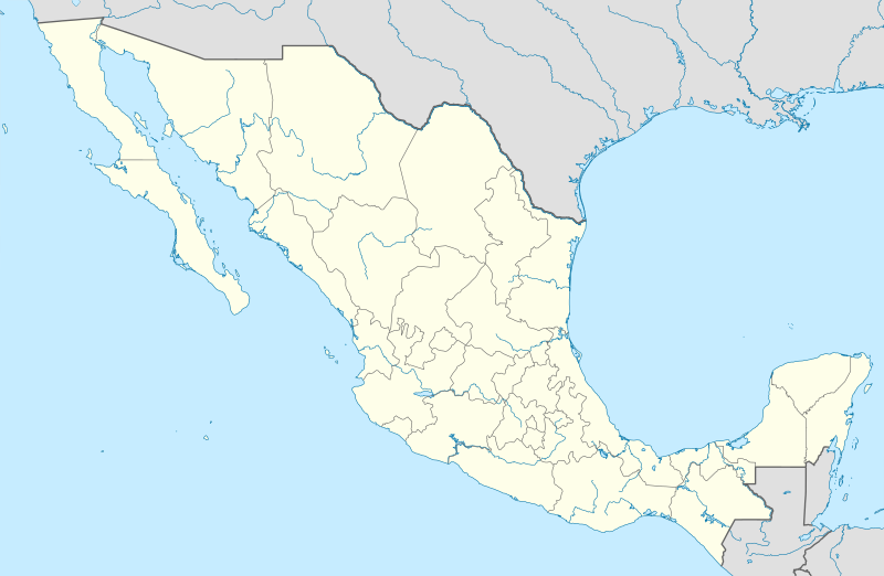
Deutsch: Positionskarte von Mexiko
Quadratische Plattkarte, N-S-Streckung 110 %. Geographische Begrenzung der Karte:
Español: Mapa de la ubicación de México
Proyección equirectangular, N / S se extiende al 110 %. Límites geográficos del mapa:
English: Location map of Mexico
Equirectangular projection, N/S stretching 110 %. Geographic limits of the map:
Հայերեն: Մեքսիկայի տեղորոշման քարտեզ
Ուղղանկյուն պրոյեկցիա, Հյուսիս-Հարավ ձգվածությունը՝ 110%։ Քարտեզում աշխարհագրական սահմանները.
|
| Date | 11-03-2009 |
| Source |
own work, using
|
| Author | NordNordWest |
| Other versions |
Derivative works of this file: Islands of Mexico.svg
|


|
This map has been made or improved in the German Kartenwerkstatt (Map Lab). You can propose maps to improve as well.
|
Licensing[edit]
I, the copyright holder of this work, hereby publish it under the following licenses:

|
Permission is granted to copy, distribute and/or modify this document under the terms of the GNU Free Documentation License, Version 1.2 or any later version published by the Free Software Foundation; with no Invariant Sections, no Front-Cover Texts, and no Back-Cover Texts. A copy of the license is included in the section entitled GNU Free Documentation License. |
This file is licensed under the Creative Commons Attribution 3.0 Unported license.
- You are free:
- to share – to copy, distribute and transmit the work
- to remix – to adapt the work
- Under the following conditions:
- attribution – You must give appropriate credit, provide a link to the license, and indicate if changes were made. You may do so in any reasonable manner, but not in any way that suggests the licensor endorses you or your use.
You may select the license of your choice.
File history
Click on a date/time to view the file as it appeared at that time.
| Date/Time | Thumbnail | Dimensions | User | Comment | |
|---|---|---|---|---|---|
| current | 14:04, 24 July 2012 | | 2,028 × 1,323 (600 KB) | NordNordWest (talk | contribs) | upd |
| 18:34, 11 March 2009 |  | 2,029 × 1,326 (861 KB) | NordNordWest (talk | contribs) | {{Information |Description= {{de|Positionskarte von Mexiko}} Quadratische Plattkarte, N-S-Streckung 110 %. Geographische Begrenzung der Karte: * N: 33.3° N * S: 14.2° N * W: 118.5° W * O: 86.3° W {{en|Location map of [[:en:Mexico|Mexico |
You cannot overwrite this file.
File usage on Commons
The following 54 pages use this file:
- México
- User:NordNordWest/Gallery/Location maps
- File:Aguascalientes in Mexico.svg
- File:Aguascalientes in Mexico (zoom).svg
- File:Baja California Sur in Mexico.svg
- File:Baja California in Mexico.svg
- File:Campeche in Mexico.svg
- File:Chiapas in Mexico (location map scheme).svg
- File:Chihuahua in Mexico (location map scheme).svg
- File:Coahuila in Mexico (location map scheme).svg
- File:Colima in Mexico (location map scheme).svg
- File:Costco footprint map Mexico 2021-01.png
- File:Costco footprint map USA 2021-01.png
- File:Durango in Mexico (location map scheme).svg
- File:Guanajuato in Mexico (location map scheme).svg
- File:Guatemala location map.svg
- File:Guerrero in Mexico (location map scheme).svg
- File:Hidalgo in Mexico (location map scheme).svg
- File:Hidalgo in Mexico (zoom).svg
- File:Islands of Mexico.svg
- File:Jalisco in Mexico (location map scheme).svg
- File:Mapa del Caribe (límites marinos).svg
- File:Mexico (city) in Mexico.svg
- File:Mexico (city) in Mexico (special marker).svg
- File:Mexico (city) in Mexico (zoom).svg
- File:Mexico (state) in Mexico.svg
- File:Mexico (state) in Mexico (zoom).svg
- File:Mexico Wikivoyage locator maps - Baja California.png
- File:Mexico Wikivoyage locator maps - Central Mexico.png
- File:Mexico Wikivoyage locator maps - Northern Mexico.png
- File:Mexico Wikivoyage locator maps - Yucatán Peninsula.png
- File:Mexico relief location map.jpg
- File:Michoacan in Mexico (location map scheme).svg
- File:Morelos in Mexico (location map scheme).svg
- File:Morelos in Mexico (zoom).svg
- File:Nayarit in Mexico (location map scheme).svg
- File:Nuevo Leon in Mexico (location map scheme).svg
- File:Oaxaca in Mexico.svg
- File:Puebla in Mexico (location map scheme).svg
- File:Queretaro in Mexico (location map scheme).svg
- File:Queretaro in Mexico (zoom).svg
- File:Quintana Roo in Mexico (location map scheme).svg
- File:San Luis Potosi in Mexico (location map scheme).svg
- File:Sinaloa in Mexico (location map scheme).svg
- File:Sonora in Mexico (location map scheme).svg
- File:Tabasco in Mexico (location map scheme).svg
- File:Tamaulipas in Mexico (location map scheme).svg
- File:Tlaxcala in Mexico (location map scheme).svg
- File:Tlaxcala in Mexico (zoom).svg
- File:Veracruz in Mexico (location map scheme).svg
- File:Yaqui location.svg
- File:Yucatan in Mexico (location map scheme).svg
- File:Zacatecas in Mexico (location map scheme).svg
- Category:La Barca de la Fé, Templo Parroquial de San Andrés Buenavista, Tlaxco, Tlaxcala, México
.svg)
.svg)
.svg)
.svg)
.svg)
.svg)
.svg)
.svg)
.svg)
.svg)
.svg)
.svg)
_in_Mexico.svg)
_in_Mexico_(special_marker).svg)
_in_Mexico_(zoom).svg)
_in_Mexico.svg)
_in_Mexico_(zoom).svg)
.svg)
.svg)
.svg)
.svg)
.svg)
.svg)
.svg)
.svg)
.svg)
.svg)
.svg)
.svg)
.svg)
.svg)
.svg)
.svg)
.svg)
.svg)
.svg)
File usage on other wikis
The following other wikis use this file:
- Usage on af.wikipedia.org
- Usage on als.wikipedia.org
- Usage on an.wikipedia.org
- Ciudat de Mexico
- Tequixquiac
- Pachuca de Soto
- Apaxco
- Apaxco de Ocampo
- Acapulco de Juárez
- Jaltenco
- Zumpango (municipio)
- Nextlalpan
- Hueypoxtla (municipio)
- Naucalpan de Juárez
- Amecameca
- Tijuana (municipio)
- Acambay
- Toluca (municipio)
- Acolman
- Tonanitla
- Atizapán de Zaragoza
- Ecatepec de Morelos
- Tecate (municipio)
- Mexicali (municipio)
- Playas de Rosarito
- Municipio de Ensenada (Baixa California)
- Atlacomulco
- Aculco
- Ixtapaluca
View more global usage of this file.