File:Mexico Chihuahua Julimes location map.svg
Jump to navigation
Jump to search

Size of this PNG preview of this SVG file: 532 × 600 pixels. Other resolutions: 213 × 240 pixels | 426 × 480 pixels | 681 × 768 pixels | 908 × 1,024 pixels | 1,817 × 2,048 pixels | 2,176 × 2,453 pixels.
Original file (SVG file, nominally 2,176 × 2,453 pixels, file size: 805 KB)
Captions
Captions
Add a one-line explanation of what this file represents
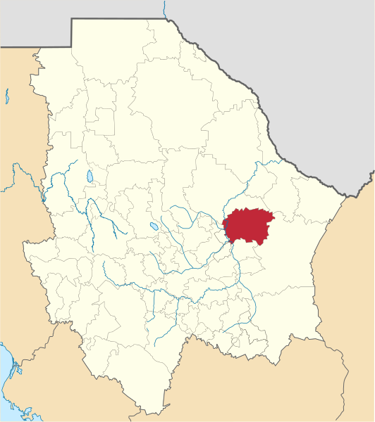
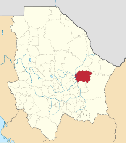
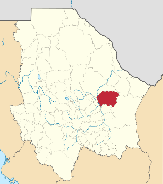
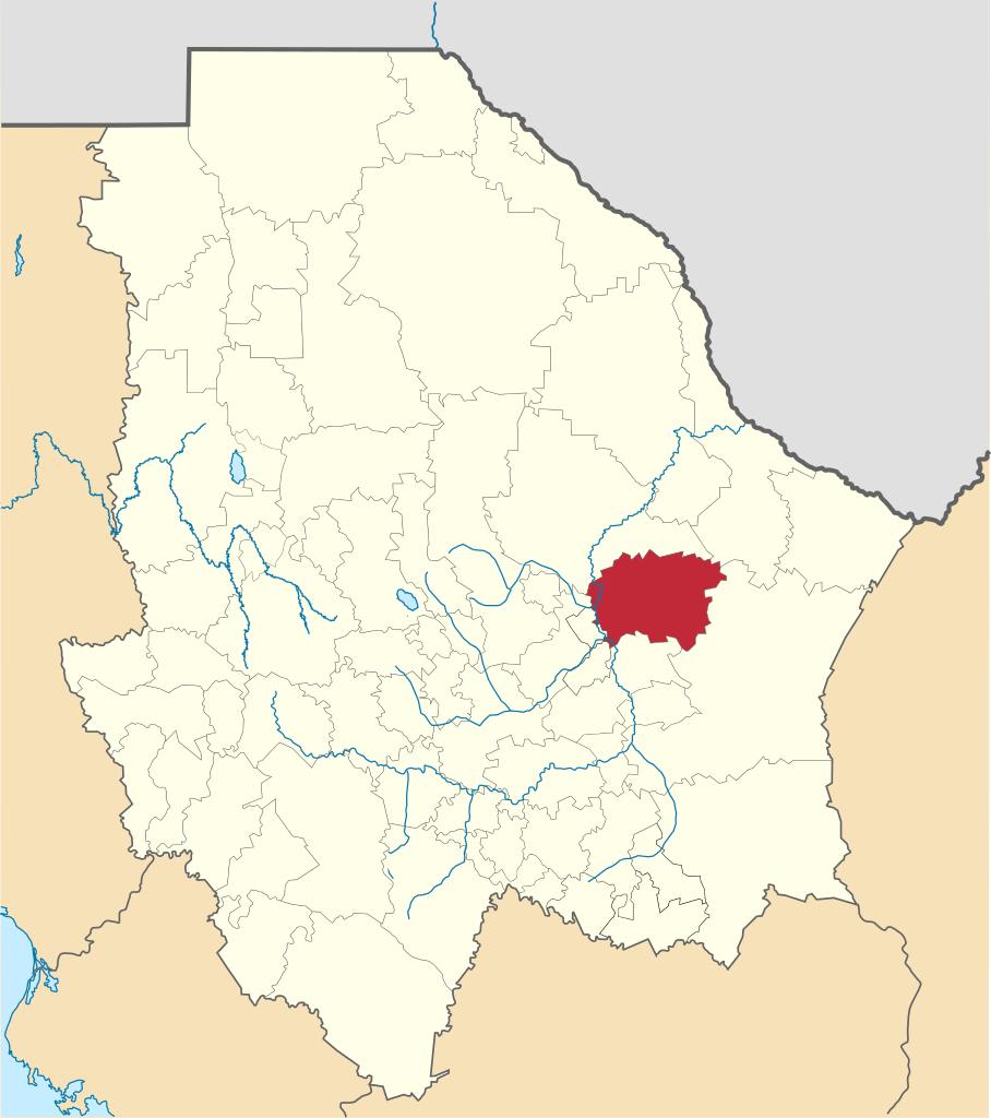
| Description | Mapa de la localización del municipio de Julimes, Chihuahua, México. | ||
| Date | |||
| Source |
Own work This W3C-unspecified vector image was created with Inkscape . |
||
| Author | Battroid | ||
| Permission (Reusing this file) |
|
File history
Click on a date/time to view the file as it appeared at that time.
| Date/Time | Thumbnail | Dimensions | User | Comment | |
|---|---|---|---|---|---|
| current | 05:39, 24 February 2013 | | 2,176 × 2,453 (805 KB) | Battroid (talk | contribs) | {{Information |Description=Mapa de la localización del municipio de Julimes, Chihuahua, México. |Source={{own}} {{Inkscape}} |Date=2013-02-23 |Author= Battroid |Permission={{PD-self}} |other_versions= }} [[Category:SVG maps of Chih... |
You cannot overwrite this file.
File usage on Commons
There are no pages that use this file.