File:Metrolink Airport Line, Barlow Moor Road Stop, David Dixon, 4236967.jpg
From Wikimedia Commons, the free media repository
Jump to navigation
Jump to search
Metrolink_Airport_Line,_Barlow_Moor_Road_Stop,_David_Dixon,_4236967.jpg (640 × 480 pixels, file size: 264 KB, MIME type: image/jpeg)
File information
Structured data
Captions
DescriptionMetrolink Airport Line, Barlow Moor Road Stop, David Dixon, 4236967.jpg |
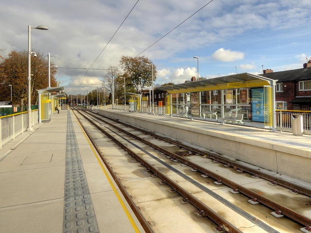
English: The barlow Moor Road Metrolink stop is in the central reservation of Mauldeth Road West at its junction with Barlow Moor Road. It has two facing platforms for inbound (ie travelling towards Manchester) and outbound (ie travelling towards Manchester Airport) trams. |
||
Date | |||
Source | geograph.org.uk | ||
Author | David Dixon | ||
Permission (Reusing this file) |
This file is licensed under the Creative Commons Attribution-Share Alike 2.0 Generic license. Attribution: David Dixon
|
||
Attribution (required by the license) InfoField | David Dixon / Metrolink Airport Line, Barlow Moor Road Stop / | ||
InfoField | David Dixon / Metrolink Airport Line, Barlow Moor Road Stop |
Camera location | 53° 25′ 57.4″ N, 2° 16′ 12″ W | View this and other nearby images on: OpenStreetMap | 53.432620; -2.269900 |
---|
Object location | 53° 25′ 58.1″ N, 2° 16′ 09″ W | View this and other nearby images on: OpenStreetMap | 53.432800; -2.269200 |
---|
File history
Click on a date/time to view the file as it appeared at that time.
Date/Time | Thumbnail | Dimensions | User | Comment | |
---|---|---|---|---|---|
current | 20:40, 13 November 2014 | 640 × 480 (264 KB) | G-13114 (talk | contribs) | {{Information |description={{en|1=The barlow Moor Road Metrolink stop is in the central reservation of Mauldeth Road West at its junction with Barlow Moor Road. It has two facing platforms for inbound (ie travelling towards Manchester) and outbound (i... |
You cannot overwrite this file.
File usage on Commons
The following 4 pages use this file:
File usage on other wikis
The following other wikis use this file:
- Usage on cy.wikipedia.org
- Usage on en.wikipedia.org
- Usage on www.wikidata.org
Metadata
This file contains additional information such as Exif metadata which may have been added by the digital camera, scanner, or software program used to create or digitize it. If the file has been modified from its original state, some details such as the timestamp may not fully reflect those of the original file. The timestamp is only as accurate as the clock in the camera, and it may be completely wrong.
Camera manufacturer | Panasonic |
---|---|
Camera model | DMC-TZ60 |
Date and time of data generation | 12:34, 4 November 2014 |
Exposure time | 1/320 sec (0.003125) |
F-number | f/5.6 |
ISO speed rating | 100 |
Lens focal length | 4.3 mm |
Latitude | 53° 25′ 57.82″ N |
Longitude | 2° 16′ 10.26″ W |
Horizontal resolution | 300 dpi |
Vertical resolution | 300 dpi |
Orientation | Normal |
File change date and time | 12:34, 4 November 2014 |
Software used | PaintShop Pro 15.00 |
Color space | sRGB |
Date and time of digitizing | 12:34, 4 November 2014 |
Exposure Program | Aperture priority |
Metering mode | Pattern |
Flash | Flash did not fire, compulsory flash suppression |
Custom image processing | Normal process |
Exposure mode | Auto bracket |
White balance | Manual white balance |
Digital zoom ratio | 0 |
Focal length in 35 mm film | 24 mm |
Scene capture type | Standard |
GPS time (atomic clock) | 12:33 |
GPS date | 2014 |
GPS tag version | 0.0.3.2 |
Structured data
Items portrayed in this file
depicts
53°25'57.43"N, 2°16'11.64"W
4 November 2014
53°25'58.08"N, 2°16'9.12"W
0.003125 second
5.6
4.3 millimetre
100
Hidden categories:
- CC-BY-SA-2.0
- Images from Geograph Britain and Ireland
- Images from Geograph Britain and Ireland missing SDC creator
- Images from Geograph Britain and Ireland missing SDC source of file
- Images from Geograph Britain and Ireland missing SDC MIME type
- Information field template with formatting
- Files with coordinates missing SDC location of creation (53° N, 3° W)
- Pages with maps