File:Metro Paris M1-ouest2027.svg
Jump to navigation
Jump to search

Size of this PNG preview of this SVG file: 520 × 590 pixels. Other resolutions: 211 × 240 pixels | 423 × 480 pixels | 677 × 768 pixels | 902 × 1,024 pixels | 1,805 × 2,048 pixels.
Original file (SVG file, nominally 520 × 590 pixels, file size: 60 KB)
Captions
Captions
Add a one-line explanation of what this file represents
Summary[edit]
| Description |
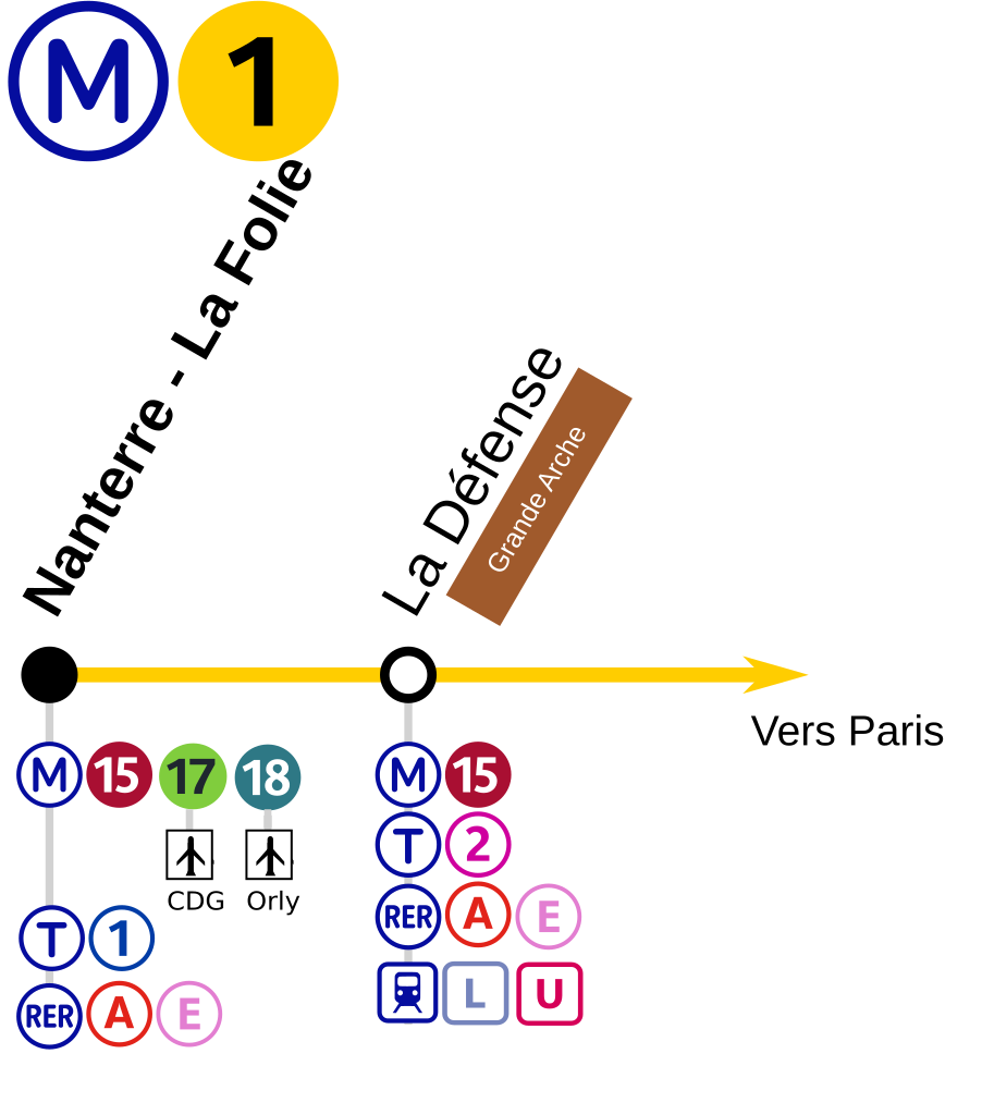
Français : Plan du tronçon ouest de la ligne en 2027 |
| Date | |
| Source | Own work |
| Author | AlexY75 |
Licensing[edit]
I, the copyright holder of this work, hereby publish it under the following license:
This file is licensed under the Creative Commons Attribution-Share Alike 4.0 International license.
- You are free:
- to share – to copy, distribute and transmit the work
- to remix – to adapt the work
- Under the following conditions:
- attribution – You must give appropriate credit, provide a link to the license, and indicate if changes were made. You may do so in any reasonable manner, but not in any way that suggests the licensor endorses you or your use.
- share alike – If you remix, transform, or build upon the material, you must distribute your contributions under the same or compatible license as the original.
File history
Click on a date/time to view the file as it appeared at that time.
| Date/Time | Thumbnail | Dimensions | User | Comment | |
|---|---|---|---|---|---|
| current | 22:21, 22 October 2019 | | 520 × 590 (60 KB) | AlexBurn44 (talk | contribs) | ++ |
| 01:11, 29 October 2018 |  | 520 × 590 (49 KB) | AlexBurn44 (talk | contribs) | Format | |
| 01:42, 5 February 2018 |  | 520 × 590 (49 KB) | Chabe01 (talk | contribs) | Fichier plus lisible, respectant la charte colorimétrique de la RATP. | |
| 21:20, 11 July 2017 | 2,134 × 768 (37 KB) | The BurnPheonix (talk | contribs) | Ajout t1 | ||
| 17:27, 6 April 2017 | 2,134 × 768 (35 KB) | The BurnPheonix (talk | contribs) | User created page with UploadWizard |
You cannot overwrite this file.
File usage on Commons
The following 18 pages use this file:
- User:Chumwa/OgreBot/Potential transport maps/2017 April 1-10
- User:Chumwa/OgreBot/Potential transport maps/2017 July 11-20
- User:Chumwa/OgreBot/Potential transport maps/2018 February 1-9
- User:Chumwa/OgreBot/Potential transport maps/2018 October 21-31
- User:Chumwa/OgreBot/Potential transport maps/2019 October 21-31
- User:Chumwa/OgreBot/Public transport information/2017 July 11-20
- User:Chumwa/OgreBot/Public transport information/2018 February 1-9
- User:Chumwa/OgreBot/Public transport information/2018 October 21-31
- User:Chumwa/OgreBot/Public transport information/2019 October 21-31
- User:Chumwa/OgreBot/Transport Maps/2017 April 1-10
- User:Chumwa/OgreBot/Transport Maps/2017 July 11-20
- User:Chumwa/OgreBot/Transport Maps/2018 February 1-9
- User:Chumwa/OgreBot/Transport Maps/2018 October 21-31
- User:Chumwa/OgreBot/Transport Maps/2019 October 21-31
- User:Chumwa/OgreBot/Travel and communication maps/2017 April 1-10
- User:Chumwa/OgreBot/Travel and communication maps/2017 July 11-20
- User:Chumwa/OgreBot/Travel and communication maps/2018 February 1-9
- User:Chumwa/OgreBot/Travel and communication maps/2018 October 21-31