File:Measurement artillery data.jpg
Jump to navigation
Jump to search

Size of this preview: 800 × 516 pixels. Other resolutions: 320 × 206 pixels | 640 × 412 pixels | 1,024 × 660 pixels | 1,280 × 825 pixels | 2,560 × 1,650 pixels | 4,965 × 3,200 pixels.
Original file (4,965 × 3,200 pixels, file size: 6.45 MB, MIME type: image/jpeg)
Captions
Captions
Add a one-line explanation of what this file represents
Summary[edit]
| Description |
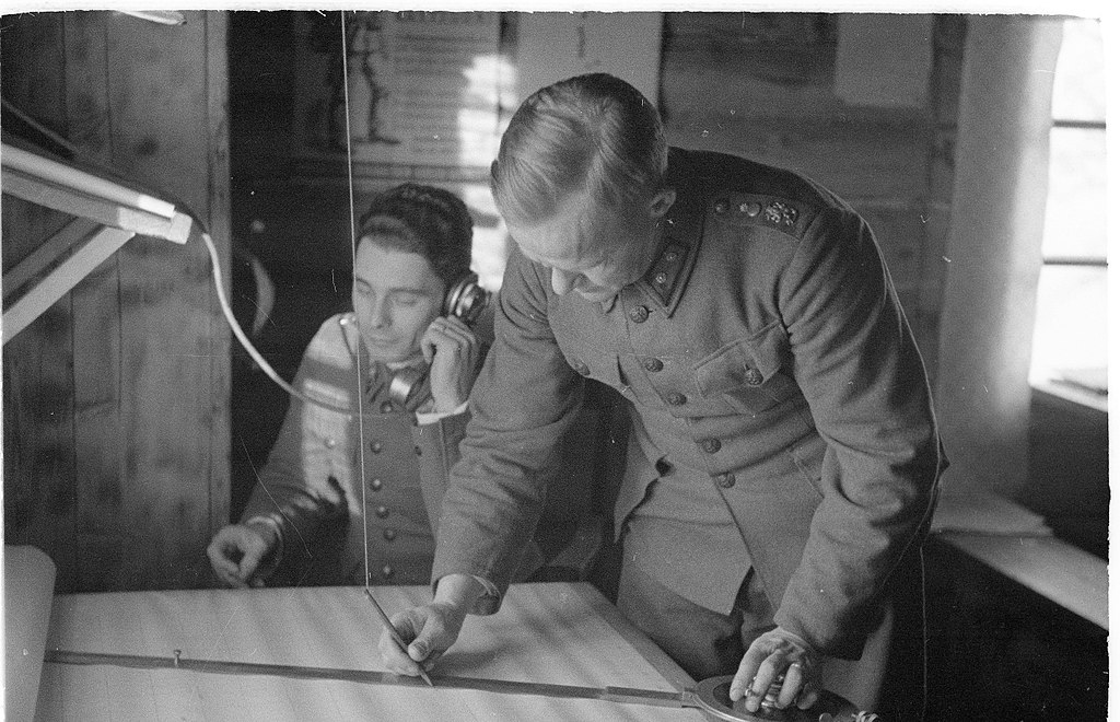
English: At Rukajärvi, light and sound measurement data of Soviet artillery locations received by phone during a battle is converted onto a map and immediately relayed to friendly Finnish Defence Forces batteries
Suomi: Valon ja äänen mittauselin on myös tärkeä tekijä taistelun aikana. Sen tehtävänä on määritellä vihollisaseitten asema. Havaintojen puhelimitse saavuttua määritellään kuvassa näkyvällä tasolla tarkalleen vihollistykistön asema ja saatetaan se viipymättä oman patteriston tietoon. Rukajärvi. |
| Date | |
| Source | https://finna.fi/Record/sa-kuva.sa-kuva-137414, Finnish Wartime Photograph Archive (SA-Kuva) |
| Author | P. Jänis |
Licensing[edit]
This file is licensed under the Creative Commons Attribution 4.0 International license.
- You are free:
- to share – to copy, distribute and transmit the work
- to remix – to adapt the work
- Under the following conditions:
- attribution – You must give appropriate credit, provide a link to the license, and indicate if changes were made. You may do so in any reasonable manner, but not in any way that suggests the licensor endorses you or your use.
File history
Click on a date/time to view the file as it appeared at that time.
| Date/Time | Thumbnail | Dimensions | User | Comment | |
|---|---|---|---|---|---|
| current | 14:21, 20 November 2017 | | 4,965 × 3,200 (6.45 MB) | Renamed user a2vv12zt2i (talk | contribs) | User created page with UploadWizard |
You cannot overwrite this file.
File usage on Commons
The following page uses this file:
File usage on other wikis
The following other wikis use this file:
- Usage on en.wikipedia.org
- Usage on he.wikipedia.org