File:Maui moku map 2.jpg
Jump to navigation
Jump to search

Size of this preview: 800 × 481 pixels. Other resolutions: 320 × 192 pixels | 640 × 385 pixels | 1,024 × 615 pixels | 1,536 × 923 pixels.
Original file (1,536 × 923 pixels, file size: 313 KB, MIME type: image/jpeg)
Captions
Captions
Add a one-line explanation of what this file represents
Summary[edit]
| Description |
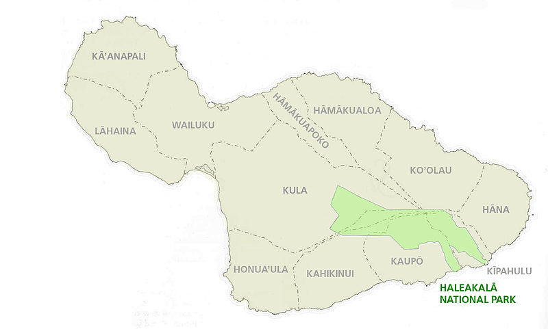
English: map of Maui Island, Hawaii, showing traditional moku (district) division, with Haleakala National Park superimposed |
| Date | Unknown date |
| Source | http://www.nps.gov/hale/historyculture/moku.htm |
| Author | NPS |
Licensing[edit]
| This image or media file contains material based on a work of a National Park Service employee, created as part of that person's official duties. As a work of the U.S. federal government, such work is in the public domain in the United States. See the NPS website and NPS copyright policy for more information. |
File history
Click on a date/time to view the file as it appeared at that time.
| Date/Time | Thumbnail | Dimensions | User | Comment | |
|---|---|---|---|---|---|
| current | 20:23, 8 July 2011 | | 1,536 × 923 (313 KB) | Ratzer (talk | contribs) | {{Information |Description ={{en|1=map of Maui Island, Hawaii, showing traditional moku (district) division, with Haleakalā National Park superimposed}} |Source =http://www.nps.gov/hale/historyculture/moku.htm |Author =NPS |Date |
You cannot overwrite this file.
File usage on Commons
There are no pages that use this file.
File usage on other wikis
The following other wikis use this file:
- Usage on az.wikipedia.org
- Usage on ceb.wikipedia.org
- Usage on de.wikipedia.org
- Usage on en.wikipedia.org
- Usage on ko.wikipedia.org
- Usage on pl.wikipedia.org
- Usage on vi.wikipedia.org