File:Matthew 2016-10-02 0845Z.jpg
Jump to navigation
Jump to search

Size of this preview: 800 × 523 pixels. Other resolutions: 320 × 209 pixels | 640 × 418 pixels | 1,024 × 669 pixels | 1,280 × 837 pixels | 1,582 × 1,034 pixels.
Original file (1,582 × 1,034 pixels, file size: 600 KB, MIME type: image/jpeg)
Captions
Captions
Add a one-line explanation of what this file represents
Summary[edit]
| Description |
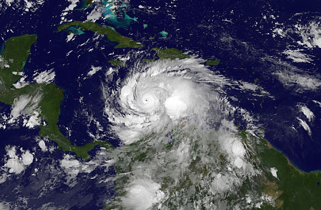
English: NOAA's GOES-East satellite on Oct. 2 at 4:45 a.m. EDT (0845 UTC) showed Hurricane Matthew's clear eye as the storm moved through the south central Caribbean Sea. |
| Date | |
| Source | http://www.noaa.gov/media-release/world-meteorological-organization-retires-storm-names-matthew-and-otto |
| Author | NOAA |
Licensing[edit]
This image is in the public domain because it contains materials that originally came from the U.S. National Oceanic and Atmospheric Administration, taken or made as part of an employee's official duties.
|
File history
Click on a date/time to view the file as it appeared at that time.
| Date/Time | Thumbnail | Dimensions | User | Comment | |
|---|---|---|---|---|---|
| current | 06:02, 28 February 2018 | | 1,582 × 1,034 (600 KB) | A1Cafel (talk | contribs) | Full size |
| 12:13, 14 February 2018 |  | 1,582 × 1,034 (212 KB) | A1Cafel (talk | contribs) | User created page with UploadWizard |
You cannot overwrite this file.
File usage on Commons
The following 4 pages use this file: