File:Mapanuepe River confluence and valley.gif
Jump to navigation
Jump to search

No higher resolution available.
Mapanuepe_River_confluence_and_valley.gif (700 × 525 pixels, file size: 28 KB, MIME type: image/gif)
Captions
Captions
Add a one-line explanation of what this file represents
Summary[edit]
| Description |
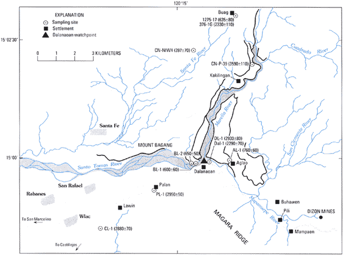
English: The confluence site of the Santo Tomas, Marella, and Mapanuepe Rivers in Zambales province, Philippines, and the settlements in the area before the formation of Mapanuepe Lake. |
| Date | |
| Source | http://pubs.usgs.gov/pinatubo/umbal/fig5.gif |
| Author | U.S. Geological Survey |
Licensing[edit]
This image is in the public domain in the United States because it only contains materials that originally came from the United States Geological Survey, an agency of the United States Department of the Interior. For more information, see the official USGS copyright policy.
|
File history
Click on a date/time to view the file as it appeared at that time.
| Date/Time | Thumbnail | Dimensions | User | Comment | |
|---|---|---|---|---|---|
| current | 15:34, 18 June 2011 | | 700 × 525 (28 KB) | Briarfallen (talk | contribs) | {{Information |Description ={{en|1=The confluence site of the Santo Tomas, Marella, and Mapanuepe Rivers in Zambales province, Philippines, and the settlements in the area before the formation of Mapanuepe Lake.}} |Source =http://pubs.usgs.gov/ |
You cannot overwrite this file.
File usage on Commons
The following page uses this file:
File usage on other wikis
The following other wikis use this file:
- Usage on en.wikipedia.org
- Usage on ilo.wikipedia.org