File:Mapa beninu.png
Jump to navigation
Jump to search
Size of this preview: 278 × 600 pixels. Other resolutions: 111 × 240 pixels | 332 × 716 pixels.
Original file (332 × 716 pixels, file size: 16 KB, MIME type: image/png)
Captions
Captions
Add a one-line explanation of what this file represents
| Description |
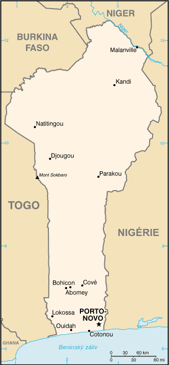
Čeština: Mapa Beninu s českými popisky.
English: Map of Benin with Czech description. |
|||
| Date | 6 July 2006 (original upload date) | |||
| Source |
|
|||
| Author | CIA World Factbool | |||
| Permission (Reusing this file) |
|

Original upload log[edit]
The original description page was here. All following user names refer to cs.wikipedia.
- 2006-07-06 14:45 NádvornÃk 332×716×4 (16169 bytes) Mapa [[Benin]]u - pÅeložená mapa z CIA World Factbook.
File history
Click on a date/time to view the file as it appeared at that time.
| Date/Time | Thumbnail | Dimensions | User | Comment | |
|---|---|---|---|---|---|
| current | 11:11, 25 June 2008 | | 332 × 716 (16 KB) | File Upload Bot (Magnus Manske) (talk | contribs) | {{BotMoveToCommons|cs.wikipedia}} {{Information |Description={{cs|Mapa cs:Beninu - pÅeložená mapa z CIA World Factbook.}} |Source=Transferred from [http://cs.wikipedia.org cs.wikipedia]; transfered to Commons by User:Sevela.p using [htt |
You cannot overwrite this file.
File usage on Commons
The following page uses this file:
File usage on other wikis
The following other wikis use this file:
- Usage on cs.wikipedia.org