File:Mapa Zootoca vivipara.png
Jump to navigation
Jump to search
Size of this preview: 800 × 407 pixels. Other resolutions: 320 × 163 pixels | 640 × 325 pixels | 1,024 × 521 pixels | 1,280 × 651 pixels | 2,753 × 1,400 pixels.
Original file (2,753 × 1,400 pixels, file size: 144 KB, MIME type: image/png)
Captions
Captions
Add a one-line explanation of what this file represents
Summary[edit]
| Description |
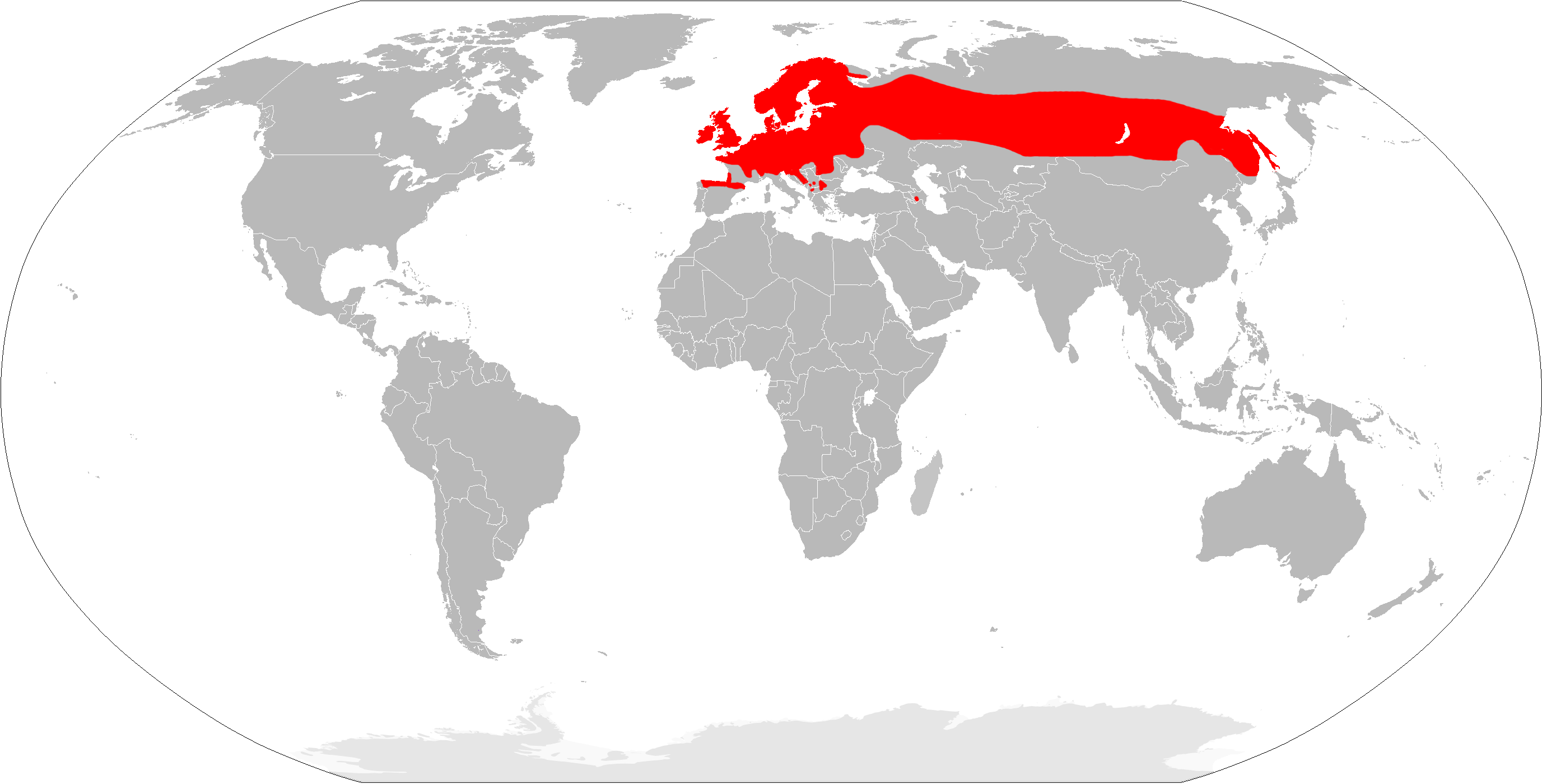
English: Zootoca vivipara range map.
Español: Mapa de distribución de la lagartija de turbera (Zootoca vivipara). |
| Date | |
| Source | Own work |
| Author | Osado |
Licensing[edit]
| I, the copyright holder of this work, release this work into the public domain. This applies worldwide. In some countries this may not be legally possible; if so: I grant anyone the right to use this work for any purpose, without any conditions, unless such conditions are required by law. |
File history
Click on a date/time to view the file as it appeared at that time.
| Date/Time | Thumbnail | Dimensions | User | Comment | |
|---|---|---|---|---|---|
| current | 20:05, 21 March 2018 | | 2,753 × 1,400 (144 KB) | Maphobbyist (talk | contribs) | South Sudan border |
| 11:51, 15 March 2010 |  | 2,753 × 1,400 (147 KB) | Osado (talk | contribs) | {{Information |Description={{en|1=''Zootoca vivipara'' range map.}} {{es|1=Mapa de distribución de la lagartija de turbera (''Zootoca vivipara'').}} |Source={{own}} |Author=Osado |Date=2010 |Permission= |other_versions= }} [http://www.iucn |
You cannot overwrite this file.
File usage on Commons
There are no pages that use this file.
File usage on other wikis
The following other wikis use this file:
- Usage on be.wikipedia.org
- Usage on ca.wikipedia.org
- Usage on dag.wikipedia.org
- Usage on de.wikipedia.org
- Usage on en.wikipedia.org
- Usage on es.wikipedia.org
- Usage on fr.wikipedia.org
- Usage on gl.wikipedia.org
- Usage on hu.wikipedia.org
- Usage on incubator.wikimedia.org
- Usage on ja.wikipedia.org
- Usage on mrj.wikipedia.org
- Usage on pt.wikipedia.org
- Usage on ro.wikipedia.org
- Usage on smn.wikipedia.org
- Usage on sv.wikipedia.org
- Usage on uk.wikipedia.org
- Usage on vi.wikipedia.org