File:Mapa Georgias del Sur y Sandwich del Sur.png
Jump to navigation
Jump to search
No higher resolution available.
Mapa_Georgias_del_Sur_y_Sandwich_del_Sur.png (337 × 360 pixels, file size: 20 KB, MIME type: image/png)
Captions
Captions
Add a one-line explanation of what this file represents
Summary[edit]
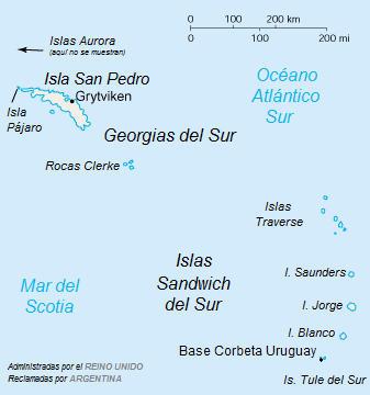
| Description |
Español: Versión en español del mapa de las islas Georgias del Sur y Sandwich del Sur |
| Date | |
| Source | Image:South Georgia and South Sandwich Islands.png |
| Author | CIA, translate: User:Gastón Cuello |
Licensing[edit]
This image is in the public domain because it contains materials that originally came from the United States Central Intelligence Agency's World Factbook.
|
 |
File history
Click on a date/time to view the file as it appeared at that time.
| Date/Time | Thumbnail | Dimensions | User | Comment | |
|---|---|---|---|---|---|
| current | 21:14, 13 September 2015 | | 337 × 360 (20 KB) | Cacen Gymraeg (talk | contribs) | "Blanca" --> "Blanco", pequeño error |
| 16:28, 13 September 2015 |  | 337 × 360 (12 KB) | Cacen Gymraeg (talk | contribs) | User created page with UploadWizard |
You cannot overwrite this file.
File usage on Commons
The following 3 pages use this file:
File usage on other wikis
The following other wikis use this file:
- Usage on ast.wikipedia.org
- Usage on es.wikipedia.org
- Departamento Islas del Atlántico Sur
- Islas Sandwich del Sur
- Islas Georgias del Sur y Sandwich del Sur
- Archipiélago Marqués de Traverse
- Dependencias de las islas Malvinas
- Disputa de las islas Georgias del Sur y Sandwich del Sur
- Gobernación militar de las Islas Malvinas, Georgias del Sur y Sandwich del Sur
- Usage on es.wikivoyage.org
- Usage on fr.wikipedia.org