File:Map of warlords in Khorasan, 1724.png
Jump to navigation
Jump to search
Size of this preview: 800 × 504 pixels. Other resolutions: 320 × 202 pixels | 640 × 403 pixels | 1,024 × 645 pixels | 1,280 × 806 pixels | 2,560 × 1,612 pixels | 4,203 × 2,647 pixels.
Original file (4,203 × 2,647 pixels, file size: 583 KB, MIME type: image/png)
Captions
Captions
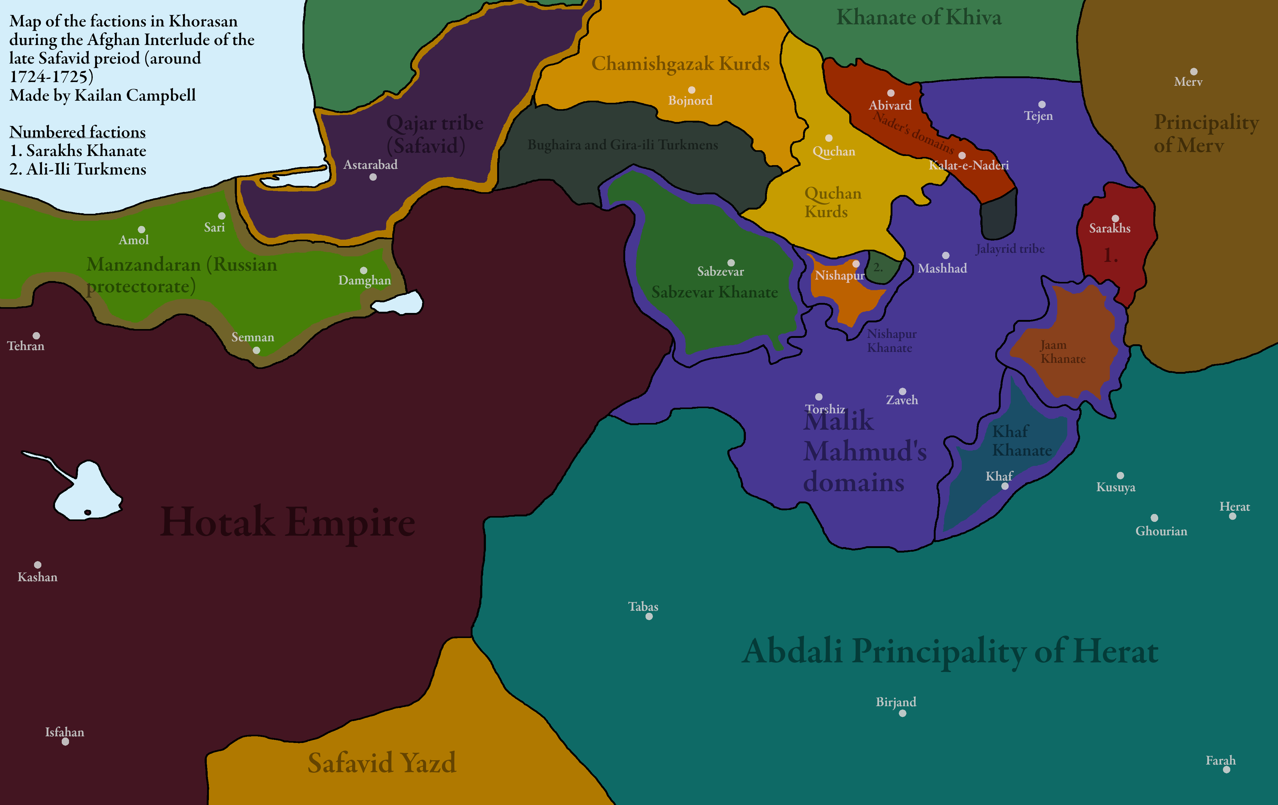
Map of warlords in Khorasan during the Hotak Rebellion
Summary[edit]
| Description |
English: Map of factions in Khorasan during the Afghan Interlude of Iranian History (1721-1729)
Edit: Manzandaran, although ceded to Russia in 1723, de facto still remained under Safavid control. Sources: Cambridge History of Iran Volume 7 The Sword of Persia: Nader Shah, from Tribal Warrior to Conquering Tyrant The Pearl of Pearls: The Abdālī-Durrānī Confederacy and Its Transformation under Aḥmad Shāh, Durr-i Durrān |
| Date | |
| Source | Own work |
| Author | Kailanmapper |
Licensing[edit]
I, the copyright holder of this work, hereby publish it under the following license:
This file is licensed under the Creative Commons Attribution-Share Alike 4.0 International license.
- You are free:
- to share – to copy, distribute and transmit the work
- to remix – to adapt the work
- Under the following conditions:
- attribution – You must give appropriate credit, provide a link to the license, and indicate if changes were made. You may do so in any reasonable manner, but not in any way that suggests the licensor endorses you or your use.
- share alike – If you remix, transform, or build upon the material, you must distribute your contributions under the same or compatible license as the original.
File history
Click on a date/time to view the file as it appeared at that time.
| Date/Time | Thumbnail | Dimensions | User | Comment | |
|---|---|---|---|---|---|
| current | 14:42, 20 January 2021 | | 4,203 × 2,647 (583 KB) | Kailanmapper (talk | contribs) | Uploaded own work with UploadWizard |
You cannot overwrite this file.
File usage on Commons
There are no pages that use this file.
File usage on other wikis
The following other wikis use this file:
- Usage on fr.wikipedia.org