File:Map of the stack.svg
Jump to navigation
Jump to search

Size of this PNG preview of this SVG file: 800 × 534 pixels. Other resolutions: 320 × 214 pixels | 640 × 427 pixels | 1,024 × 684 pixels | 1,280 × 854 pixels | 2,560 × 1,709 pixels | 806 × 538 pixels.
Original file (SVG file, nominally 806 × 538 pixels, file size: 568 KB)
Captions
Captions
Add a one-line explanation of what this file represents
This W3C-unspecified vector image was created with Inkscape .
| Description |
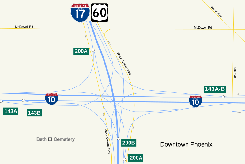
English: The Stack interchange in downtown Phoenix, Arizona, made up of Interstate 10, Interstate 17, and U.S. Route 60. |
||
| Date | Created and uploaded on June 13, 2008 | ||
| Source | Own work | ||
| Author | JohnnyAlbert10 | ||
| Permission (Reusing this file) |
|
File history
Click on a date/time to view the file as it appeared at that time.
| Date/Time | Thumbnail | Dimensions | User | Comment | |
|---|---|---|---|---|---|
| current | 18:30, 13 June 2008 | | 806 × 538 (568 KB) | JohnnyAlbert10~commonswiki (talk | contribs) | {{Information |Description={{en|1=The Stack interchange in downtown Phoenix, Arizona, made up of Interstate 10, Interstate 17, and U.S. Route 60. |
You cannot overwrite this file.
File usage on Commons
There are no pages that use this file.
File usage on other wikis
The following other wikis use this file:
- Usage on de.wikipedia.org
- Usage on hu.wikipedia.org
- Usage on www.wikidata.org